Broad Area Management FOR Defence & Intelligence
Detect the Unknown to Enhance National Security and Minimize Risk
Detect the Unknown to Enhance National Security and Minimize Risk
Rapidly identify and validate new threats with Planet persistent monitoring, hi-res imagery, and automated change detection.
Survey Crops, Coastlines, Protected Land, Forests, and Other Natural Resources
See BAM for Governments

Monitor Troop Movements and Illicit Activities Across Borders and Waterways
See BAM for Defense & Intelligence

Rapidly identify and validate new threats with Planet persistent monitoring, hi-res imagery, and automated change detection.
Learn How We Can Help
1
Expectation 1 - dolor sit amet, consectetur adipiscing elit
2
Expectation 2 - dolor sit amet, consectetur adipiscing elit
3
Expectation 3 - dolor sit amet, consectetur adipiscing elit
Step 1/3
Support natural resource management policies, and permitting accross any area of interest on Earth
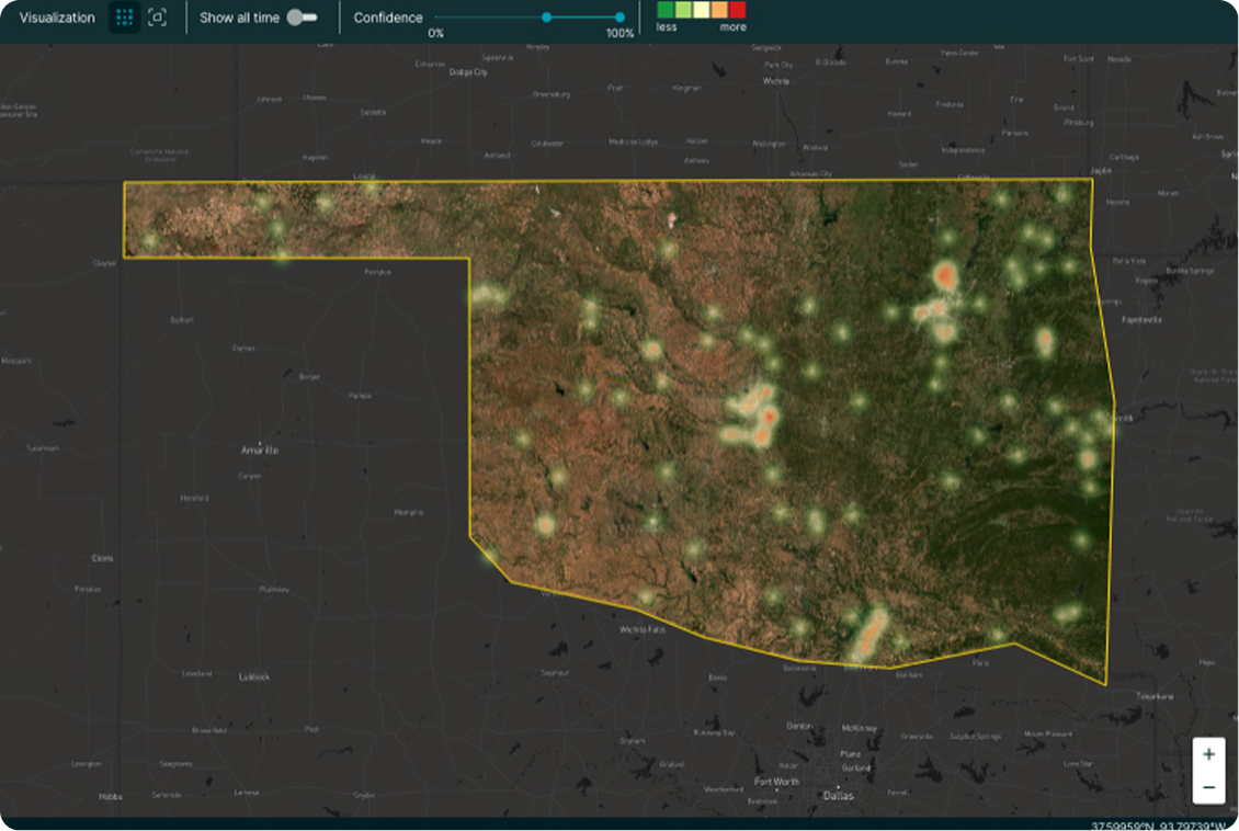
Deforestation Monitoring
Identify early indicators of illegal activity with real-time actionable data and change detection
Identify early indicators of illegal activity with real-time actionable data and change detection
Quantify trends like clearing size and log landings
Measure changes like aboveground carbon density

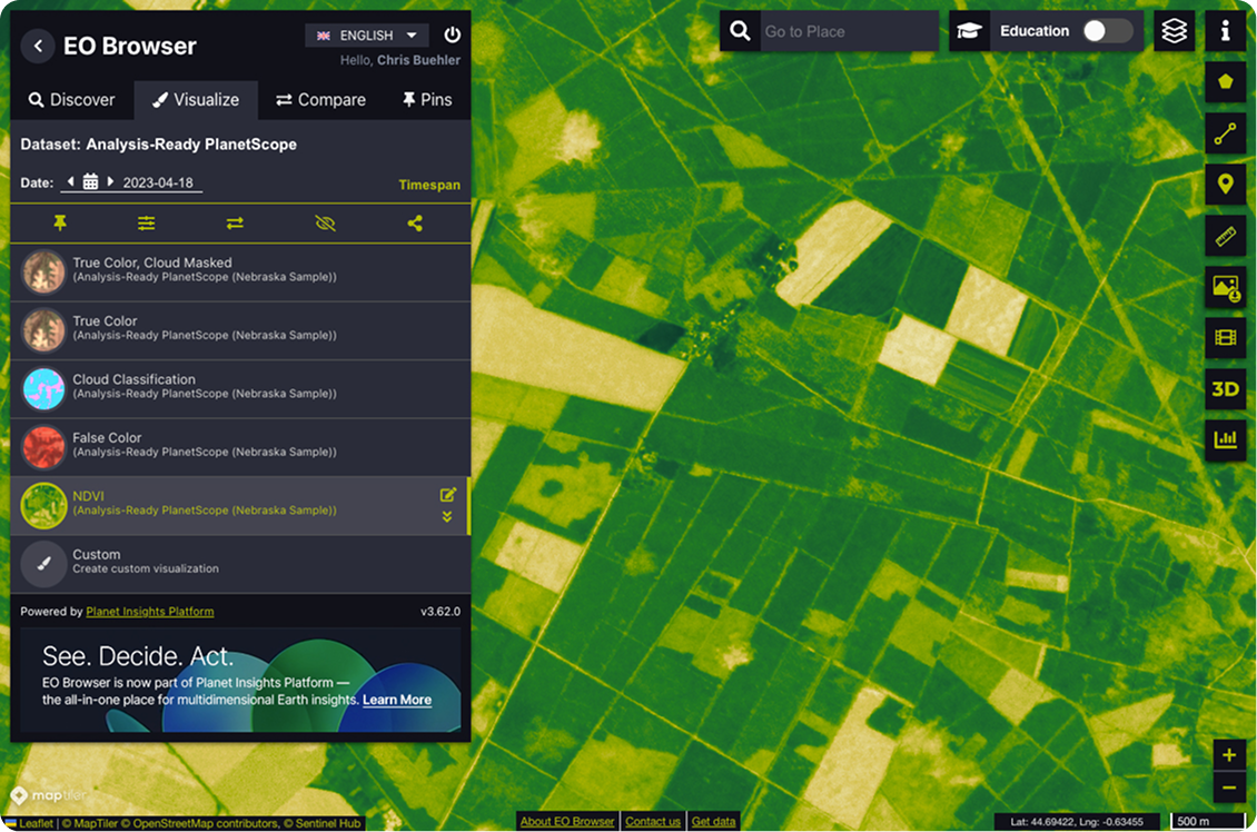
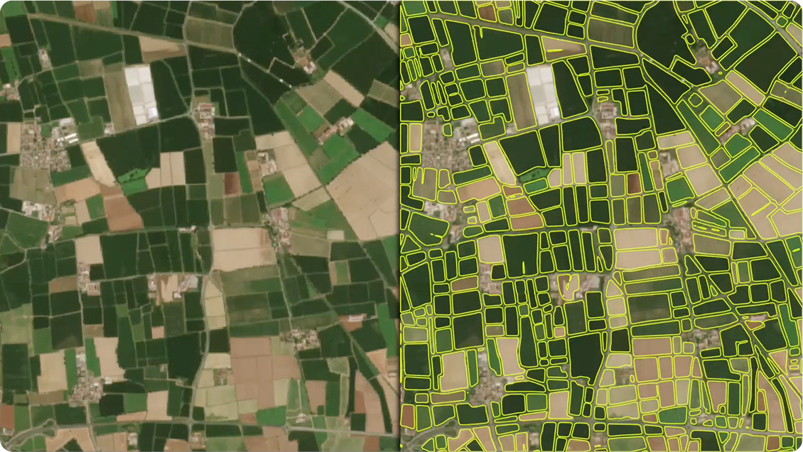
Agricultural Compliance
Accurately verify parcel-level compliance at scale with daily monitoring, derived data, and analytics.
Quantify change within field boundaries
Identify events like mowing and plowing
Measure soil water content and crop biomass
Forest Health Monitoring
Rapidly identify threats like vegetative fuel loads with high-frequency, hi-res data, and scientific measurements
Detect damage to forest inventory
Monitor pests, disease, and land degradation
Measure land surface temperature and forest cover
Not sure yet?
See More Applications
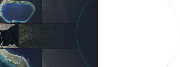
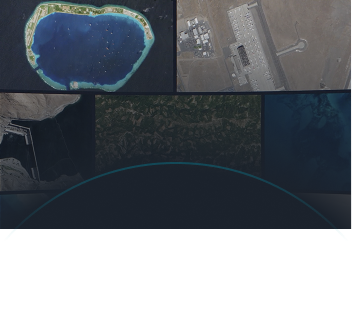
Enhance situational awareness and reduce intelligence gaps accross borders, remote geographies, and coastal waters
Maritime Domain Awareness
Identify nefarious activity like AIS spoofing with daily data and automated vessel detection
Monitor ships within areas of strategic interest
Detect anomalies in port activity or ship count
Query ports for unknown or unreported movements
Foreign Military Intelligence
Detect unknown threats across dynamic environments with high-frequency, hi-res data, and analytics.
Quantify change to infrastructure or patterns of life across specific sites and regions
Integrate with proprietary and third-party data sets
Not sure yet?
See More Applications
Planet Customers Unlock Critical Insights with Broad Area Management
Planet Customers Unlock Critical Insights with Broad Area Management
How ‘Institution’ used BAM to solve this issue
Steve Brumby,
CEO at Impact Observatory
How ‘Institution’ used BAM to solve this issue
Steve Brumby,
CEO at Impact Observatory
How ‘Institution’ used BAM to solve this issue
Steve Brumby,
CEO at Impact Observatory
See More Applications
Planet’s approach to Broad Area Management combines daily satellite monitoring with high-resolution imagery, data, and analytics to help identify known and unknown changes at any scale.


Broad Area Management from Planet can help you
Close Gaps in Data Frequency and Quality
Monitor regions commonly left unobserved with Planet daily data. Automated change detection and alerts enable proactive management and hi-res imagery detects objects and identifies blind spots.
Reduce Delays in Capturing, Managing, and Sharing Data
Access Earth data, analytics, and APIs in a single-cloud based environment. Streamline workflows and eliminate the need for disparate systems. Manage and analyze satellite imagery from Planet and public missions in one place.
Scale monitoring efforts
Reduce the need for expensive, resource-intensive data collection methods like field or aerial surveys. Planet’s pre-processed data accelerates time to value without additional costs.
Not sure yet?
See More Applications
Unlock Insights Across Space and Time with Daily Data and Advanced Analytics
Look broader, back, closer, and deeper with Planet’s Broad Area Management capabilities
We developed the products to help you
Look Broader
Monitor Vast Areas
Planet Monitoringprovides images of nearly the entire Earth landmass on a daily basis, at 3.7 m resolution.
PRODUCTS
Planet SCOPE|Near-daily multispectral imagery datasets
aNALYSIS-READY PlanetScope|Pre-processed, harmonized satellite imagery
PLANET BASEMAPS|Seamless, up-to-date mosaics
Look Back
Access Historical Data
Detect changes to buildings, roads, vessels, aircraft, and more. Before and after analysis is enabled by a living dataset of 10+ billion sq km of imagery added on a daily basis.
PRODUCTS
Planet Archive|A living dataset dating back to 1972
PLANET ANALYTIC FEEDS|Detect and classify objects, identify geographic features and monitor change
Look Closer
Rapid Revisit Tasking
Planet Tasking offers the most frequent, intraday revisit capability of high-resolution data commercially available.
PRODUCTS
Planet Tasking|Hi-res imagery with rapid revisit

Look Closer
Rapid Revisit Tasking
Planet Tasking offers the most frequent, intraday revisit capability of high-resolution data commercially available.
PRODUCTS
Planet Tasking|Hi-res imagery with rapid revisit
LOOK DEEPER
Analysis-Ready Data
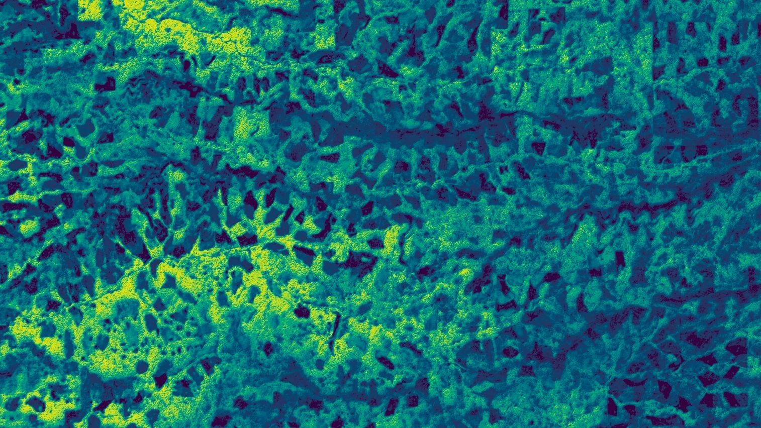
Planetary Variables™|analysis-ready data feeds measure changing conditions of the surface of the Earth outside the visible spectrum.
PRODUCTS
Soil Water Content|Daily water level measurements
Land Surface Temperature|Continuous temperature data of the surface of the Earth
Crop Biomass|Daily, cloud-free estimates of crop biomass
Field Boundaries|Polygons that represent the boundaries of agricultural fields
Forest Carbon|Global dataset of aboveground carbon density, canopy height, and canopy cover
LOOK DEEPER
Analysis-Ready Data
Planetary Variables™|analysis-ready data feeds measure changing conditions of the surface of the Earth outside the visible spectrum.
PRODUCTS
Soil Water Content|Daily water level measurements
Land Surface Temperature|Continuous temperature data of the surface of the Earth
Crop Biomass|Daily, cloud-free estimates of crop biomass
Field Boundaries|Polygons that represent the boundaries of agricultural fields
Forest Carbon|Global dataset of aboveground carbon density, canopy height, and canopy cover
Learn How We Can Help
1
Expectation 1 - dolor sit amet, consectetur adipiscing elit
2
Expectation 2 - dolor sit amet, consectetur adipiscing elit
3
Expectation 3 - dolor sit amet, consectetur adipiscing elit
Step 1/3
Get Answers to Some of the Most Common Questions About Planet Broad Area Management
- 1.
What are common applications of broad area management?
This is a question
- 2.
What industries use broad area management solutions?
This is a question
- 3.
How does AI support broad area management in satellite imagery?
This is a question
- 4.
Can Planet’s broad area management solutions be customized to specific needs?
This is a question
- 5.
How does broad area management help in disaster response and recovery?
This is a question
- 6.
Pricing related question placeholder?
Yes, if you do not need every image with …… llentesque ornare sem lacinia quam venenatis vestibulum. Lorem ipsum dolor sit amet, consectetur adipiscing elit. Maecenas faucibus mollis interdum. Sed posuere consectetur est at lobortis. Check our pricing plans.
© 2025 Planet Labs PBC. All rights reserved.
California Do Not Sell
Your Privacy Choices