
A Guide to Carbon Farming and What it Means for Global Sustainability Efforts
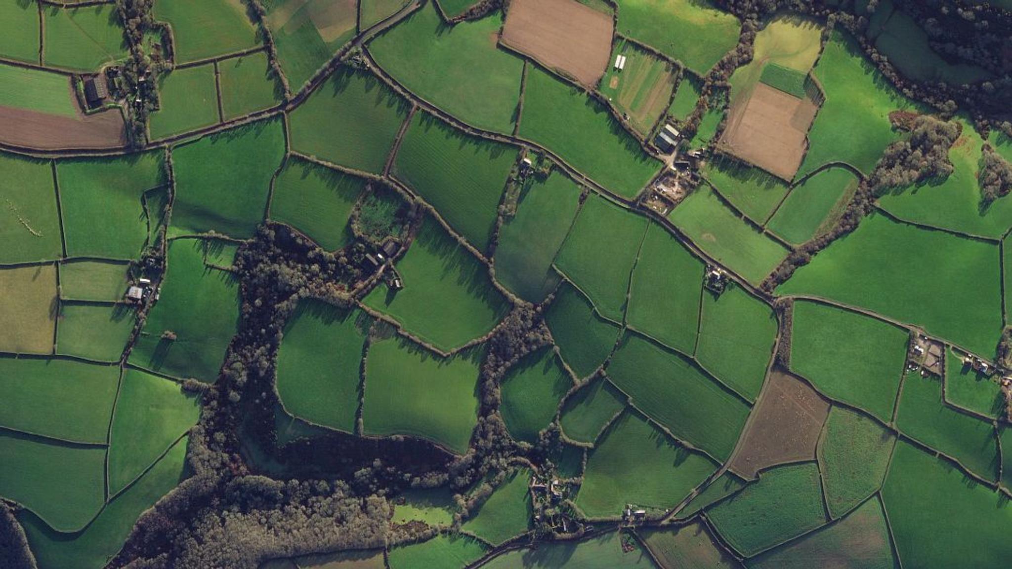
SkySat image of agricultural fields in Cornwall, England captured March 5, 2024. © 2024 Planet Labs PBC. All Rights Reserved.
StoriesLearn how satellite data and analytics help farmers and agricultural agencies monitor regenerative agriculture practices that reduce carbon emissions.
Agriculture, forestry, and land use emissions have a notable influence on global climate change, contributing 26% of total greenhouse gas (GHG) emissions. In response, environmental policies increasingly require sustainable agricultural practices like carbon farming, which maximize carbon sequestration.
But confirming compliance with evolving mandates can be challenging. Manual data collection is costly and time consuming, making it difficult to scale operations to meet new requirements.
With high-frequency satellite data and analytics, agencies can detect and monitor agricultural activity, at scale. Let’s explore how this practice, known as broad area management, helps stakeholders quantify change within agricultural parcels, verify compliance, and work towards emission reduction targets.
What Is Carbon Farming?
Carbon farming, also known as regenerative agriculture, aims to sequester atmospheric carbon dioxide (CO2) in the soil, by maximizing plant growth and minimizing soil disturbance.
When plants die, the carbon stored during photosynthesis is either released back into the atmosphere or stored for long periods of time in the soil. Many conventional agriculture practices, such as tilling, result in the release of carbon.
However, practices classified under carbon farming aim to do the opposite, by putting carbon back into the soil and keeping it there.
Carbon farming practices
Farmers that pursue carbon farming adopt several techniques, including:
- No-till farming: Avoiding plowing and tilling to minimize soil disturbance and erosion, preventing carbon from escaping the ground.
- Crop rotation and intercropping: Diversifying crops to improve soil health, increasing its capacity for carbon capture.
- Planting cover crops: Growing crops to cover the soil, rather than for harvesting. These plants protect the soil and improve nutrient cycling during off-seasons.
- Agroforestry: Integrating trees and shrubs into crop fields to improve soil structure, keeping carbon in the ground.
These methods can allow farmers to achieve greater soil health, biodiversity, water retention, and ultimately carbon sequestration.
Carbon Farming Incentives and Policy Implications
Both public and private entities increasingly view carbon farming as a vital strategy in achieving carbon neutrality.
On the private side, agricultural carbon credit markets incentivize farmers to adopt carbon farming practices. These markets trade pollution offsets in the form of carbon credits from farmers’ decarbonizing activities. And research suggests not only that agricultural carbon markets could prove profitable for U.S. farmers, but also result in the sequestration of 17 to 75 million megatons of CO2 equivalent per year.
On the public side, both the U.S. government and the European Union (EU) have pursued progressive and aggressive emissions targets and placed agriculture at the heart of ambitious carbon strategies. The Common Agricultural Policy (CAP) introduced subsidies for farmers who employ sustainable practices in the EU.
But farmers, regulators, and agricultural agencies all need accurate and reliable information to adopt, validate, and monetize agricultural decarbonization. And with Earth observation (EO) data, these stakeholders are able to monitor and quantify the impact of carbon farming practices, over time.
Monitoring Carbon Farming With Broad Area Management
Broad area management is the practice of monitoring, measuring, and reporting change across large, dispersed geographic areas using EO data.
Planet’s unique approach to broad area management brings together daily monitoring, high-resolution imagery, analysis-ready data, and analytics. Together, these capabilities allow agencies to look broader, back, closer, and deeper, to track and validate carbon farming practices.
Look broader
Monitor country-wide field activity throughout a growing season with near-daily, pre-processed Analysis-Ready PlanetScope® data, which is optimized and harmonized to simplify processing workflows.
Look back
Identify change within individual parcels over time with the Planet Archive, a living database that includes proprietary datasets back to 2009, and public datasets back to 1972.
Look closer
Track detailed agricultural events like mowing, plowing, and harvesting with PlanetScope data, which has a higher frequency and resolution than free satellite imagery, like Sentinel-2.
Look deeper
Quantify physical characteristics like crop biomass, soil water content, and field boundaries with Planetary Variables® — analysis-ready data products derived from information across the electromagnetic spectrum.
Use Cases for Planet data in Carbon Farming
Planet data and analytics support a wide range of carbon farming activities, including:
- Tracking farming practices: Monitor and verify crop rotation, planting schedules, and land use changes.
- Supporting compliance verification: Prove adherence to environmental policy mandates with reliable reporting and auditing data.
- Validating carbon sequestration: Measure the effectiveness of carbon farming via changes in soil health, vegetation cover, and carbon storage.
- Optimizing sustainable practices: Improve crop yields, reduce inputs, and become more resilient to the impacts of climate change.
- Improving resource management: Apply water, seed, amendments, and pesticides more strategically with timely and accurate data on agricultural conditions.
- Fostering collaborative research: Agricultural and environmental science partnerships rely on Planet imagery as a shared data source for research and development of innovative sustainable farming practices.
Case Studies: How Organizations Use Planet data in Sustainable Farming
Slovenia uses EO data to verify subsidy eligibility
Europe’s Common Agricultural Policy grants direct payments to farmers for approved greening practices. Unfortunately, on-the-spot checks for payments can put an administrative burden on member countries.
When the EU started allowing countries to use remote sensing for verification, the Slovenian National Paying Agency (ARSKTRP) leveraged national-scale Area Monitoring System (AMS) to streamline the payment eligibility determination process.
However, they soon realized that publicly available satellite data wasn’t a complete solution. Lea Remic, Head of the Department for Geospatial Applications at ARSKTRP, shared that almost a quarter of Slovenia’s parcels were too narrow for Sentinel’s constraints. “The whole program would be under risk due to too many inconclusive parcels, were there not for this additional source — Planet.”
By looking closer with Planet data, ARSKTRP has reduced the number of inconclusive parcels from 246,000 to 66,000 and cut the cost of follow-up activities by more than €1M. Using Planet data has also reduced the burden on farmers to submit additional proof of certain activities, which has improved public sentiment about the program.
Netherlands Geomatics & Earth Observation B.V. (NEO) helps European nations implement efficient AMS for CAP
“At NEO, our goal is to monitor all objects visible from the skies,” said Henk Janssen, Project Manager and Consultant for Earth Observation and Geomatics at NEO. “Specifically, we focus on agricultural parcels to support national paying agencies in monitoring subsidy applications from farmers.”
NEO supported the Area Monitoring System implementation in Denmark, the Netherlands, and Ireland. By using Planet data to generate parcel-aggregated time series, NEO helped the Netherlands Enterprise Agency (RVO) increase the number of monitored parcels from 650,000 to 1 million.
“The Planet datasets are crucial for us because they fill the gaps left by Sentinel data sets,” explained Janssen. “With a higher return time and the ability to identify activities on smaller and narrower parcels, we can monitor 25% more parcels and use twice as many images to fill our models.”
Quantify Change and Verify Compliance With Planet
In a world already experiencing the effects of climate change, carbon farming emerges as a powerful solution to mitigating emissions and promoting sustainable land use.
Carbon farming benefits include more biodiversity, healthier ecosystems, better soil health, and stronger agricultural resilience — which reduce greenhouse gases in the atmosphere.
And with Planet EO data and analytics, stakeholders can better monitor carbon farming activity, streamline subsidy program administration, and accelerate progress towards shared emission reduction goals. Contact us today, to learn more.
Ready to Get Started
Connect with a member of our Sales team. We'll help you find the right products and pricing for your needs.