
Powered by Planet Data, The Allen Coral Atlas Completes Its Mission to Comprehensively Map All of the World’s Coral Reefs from Space
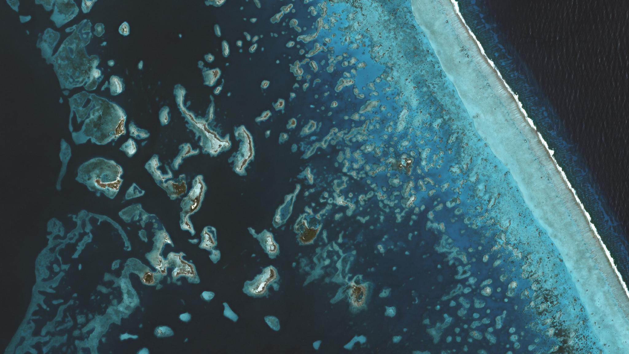
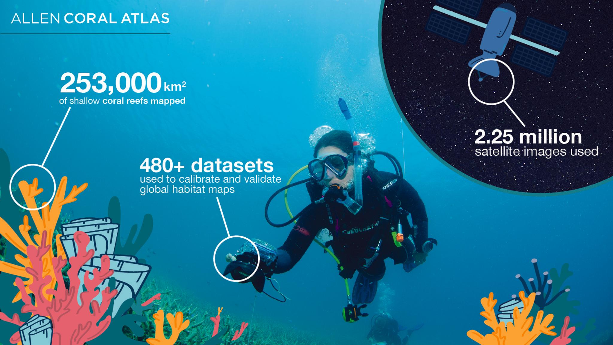
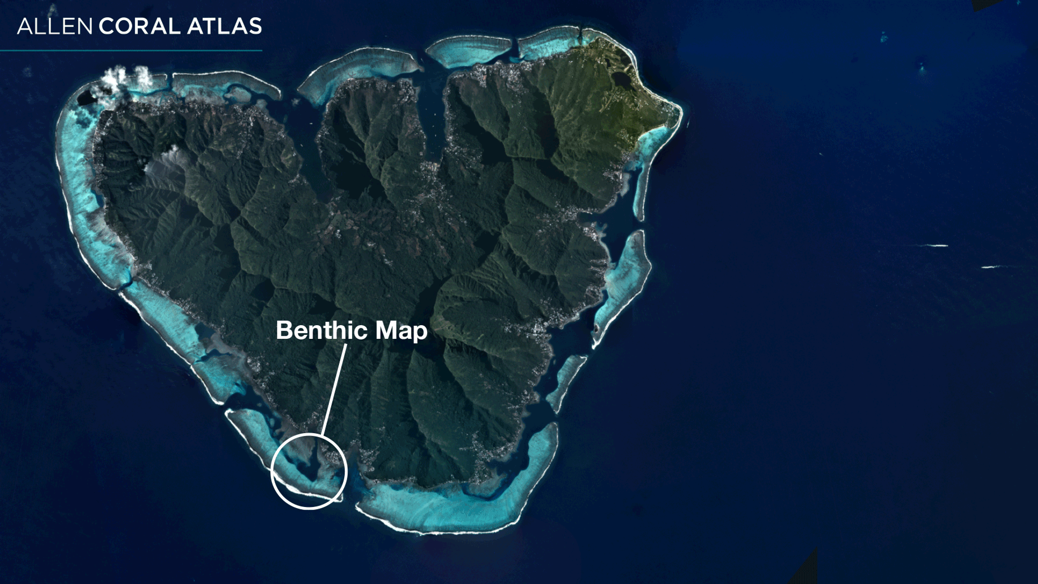
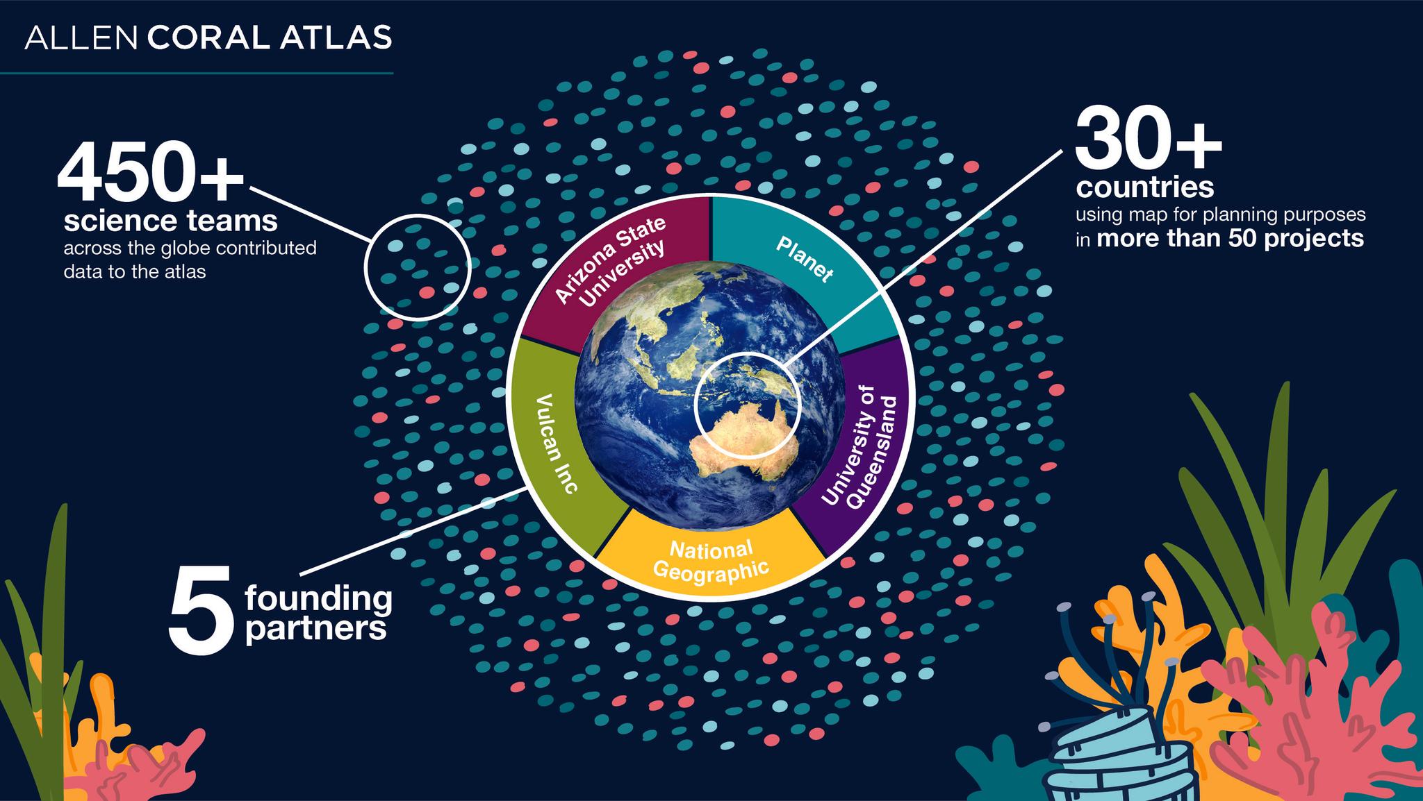
Today marks a major milestone for global ocean science, management and biodiversity conservation. Utilizing more than two million Planet images, ground data collected from around the world, and advanced machine learning techniques, our partners at the Allen Coral Atlas, housed at Arizona State University, have now completed the first-ever, high-resolution spatial and thematic detailed mapping of all the world’s tropical, shallow coral reefs. The results are available for free at allencoralatlas.org. Starting with a base layer of coral reef satellite images, the Atlas project interweaves a series of robust data layers to map reef structure, benthic information, and species composition. Planet provides a global coral reef mosaic from PlanetScope satellite imagery as part of this foundational layer. This continuously updated high-resolution imagery of coral reefs, allows the mapping project to scale across the global tropics. With this level of timeliness and detail, conservationists, governments and local communities can plan more precisely and effectively target conservation and restoration interventions. [caption id="attachment_147346" align="aligncenter" width="1500"]
Ready to Get Started
Connect with a member of our Sales team. We'll help you find the right products and pricing for your needs