
Civil Government Expands Investment in High Frequency Satellite Imagery
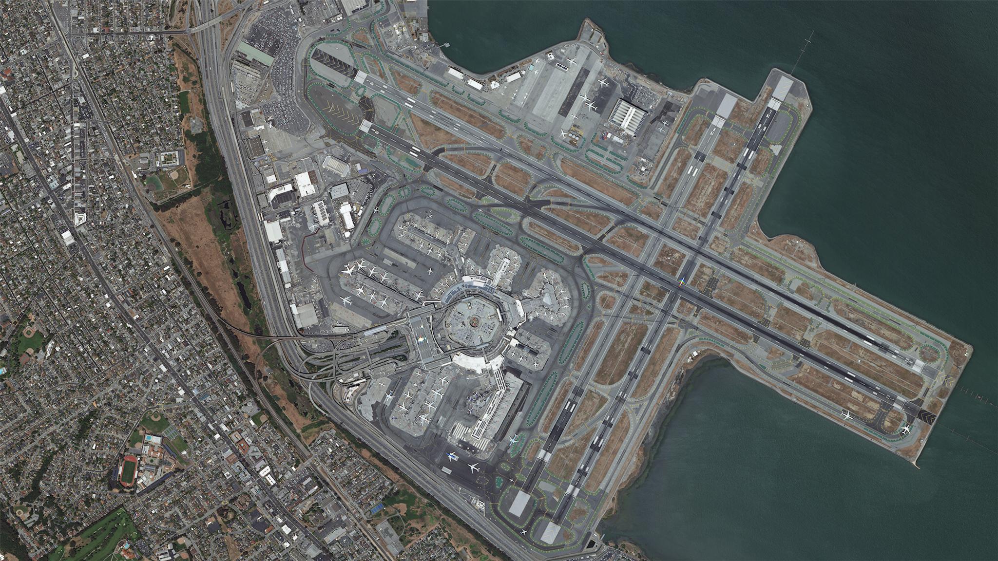
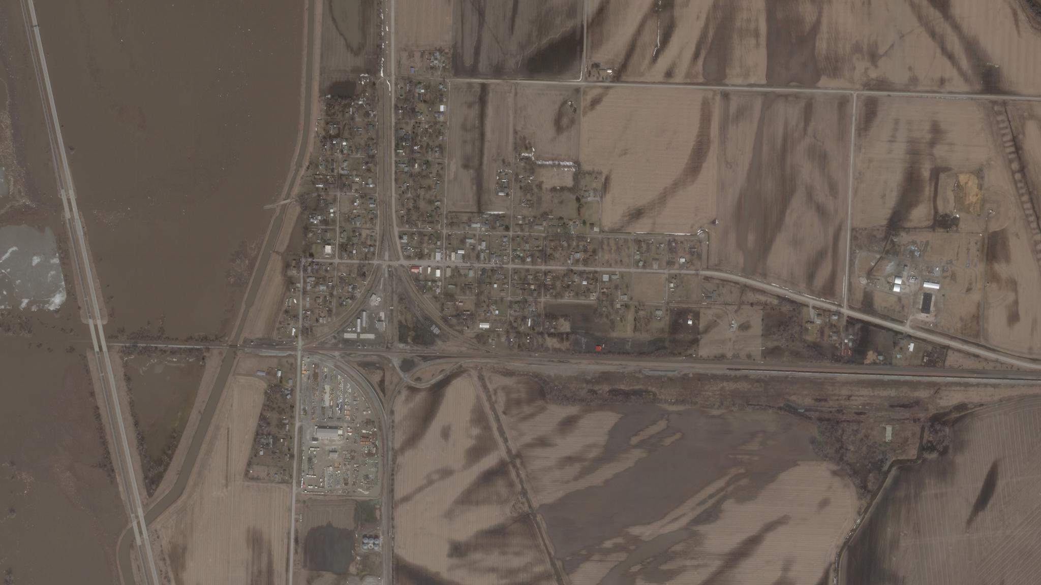
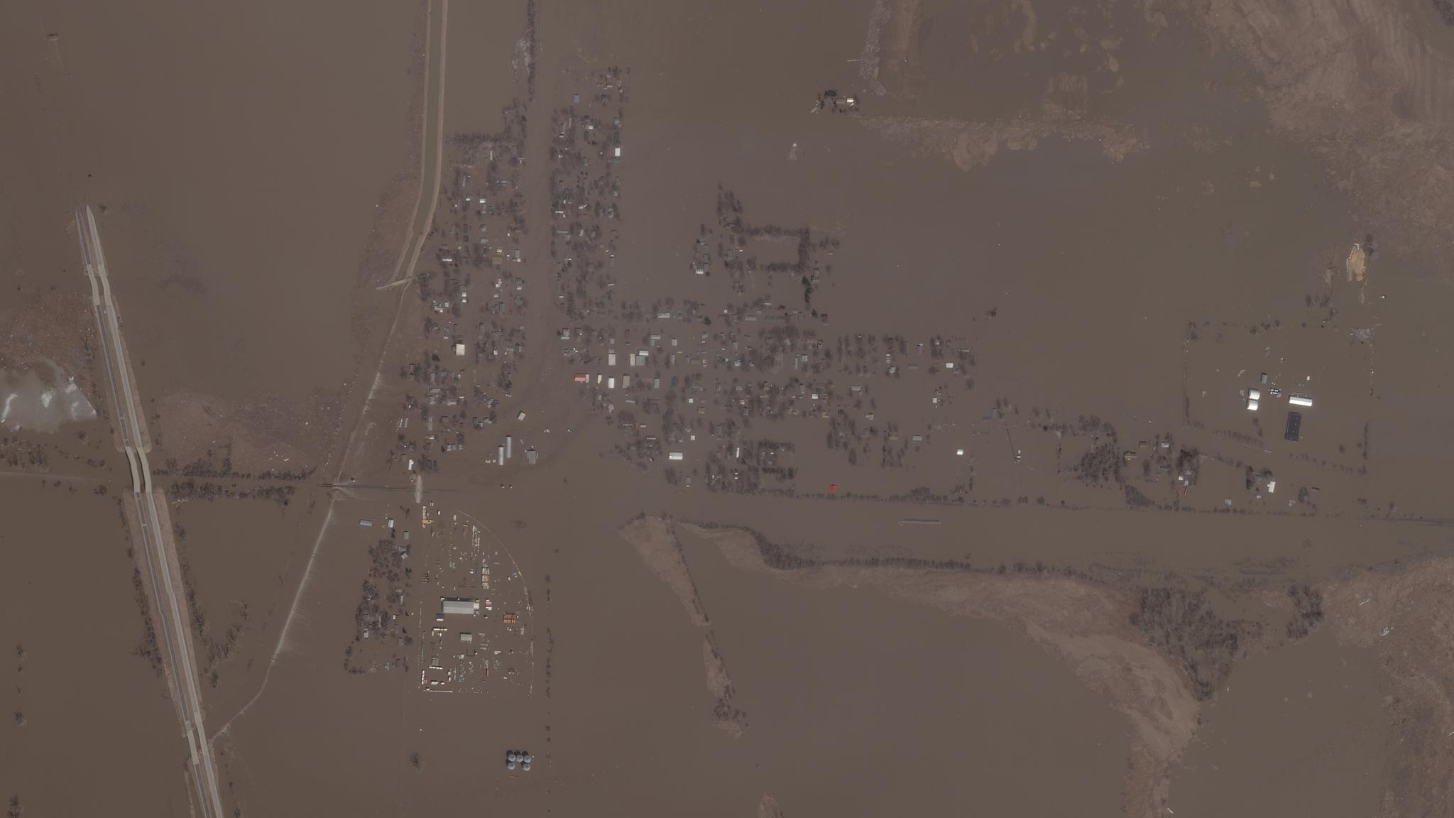
Effective governance requires good data. Local governments are spending billions to upgrade their technology infrastructure, ranging from smart cities initiatives to data migration to the cloud. At the same time, budgets are constrained and expenditures need to be justified by demonstrating clear value. Planet satellite imagery is proving to be a cost-effective data source that enables government leaders to make more informed decisions with real-time information. Planet has signed a roster of new deals with civil government customers in the first half of 2019, underscoring continued traction in this strategic market. The City & County of San Francisco is using Planet’s high resolution imagery for biweekly monitoring of infrastructure upgrades and maintenance at San Francisco International Airport. This includes the upcoming multi-million dollar project to reconstruct one of the main runways which accounts for more than two thirds of all traffic. Planet's current imagery enables more efficient reviews of airport plan updates, and allows airports to collaborate more effectively with the Federal Aviation Administration (FAA) on airport planning, design, operations and maintenance decisions. At the state level, Iowa Homeland Security & Emergency Management enrolled as a new Planet customer after the United States Midwest experienced the wettest spring on record in over 100 years. “When disaster strikes, you need to take immediate action,” says Jon Paoli, who serves as Iowa’s GIS/IT Coordinator Communications and Infrastructure Bureau Chief. [caption id="attachment_143600" align="aligncenter" width="3840"]
Ready to Get Started
Connect with a member of our Sales team. We'll help you find the right products and pricing for your needs