
A Protocol for Near Real-time Tropical Deforestation Monitoring
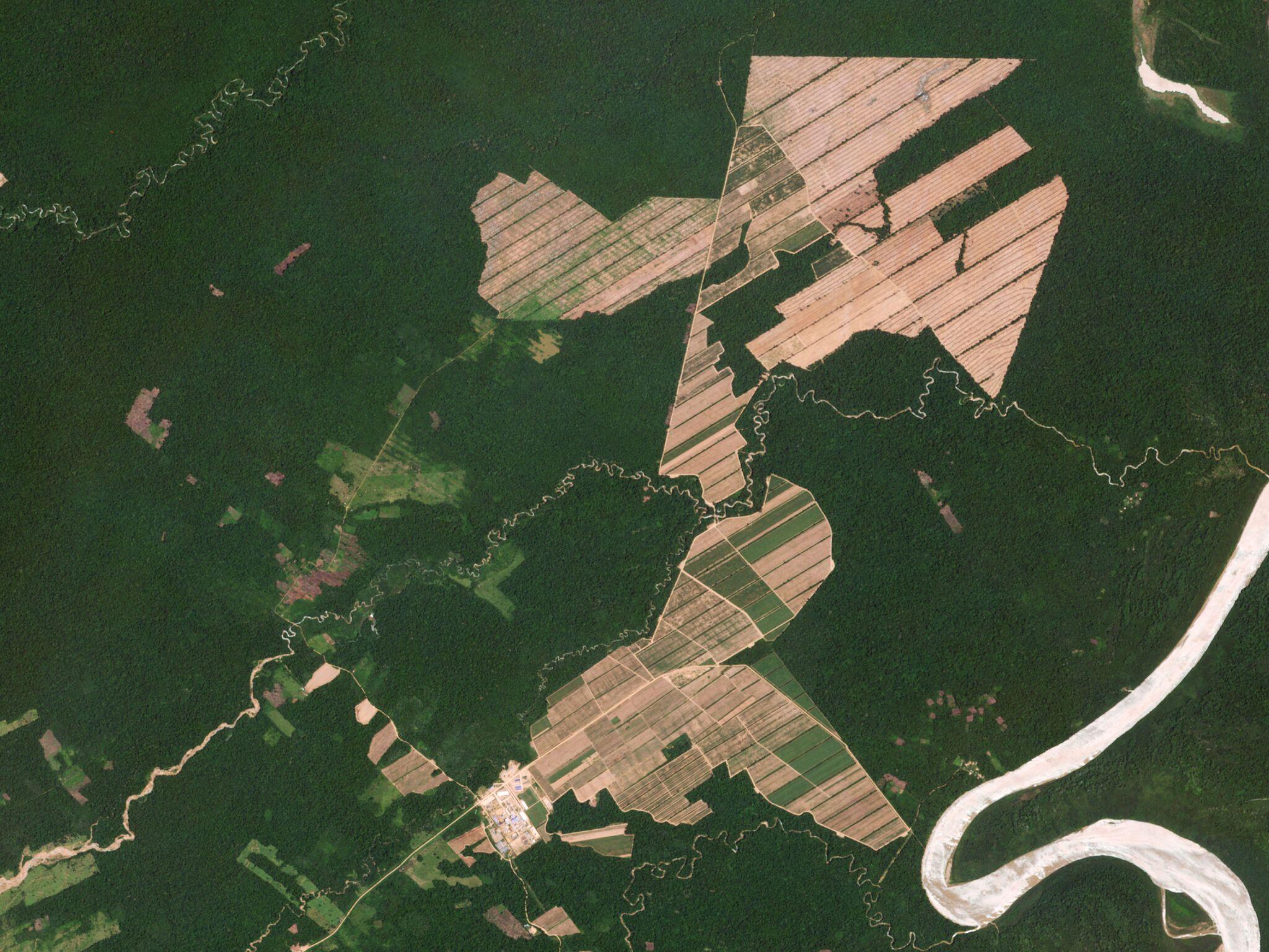
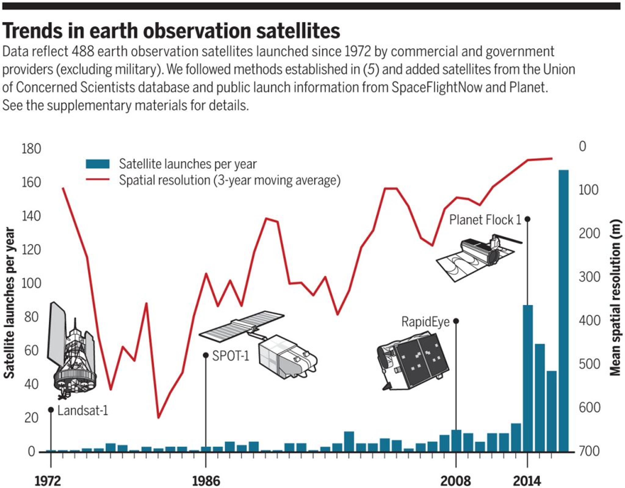
Over the past few decades, traditional Earth observation satellites have made huge contributions to the creation of standardized, historical, and publicly accessible information on land cover and land use change. However, their low spatial and temporal resolutions – exacerbated by limited computing power – have constrained their use by decision makers. The challenge is even greater in tropical forests, where persistent clouds reduce actionable data. A new paper in Science, by lead author Matt Finer of Amazon Conservation Association and co-authored by my colleagues Joe Mascaro and Forest Stearns, argues that the tradeoff between resolution and frequency of satellite imagery is no longer a significant barrier to achieving near-real-time monitoring of tropical forests. This is due to a dramatic increase in the number of Earth observation satellites and the rise of cloud computing and machine learning, which can quickly process and analyze petabytes of data.
Ready to Get Started
Connect with a member of our Sales team. We'll help you find the right products and pricing for your needs