Detecting and Eradicating Invasive Grass Affecting Pasture and Ranch Land
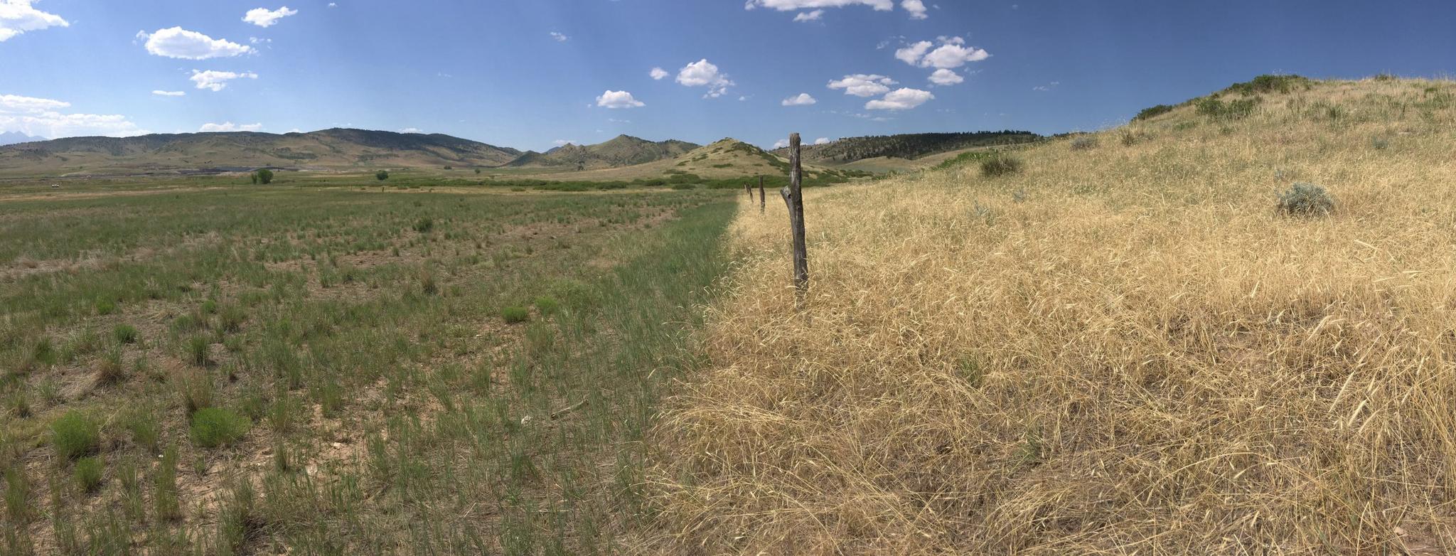
Grass treatment line after being treated with Rejuvra. Image credit: Bayer Environmental Science
StoriesInvasive plants such as cheatgrass, medusahead, and ventenata are wreaking havoc with ranchers, farmers, land managers, and transport companies around the world, and driving concern among environmental groups that fear the impacts on other plants and wildlife. Once invasive plants become established, they can dominate a landscape – creating monocultures and destroying wildlife habits.
For ranchers, invasive plants can also significantly reduce the land’s natural productivity for livestock, greedily removing water and nutrients from the soil which outcompetes all native species.
To respond to this need, Bayer Environmental Science created RangeView, a digital platform for the range and pasture industry using satellite imagery and planning tools to help ranchers assess pastures with the most infestation of annual invasive grasses and evaluate the return on investment for treating them.
Bayer ES needed satellite imagery with the right spectral, spatial and temporal resolution to identify the location of cheatgrass for their RangeView platform. In addition, land managers needed predictability – that is, the accuracy of cheatgrass identification on RangeView models, and the ability to see progress in eradicating cheatgrass over time.
Planet’s Professional Services Team helped Bayer ES discover the best approaches for using satellite imagery, without the time-consuming extra work along with working together on figuring out how best to process and serve the data out to end users.
“A huge benefit to working with the Professional Services team is a transparent understanding of new products and features that are on their roadmap,” said Brent Slone, Director of Geospatial Solutions for LifeScale Analytics, who provides geospatial expertise to Bayer on projects including RangeView. “Being able to communicate with the Professional Services team and get their assistance made us realize that we could use their weekly surface reflectance basemaps to create an accurate and scalable solution.”
With Planet surface reflectance (SR) Basemaps, RangeView now offers the updated and historical images that allow users to compare cheatgrass infestations in both treated and non-treated areas. For Bayer ES, the result is a complete platform that significantly reduced the R&D and product prototyping necessary to bring RangeView to market. Planet’s global coverage is also critical to RangeView’s ability to attract customers that need to maximize profitability in every acre.
“Planet’s SR Basemaps are great for our line of work. In fact, I don't know that RangeView would be where it is now without Planet – for one thing, Planet helped save us from a lot of the R&D and prototyping that we were doing,” said Slone.
Bayer reports that RangeView now offers more than 90 percent accuracy on its models for cheatgrass identification.
Learn more about how Bayer Environmental Sciences leverages Planet data for invasive species here.
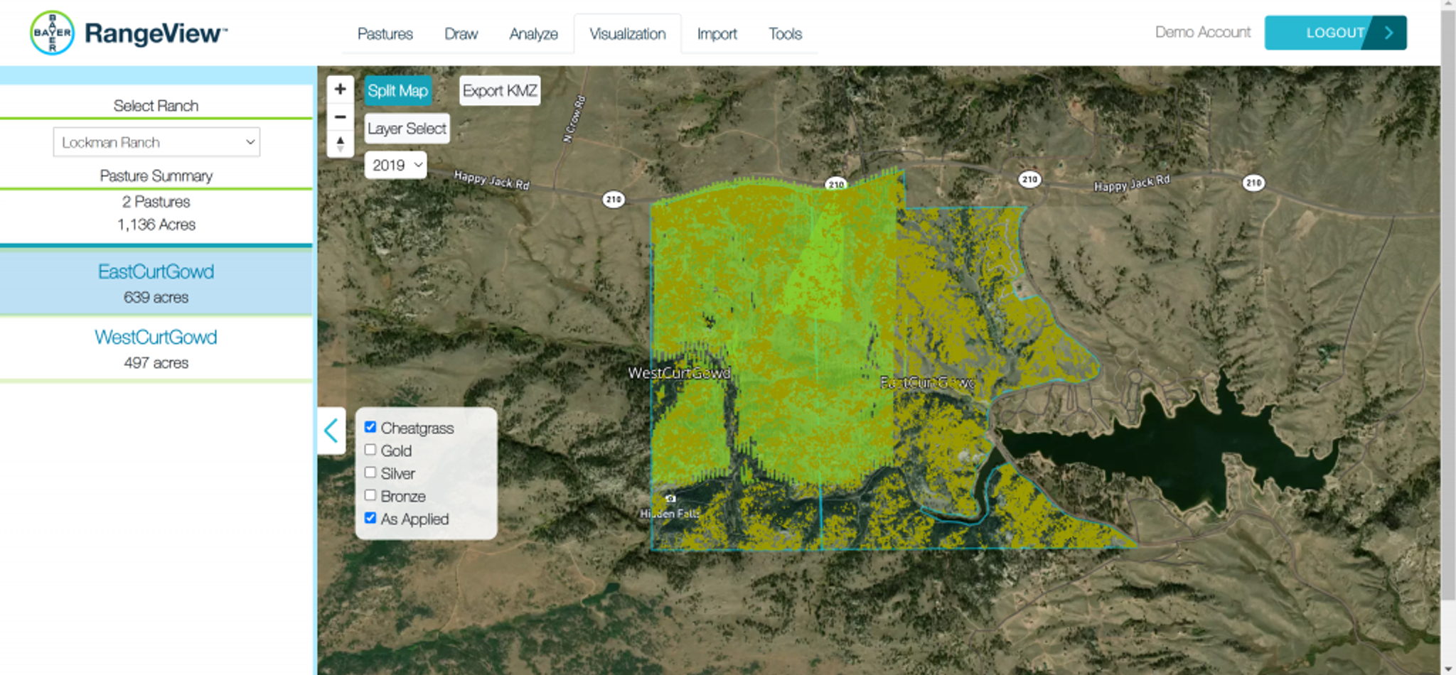
Rejuvra is an herbicide designed to stop cheatgrass at the germination stage. It was applied to a large section of this ranch using aerial application in 2019 (green shaded area).
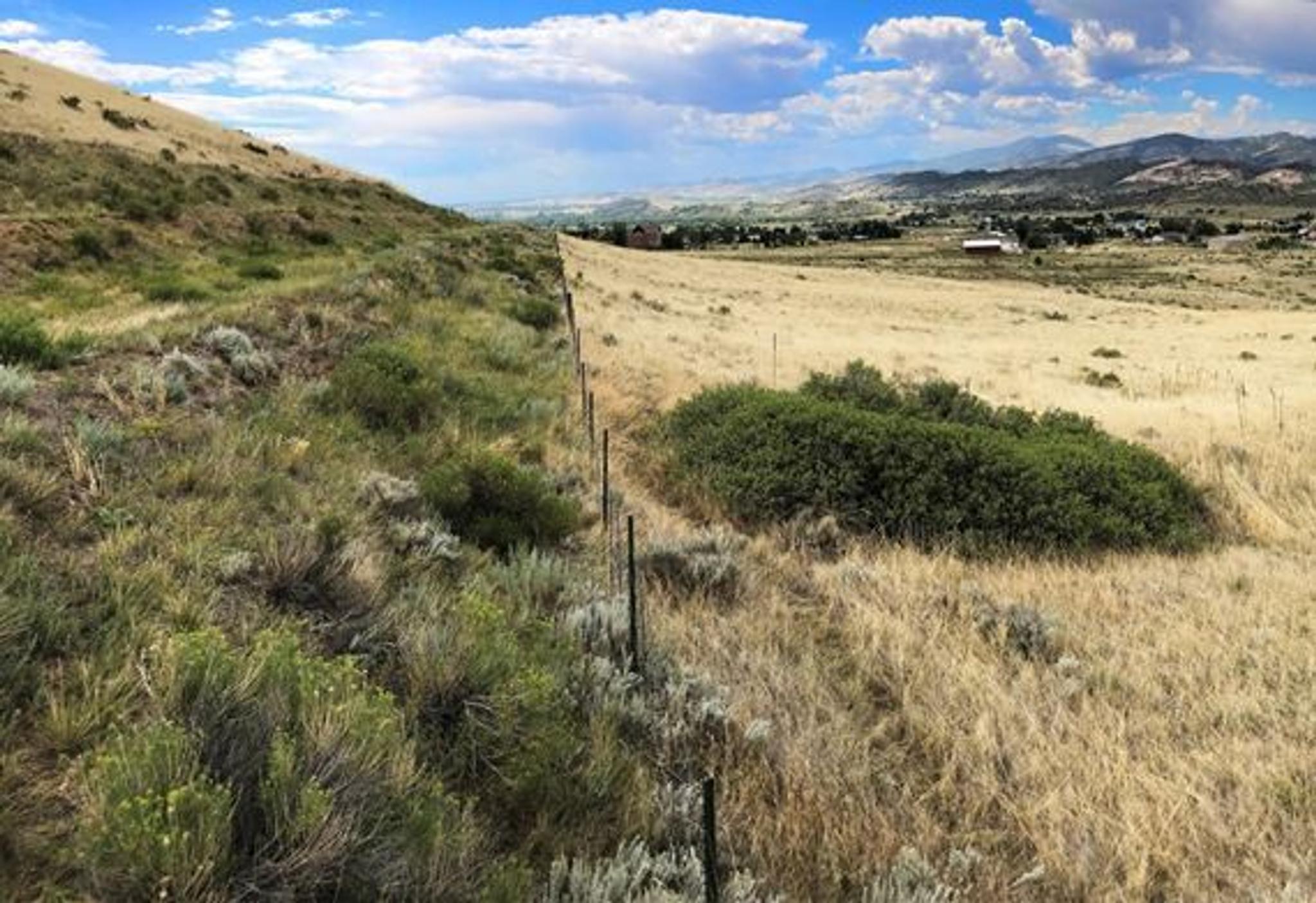
Side by side of treated cheatgrass with Rejuvra and untreated cheatgrass. Image provided by Bayer ES.
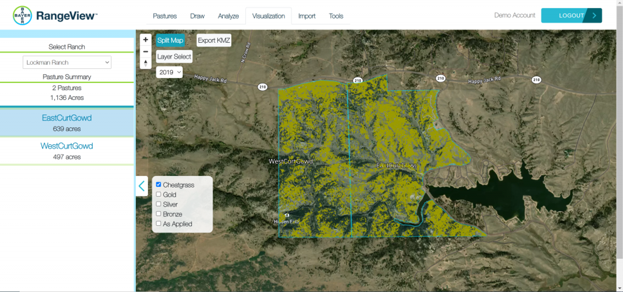
Rangeview combines vegetation research and proprietary algorithms with Planet satellite imagery to detect cheatgrass (Bromus tectorum) invasion on ranches in the western United States. Yellow pixels depict the density of cheatgrass on this ranch.
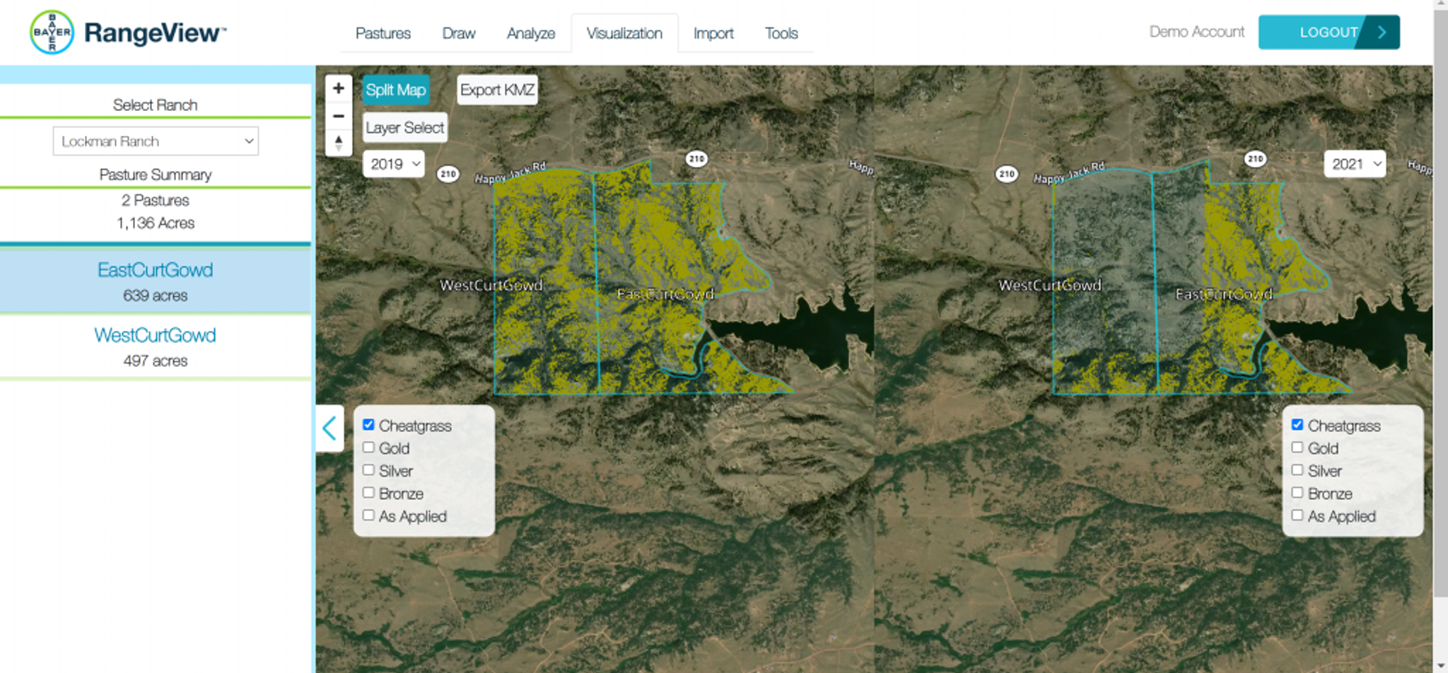
Rejuvra is designed to protect rangelands for up to four years so desirable forage can return. This increase in forage availability reduces grazing pressure on the land and improves the overall ecosystem productivity. The above split view shows before and after Rejuvra treatment between 2019 and 2021 and the reduction of cheatgrass.

Ready to Get Started
Connect with a member of our Sales team. We'll help you find the right products and pricing for your needs.

