
Ensuring Sustainable Urban Development and Protecting Biodiversity with the Government of New South Wales
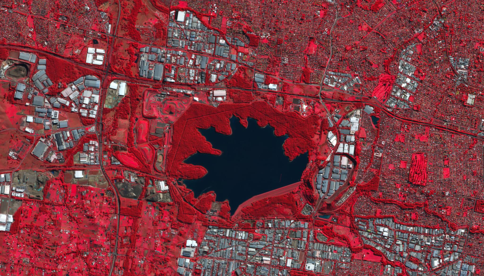
False color Planet image of region of urban development and vegetation (seen in red) around a reservoir in Sydney, New South Wales, Australia taken June 15, 2024. © 2024 Planet Labs PBC. All Rights Reserved.
StoriesEarlier this year, the Australian government of New South Wales (NSW) designated $100 million towards housing development and biodiversity protection. This allocation is set to enhance the existing programs run by the government of NSW, such the Cumberland Plain Conservation Plan. This 35-year plan aims to enable needed housing development in Western Sydney while protecting areas of high biodiversity value across the landscape - including the home of the largest koala population in the Sydney Basin.
To conduct this ambitious project, the government of NSW worked with Planet partner NGIS, to employ our SkySat 50 cm satellite data to map and monitor the evolving Australian landscape and make informed policy recommendations regarding urban housing and the protection of wildlife corridors.
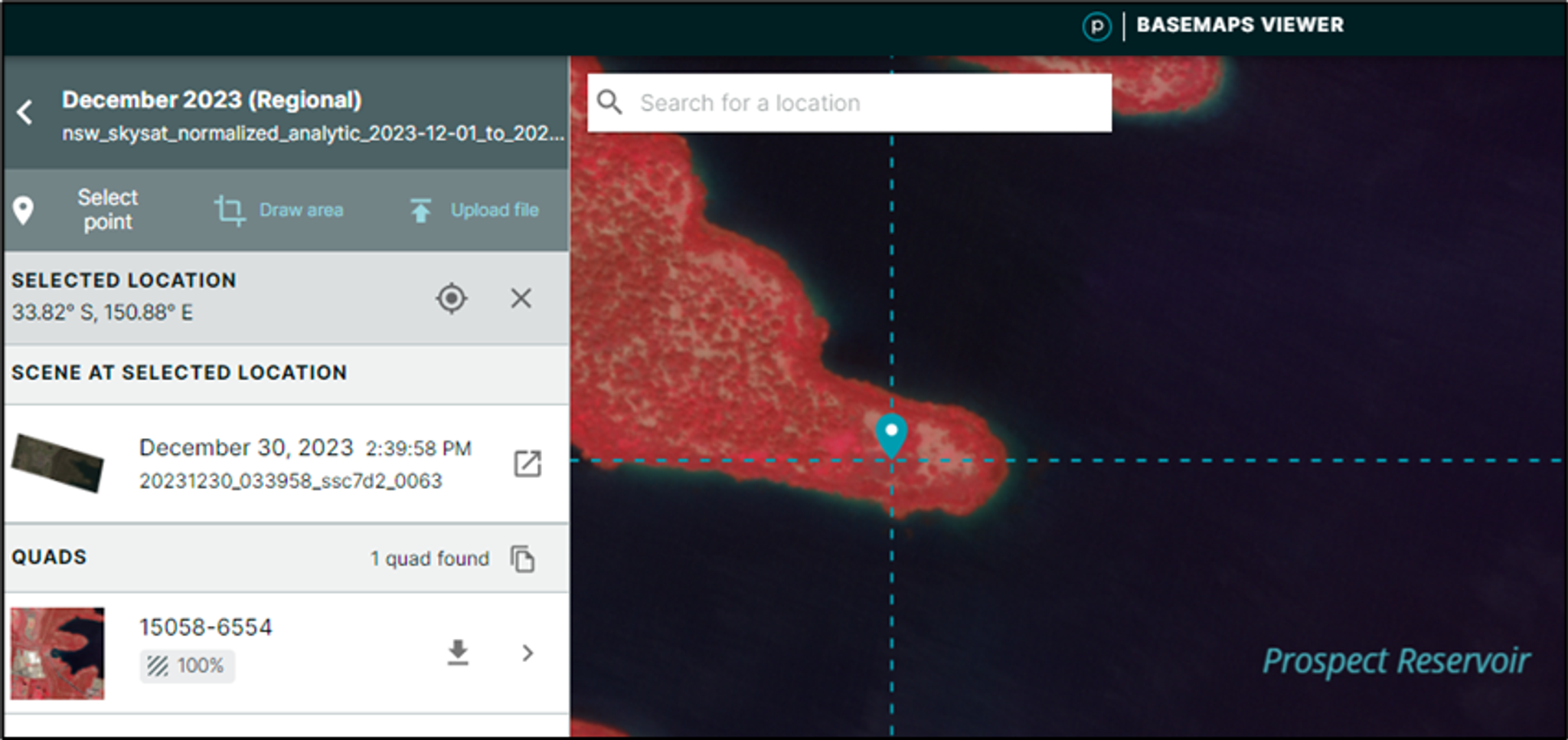
Planet Insights Platform interface showing Basemaps Viewer for New South Wales location.
“Our goal is to help design and create thriving communities, towns, and cities for the people of New South Wales,” explained Dyllen Redman, Senior Planning Policy Officer for the New South Wales Government. “We work to ensure jobs, infrastructure, and housing are delivered sustainably with environmental protection at the front of mind.”
Through remote sensing and geospatial analyses, Dyllen and his teammates are working to establish a baseline of biodiversity values and native vegetation extent across the region to support the execution of the Cumberland Plain Conservation Plan (CPCP). The CPCP reported that it will facilitate the creation of around 73,000 homes in the region by providing necessary biodiversity approvals.
“Our plan’s area covers approximately 200,000 hectares. This is quite a large area to be monitoring each and every year, so we need a system that can capture this size in a short time period, can be mobilized quickly, and most importantly, something that is reliable,” Dyllen explained.
While the team made significant headway on their biodiversity assessments by conducting field surveys and analyzing airborne or aerial images, Dyllen noted that since working with Planet data, they are able to more efficiently conduct their assessments. With traditional airborne captures, their team reportedly faced significant uncertainty as factors, such as unpredictable weather, hangar locations, and airspace restrictions, could cause the team to have to wait up to four months to receive data of the full region. Dyllen shared that, in comparison, the same data could be received from Planet in just a few days.
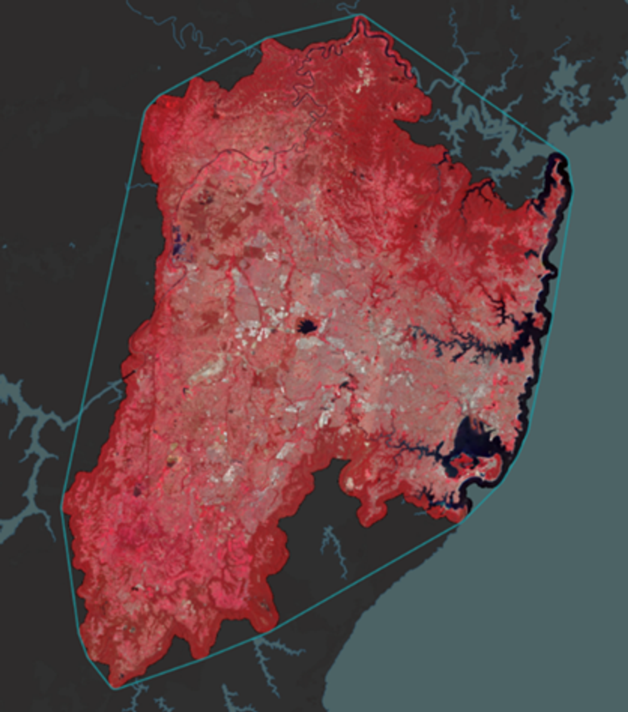
Planet false color representation of SkySat Basemap showing New South Wales.
“We used SkySat captures in our program to make a complete image of Western Sydney for analysis. The higher frequency at which the SkySat captures are able to be tasked is what makes Planet a leading provider for us, as we're able to save on cost and time compared to traditional airborne captures,” Dyllen said. “With Planet, we have saved around two months on average as we're able to leverage the SkySat system, which is constantly in orbit, passing over Australia multiple times every day. We have also saved tens of thousands of dollars in labor, parts, and fuel that usually go with using airborne captures.”
So, what’s next for the government of New South Wales?
Dyllen is excited to keep working with NGIS to utilize Planet’s satellite data. “NGIS has been a great partner to help identify Planet's data as meeting our remote sensing specifications. They have been pivotal in making our latest imagery capture happen by leveraging their relationship with Planet as a provider and by also being able to translate all of the technical remote sensing information, helping ensure that the data we're getting will meet our business requirements,” he shared.
This data is enabling the government of NSW to evaluate vegetation change over time, identify regions for ecological restoration, and create wildlife corridor maps for koalas to move safely from one part of the ecosystem to another. These satellite images are now also being shared across eight state and local government agencies participating in the CPCP, generating new opportunities for data-informed policy planning.
“Our vision for the future of using Planet data is to continue with the satellite captures year-to-year. We're also very excited to test the upcoming Pelican system that hopefully will be launched soon,” Dyllen shared. “That high resolution and high-quality specifications for the camera will only improve our monitoring of biodiversity across the landscape. Who knows what we'll be able to uncover by using the improved systems as we go forward for the next 35 years?”
Ready to Get Started
Connect with a member of our Sales team. We'll help you find the right products and pricing for your needs.