
Forest Recognition: Planet Launches Kaggle Competition
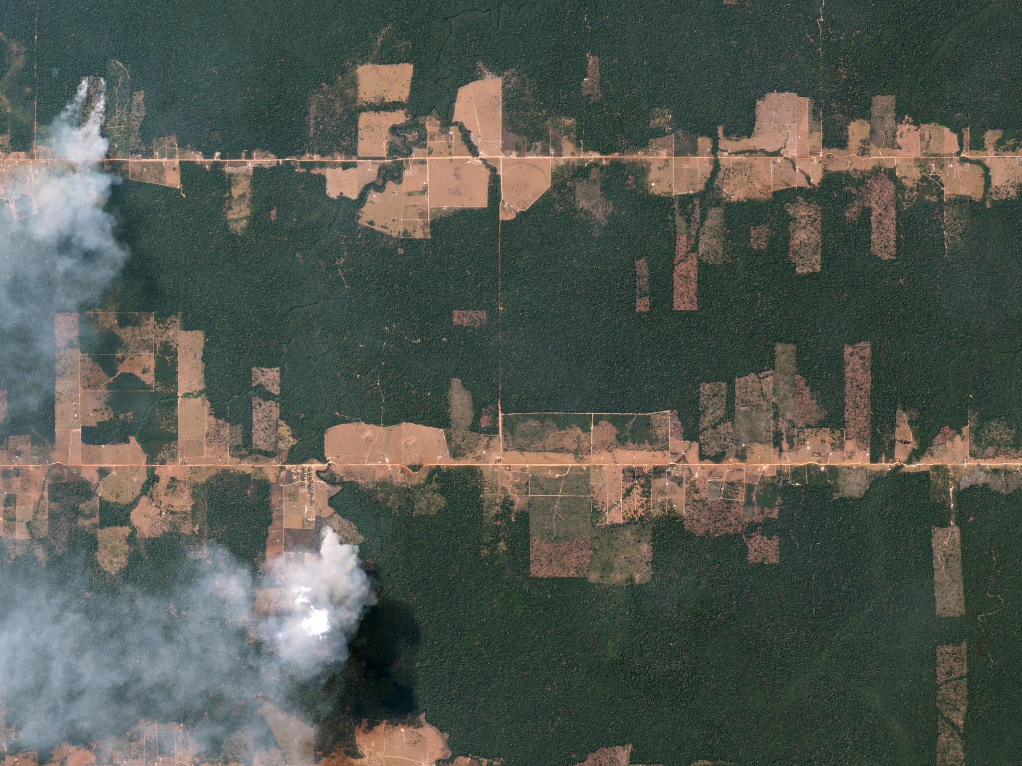
"Fishbone" deforestation patterns In the Amazon rainforest near Porto Velho, Brazil © 2016, Planet Labs Inc. All Rights Reserved.
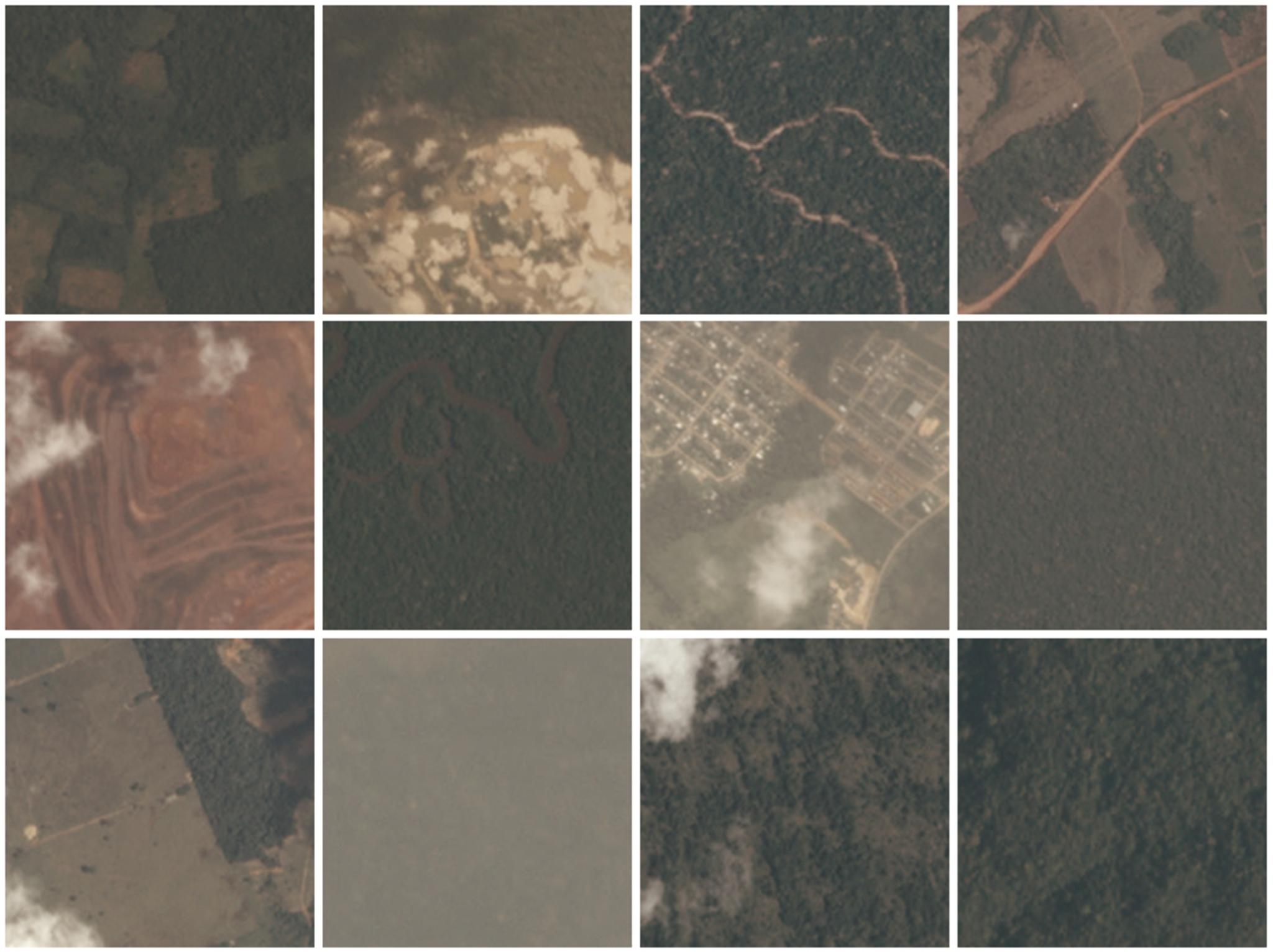
NewsThe amount of data is growing exponentially. The amount of labeled, clean data is not. Every advance in machine learning is built upon a well-labeled dataset. Technology companies all over the world use the ImageNet library to train computer vision and machine learning algorithms; and modern facial recognition technology was built on top of Carnegie Mellon’s PIE database. In an effort to spur on machine learning advances in the satellite imagery field, Planet has launched a satellite data competition on Kaggle for the Amazon basin. Every minute, the world loses an area of forest the size of 48 football fields. Better data about the location of deforestation and human encroachment on forests can help governments and local stakeholders respond more quickly and effectively. Planet is releasing thousands of image chips from the Amazon basin, labeled with information about atmospheric conditions and the presence of roads, mining, agriculture, human habitation, rivers, and more. Kagglers from around the world are challenged to label each chip as accurately as possible, competing for $60,000 in prizes. 1st place: $30,000 USD 2nd place: $20,000 USD 3rd place: $10,000 USDPlaneteers and the remote sensing experts of SCCON will be active on forums throughout the competition to advise on technical details and the phenomena visible in the imagery.
Ready to Get Started
Connect with a member of our Sales team. We'll help you find the right products and pricing for your needs.