
Forests, Food, and Frequent Satellite Data for International Day of Forests 2025
Food security begins with forest protection. Forests enrich the ecosystem as a haven for wildlife, supplying water for agriculture, and as a source of diverse products needed to produce food. Recognizing this vital link, the United Nations’ International Day of Forests 2025 theme highlights “Forests and Foods”.
The pressing question now is: How do we use technology to efficiently protect our forests from bushfires, wildlife poaching, unauthorized land conversions, and other illicit activities?
Forest health monitoring using satellite data offers a powerful, proactive, and practical approach, enabling governments and conservation organizations to effectively protect these invaluable resources.
Forest Protection and Food Security in Asia-Pacific
The Asia-Pacific region is home to the world’s most biodiverse countries. Monitoring and collecting forest health data across biodiverse countries like Indonesia, Australia, India, and Malaysia, is challenging. Manual processes, gaps in public datasets, and limited access to certain remote and contested areas make it even harder to gather accurate, timely information.
That’s where broad area management comes in. Broad area management, as pioneered by Planet, is a distinct approach to monitoring, measuring, and reporting changes over land and sea, across different timescales. Even without prior experience in geospatial data, authorities and conservationists can easily detect changes in their areas of interest and access analysis-ready satellite data to make informed decisions.
Watch this 2-minute video about broad area management in forest health monitoring:
With the powerful combination of broad area management and advanced AI within a cloud-native platform, governments gain unparalleled insights and applications of satellite imagery to protect forested ecosystems.
How you can use Planet satellite imagery and analytics to enhance natural resource management:
- Spot early signs of deforestation before they escalate
- Track global deforestation trends and understand their impact
- Accurately measure forest cover loss with high-frequency imagery
- Strengthen bushfire response strategies using near-daily data
- Monitor wildlife populations to prevent poaching and habitat loss
- Manage reforestation projects remotely with updated insights
- Estimate forest carbon levels to support carbon offset projects
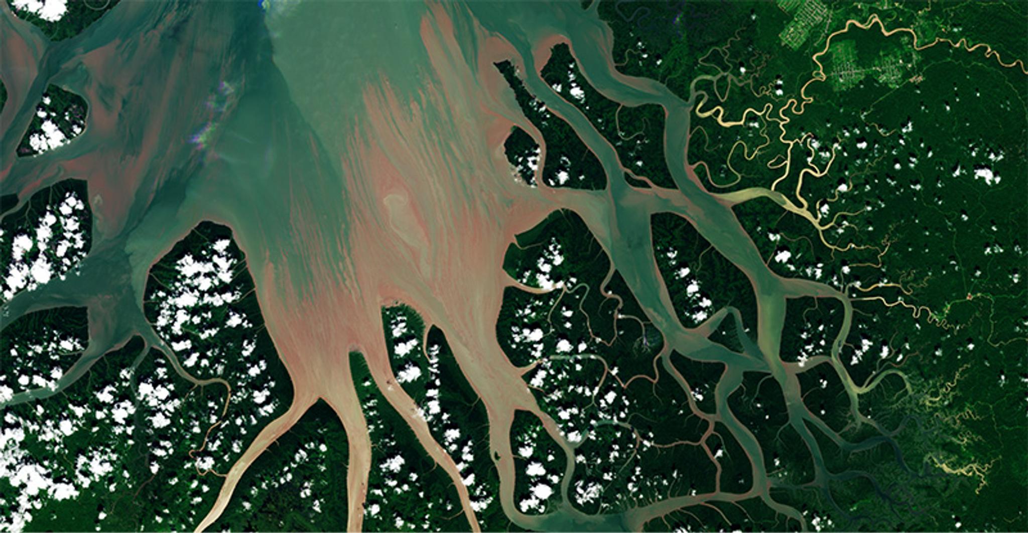
PlanetScope image of a mangrove forest in West Papua, Indonesia, captured on March 16, 2023. © 2023, Planet Labs PBC. All Rights Reserved.
When forests are protected, we move closer to achieving global food security. Healthy forests regulate water cycles, reducing the risk of droughts and floods that disrupt agricultural systems. They preserve soil health, which is essential for food production, and serve as a direct food source for vulnerable communities across Asia-Pacific.
Explore more use cases on how forest protection advances global food security in our on-demand webinar, “Cultivating a Regenerative Future: Satellite Data for Food Security & Environmental Protection in Asia-Pacific”.
Ready to make an impact? Connect with us to get started.
Ready to Get Started
Connect with a member of our Sales team. We'll help you find the right products and pricing for your needs