
From Floods to Fires: How Latin America is Tackling Disasters with Technology
Note: This piece can also be read in Spanish and Portuguese.
Climate change is intensifying natural disasters in Central and South America, from raging forest fires to devastating floods and landslides. According to the Intergovernmental Panel on Climate Change (IPCC), the frequency and intensity of extreme weather events in the region have increased significantly in recent years, leading to a 23% rise in the number of recorded natural disasters in the last decade. The rising risk has pushed public and private sectors alike to rethink their approach to disaster management.
At the "Planet On The Road" event in Bogotá, Colombia, experts from the region shared how they’re using real-time satellite data to protect communities.
Monitoring Hazards at a Mega-Dam Project in Colombia
At large dam sites, flood and landslide risks create high stakes for environmental protection and local communities. William Ramírez, Environmental, Social, and Sustainability Professional at Empresas Públicas de Medellín (EPM), discussed risk monitoring at Colombia’s Hidroituango hydropower project.
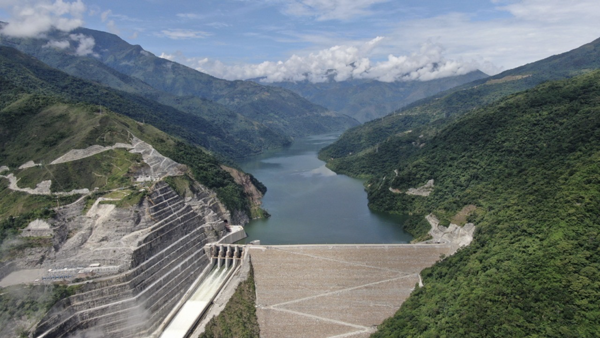
Imagery provided by EPM - DAM HidroItuango Hydroelectric Project
Imagery provided by EPM - DAM HidroItuango Hydroelectric Project
The Hidroituango project presents a unique challenge due to its scale and potential environmental impacts along the Cauca River. Floating debris, shifting land, and heavy rainfall all threaten the dam and surrounding areas.
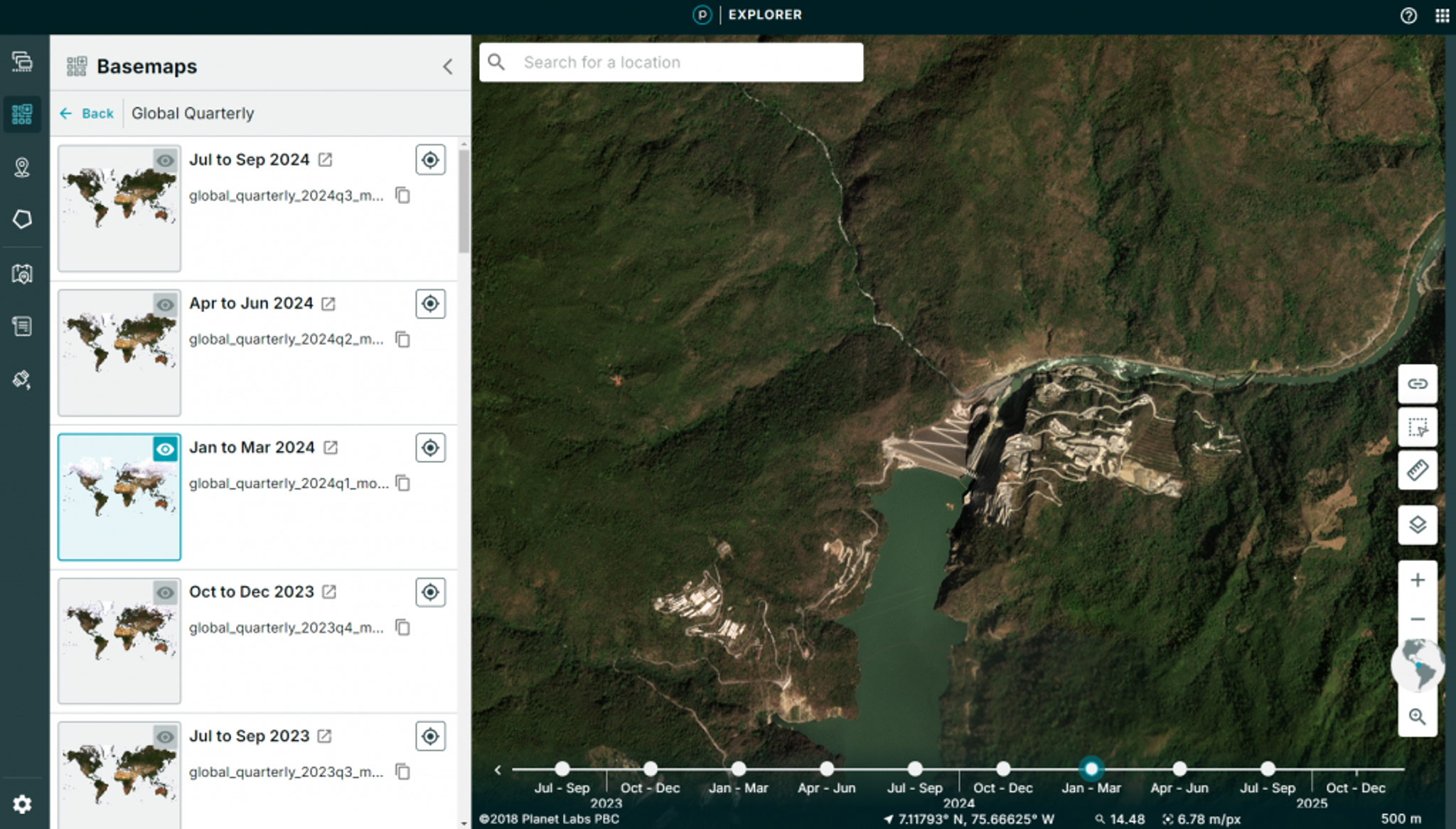
Imagery from the Planet Insights Platform displaying DAM HidroItuango Hydroelectric Project
Ramírez’s team uses Planet imagery to continuously assess the situation and take preventative action before hazards become disasters. "Satellite monitoring allowed us to control and characterize the phenomena," he noted. “That does not only involve the threat of flooding but other types of threats of natural or human origin.” With near real-time data, EPM can better safeguard infrastructure, land, and lives.
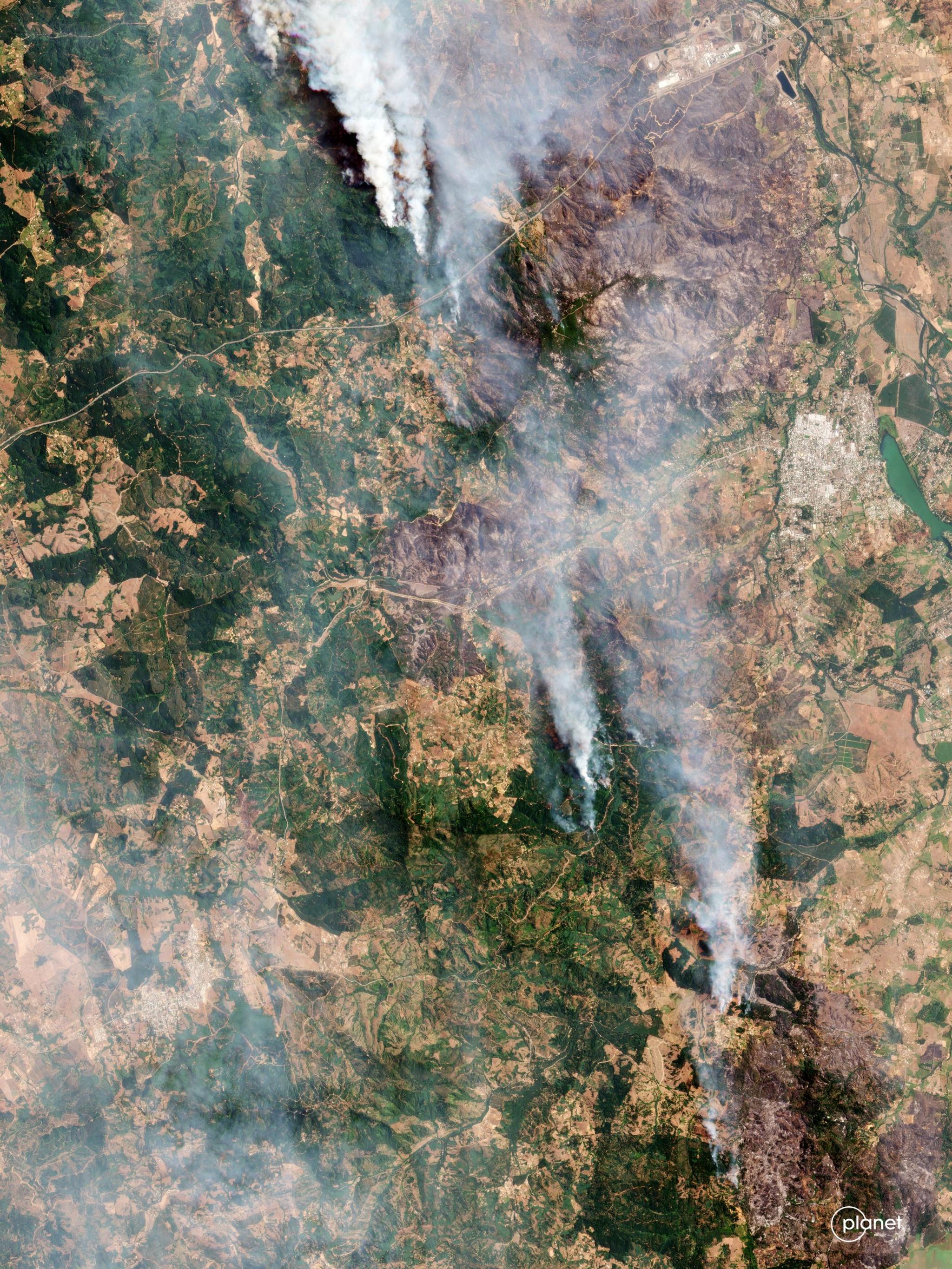
Fighting Wildfires with Real-Time Data in Chile
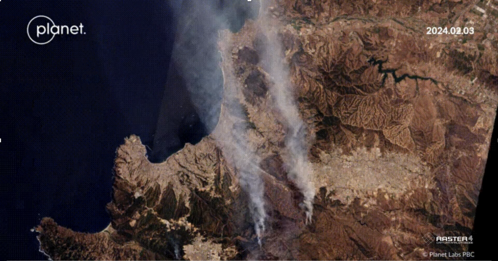
Imagery from the Planet Insights Platform displaying a Chilean wildfire.
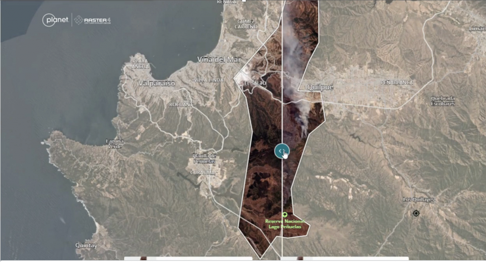
Imagery from the Planet Insights Platform displaying a Chilean wildfire with Raster4's analysis.
Chile faces its own set of challenges. Valentina Espinosa, General Manager at Raster4, told us what a difference reliable satellite data makes in a country that spans over 4,000 kilometers and faces everything from tsunamis to volcanoes. "Before Planet, we were essentially blind," she said.
She illustrated the life-saving value of near real-time data during Chile’s devastating fire earlier this year. “We were able to help in the Valparaíso fire by automatically detecting where sectors were being affected by the fire and quickly delivering this information to the municipalities and government institutions that we support.”
Espinosa stressed that automation through deep learning was critical for rapid response. Applying automated AI processing to Planet images let Raster4 share updates to government institutions in moments, not hours. "By delivering data in practically real-time, they could see what the best evacuation routes were and deliver this information to firefighters.”
Predicting Disaster Risk Across Colombia, Ecuador, and Panama
Innovations that integrate AI and satellite imagery are reshaping disaster risk management. Marta Valbuena, Research and Development Manager at Procalculo, walked us through how Procalculo uses big data to predict and mitigate risks across Colombia, Ecuador, and Panama.
Procalculo uses Planet data to understand how various characteristics of a territory raise or lower its vulnerability to risks. For example, certain types of vegetation could make an area more or less susceptible to fire.
Procalculo’s predictive models incorporate a wide range of natural variables, including topography, soil capacity, geology, rainfall, and El Niño and La Niña phenomena. They also consider anthropogenic elements such as roads, crops, populations, and location of housing and industry. With all that information, Procalculo can predict which territories are likely to be more affected by natural disasters and implement measures to protect both people and the environment.
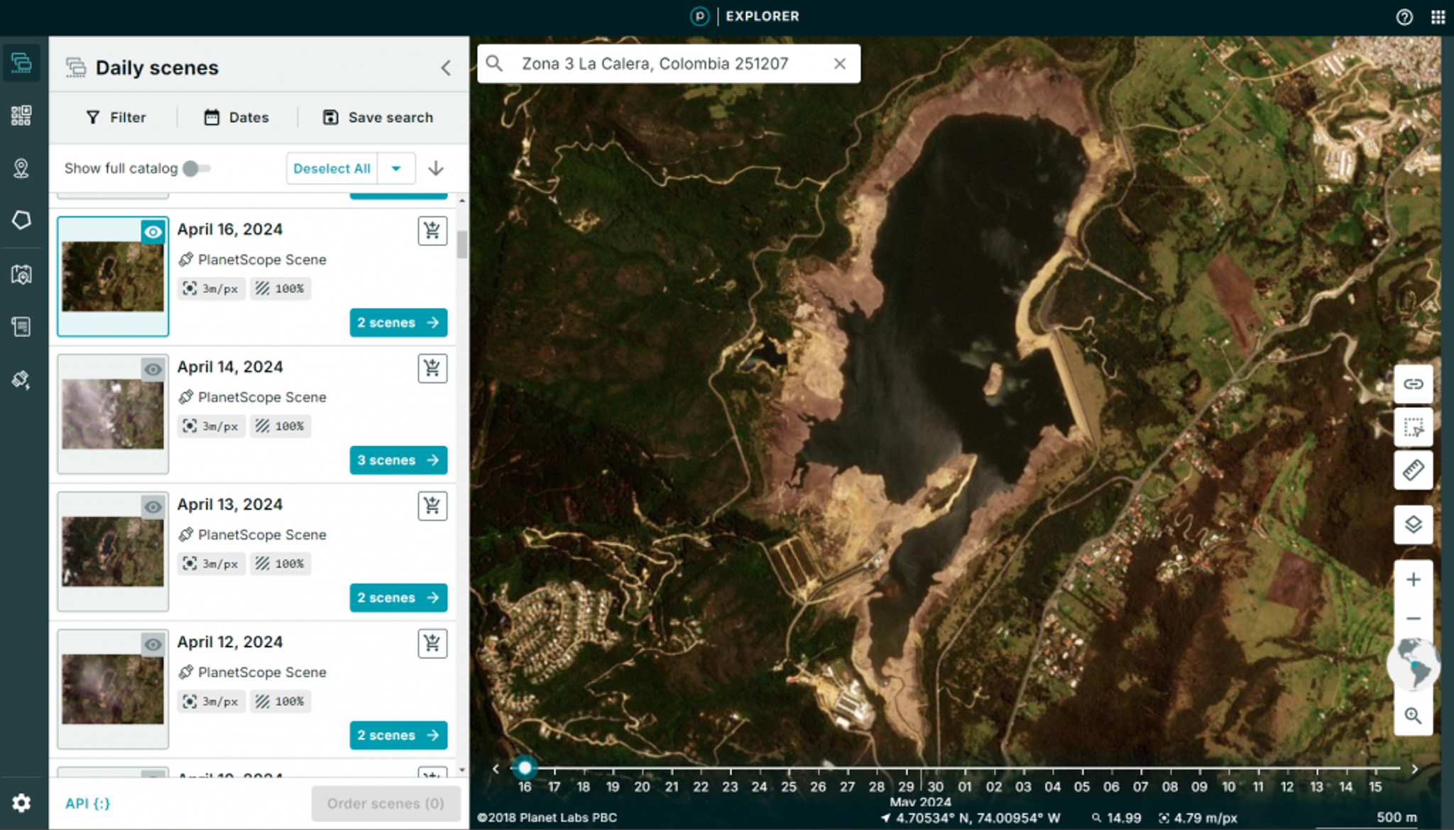
Planet Insights Platform displaying landscape in La Calera, Colombia on April 16, 2024.
"The detailed and frequent data from Planet allows us to enrich our artificial intelligence processes,” Valbuena said, “to carry out different analyses with better performance, and gain more detailed knowledge of how our territory is in terms of risk management.”
A New Era for Disaster Management in Latin America
From predicting and mitigating disaster risk to helping coordinate disaster responses, decision-makers in Latin America are using technology to respond proactively, rather than reactively, to the growing threat of natural disasters.
Timely insights help governments and organizations to act swiftly and effectively. Moreover, collaboration between public and private sectors has accelerated the development of new tools, such as AI-driven risk models, that transform how communities understand and respond to natural disaster threats. As the climate continues to change, these technologies will only become more vital. The work we’re seeing across Latin America serves as a model for how data-driven solutions can save lives worldwide.
Ready to Get Started
Connect with a member of our Sales team. We'll help you find the right products and pricing for your needs