
How Colombia and Brazil Tackle Crime in Vast Protected Areas
This blog is also available in Spanish and in Portuguese.
At Planet’s Latin American conference session in Bogotá, representatives from the Colombia's Air Force, Brazil’s Federal Police, and Planet partners in Colombia and Brazil shared insights on their collaborative efforts to monitor and enforce laws against environmental crimes. By working together and utilizing advanced technologies, these nations are setting a strong precedent for protecting the Amazon and its vital ecosystems. To address these challenges, both countries are leveraging cutting-edge technologies such as satellite data, artificial intelligence, and near real-time monitoring. These tools empower law enforcement agencies to take faster, more decisive action against environmental crimes. For example, satellite imagery can detect illegal deforestation and mining activities as they happen, allowing authorities to respond quickly and effectively.
Defending Colombia’s Land With Rapid Response
Illegal activities such as logging, illicit crops cultivation and unregulated development pose constant threats to Colombia’s national parks and protected areas. To combat these issues the Airforce of Colombia (FAC) has partnered with Planet partner Procalculo, to utilize satellite imagery and data analysis, enabling them to quickly detect threats, track changes over time, and share this vital information with other government agencies.
Captain Laura Fernanda Guerra Ibáñez, Head of Space Production Area in the FAC, along with Juan Camilo Amaya, Geospatial Technology Manager at Procalculo, explained how their teams leverage this data to safeguard Colombia’s ecosystems.
One of the areas they monitor is Catatumbo Bari National Natural Park, located near the Venezuelan border. Here, satellite imagery reveals vegetation loss due to deforestation, illicit crop cultivation, and other unauthorized activities. As Captain Guerra explained, “In key areas where we know that organized armed groups operate, we can identify actions right away.” This rapid detection enables the FAC to intervene before a problem escalates, preserving vital ecosystems.
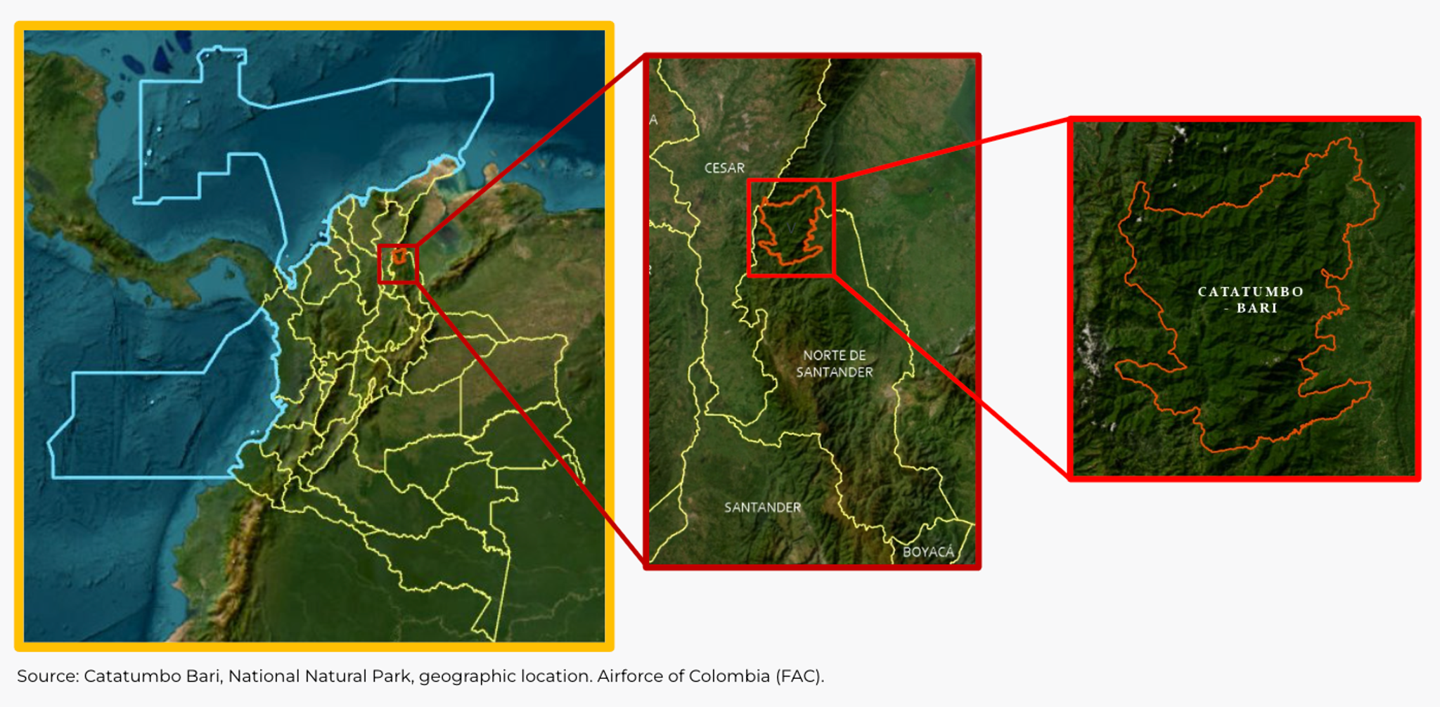
Source: Catatumbo Bari, National Natural Park, geographic location. Airforce of Colombia (FAC)
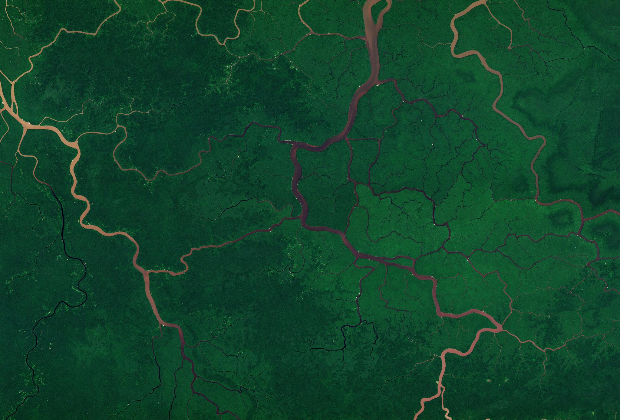
Procalculo also assists the FAC in monitoring changes in the world’s largest tropical rainforest park, Serranía del Chiribiquete which spans 4.3 million hectares. This sensitive area in the Amazonian part of Colombia is particularly challenging to protect. “What we've observed in recent years is the constant fight against deforestation, illegal roads, and other infrastructure issues,” she explained.
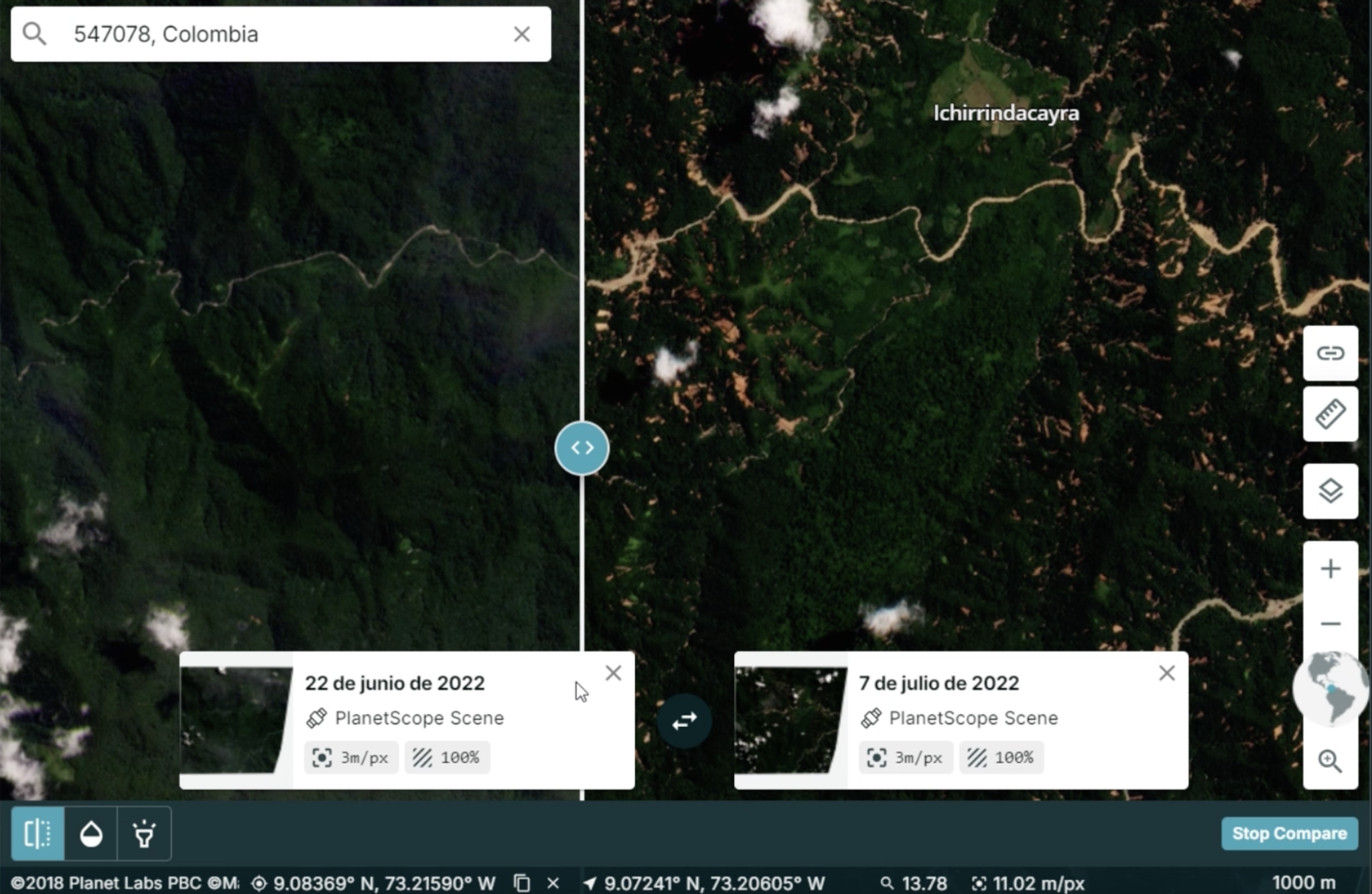
Source: Planet Labs PBC
To enhance their monitoring efforts, the FAC has implemented analytics feeds to monitor new changes in buildings and roads over time. On suspicion of illegal building activity, they can conduct further investigations using Planet’s 50-centimeter satellite imagery. This rapid confirmation of illegal building activities significantly speeds up response times, helping to mitigate environmental damage and protect Colombia's rich biodiversity.
Protecting Brazil’s Amazon via Data Sharing
In Brazil, law enforcement is adopting a tech-driven approach to safeguard its natural resources. The Brasil MAIS program, a collaboration between Brazil’s Federal Police and Planet partner SCCON Geospatial, uses satellite images to combat deforestation and illegal mining in the Brazilian Amazon rainforest.
Camila Pintarelli, Director-Chief of the National Fund for Public Security at Brazil’s Ministry of Justice (MJSP), and Cristiano Cunha, Chief of the Geomatics Service of the Federal Police, shared about how they are able to monitor, more than 8.6 million square kilometers of state municipalities, conservation units, and indigenous lands with the support of Planet and SCCON.
“SCCON uses automated change detection through its SCCON Platform, integrated with the Planet Platform and daily PlanetScope imagery, which enables rapid alerts to the Federal Police regarding activities related to environmental crimes. This is facilitated by the program’s Transparency Dashboard, which provides near real-time deforestation alerts and other data about changes observed in the Brazilian Amazon. This dashboard provides all public institutions with crucial insights into monthly, quarterly, and annual changes for law enforcement efforts to combat environmental crimes. Since this inception in 2020, the Brasil MAIS program has significantly reduced deforestation rates and has collected over $3 billion from fines, seized goods, and frozen assets related to illegal logging and mining activities.
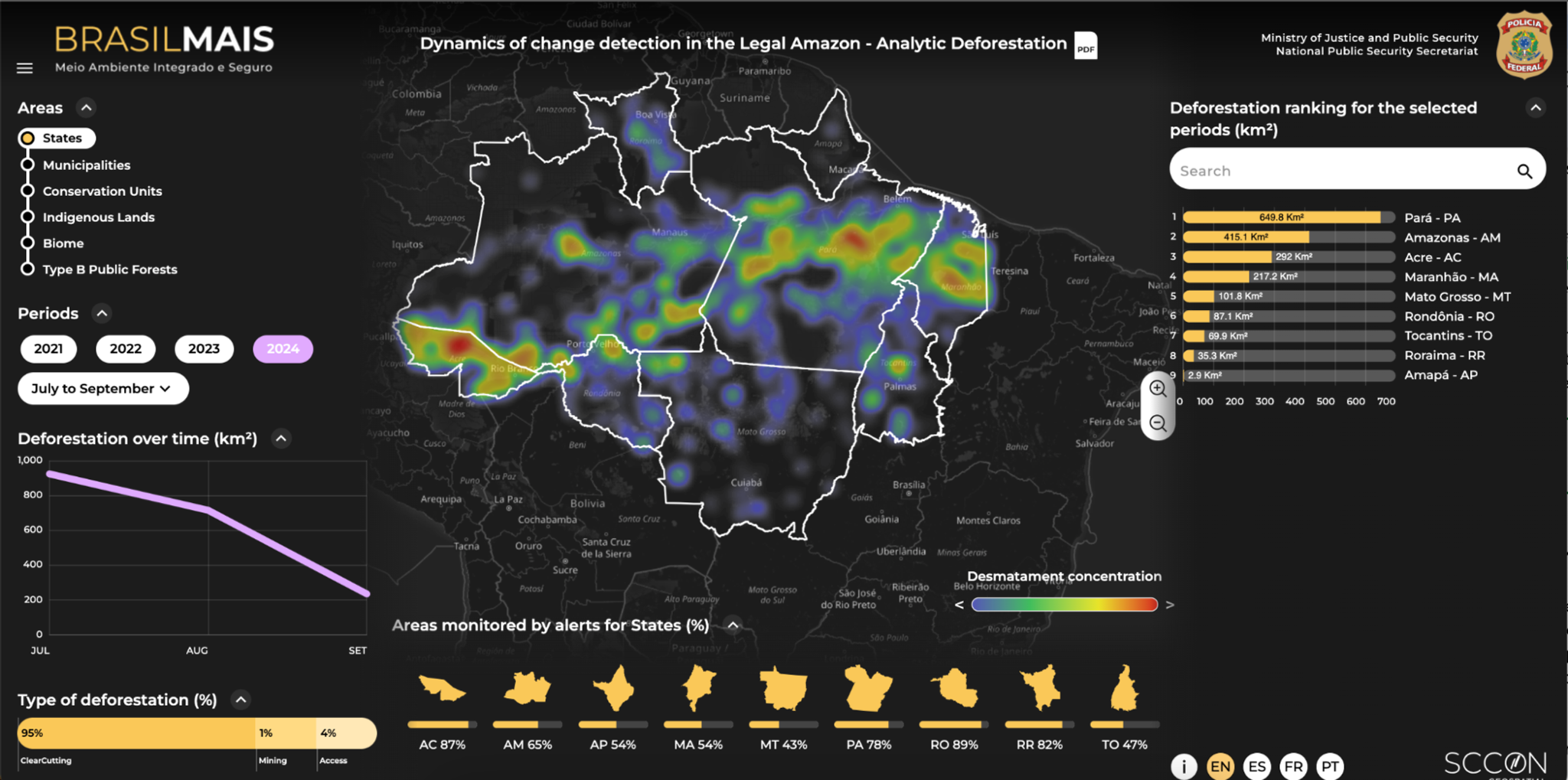
Source: Brasil MAIS program 2024. Dynamics of change detection in the Legal Amazon (https://plataforma-pf.sccon.com.br/#/deforestation-detector) - Analytic Deforestation
Model Technology Partnerships for Fighting Environmental Crime
Brazil's Brasil MAIS program and Colombia’s environmental protection initiative show us two important truths: First, technology can shrink vast distances and empower law enforcement to protect natural resources on a large scale; second, public-private partnerships are essential for governments to access the cutting-edge technologies needed for swift and efficient action.
As Colombia and Brazil continue using satellite data to protect their natural resources, they serve as models for other nations in Latin America and around the world. These initiatives highlight the effectiveness of innovative technology and collaborative efforts in the fight against environmental crime.
Ready to Get Started
Connect with a member of our Sales team. We'll help you find the right products and pricing for your needs