
How Fathom Leverages Frequent Satellite Imagery for Dynamic Flood Maps
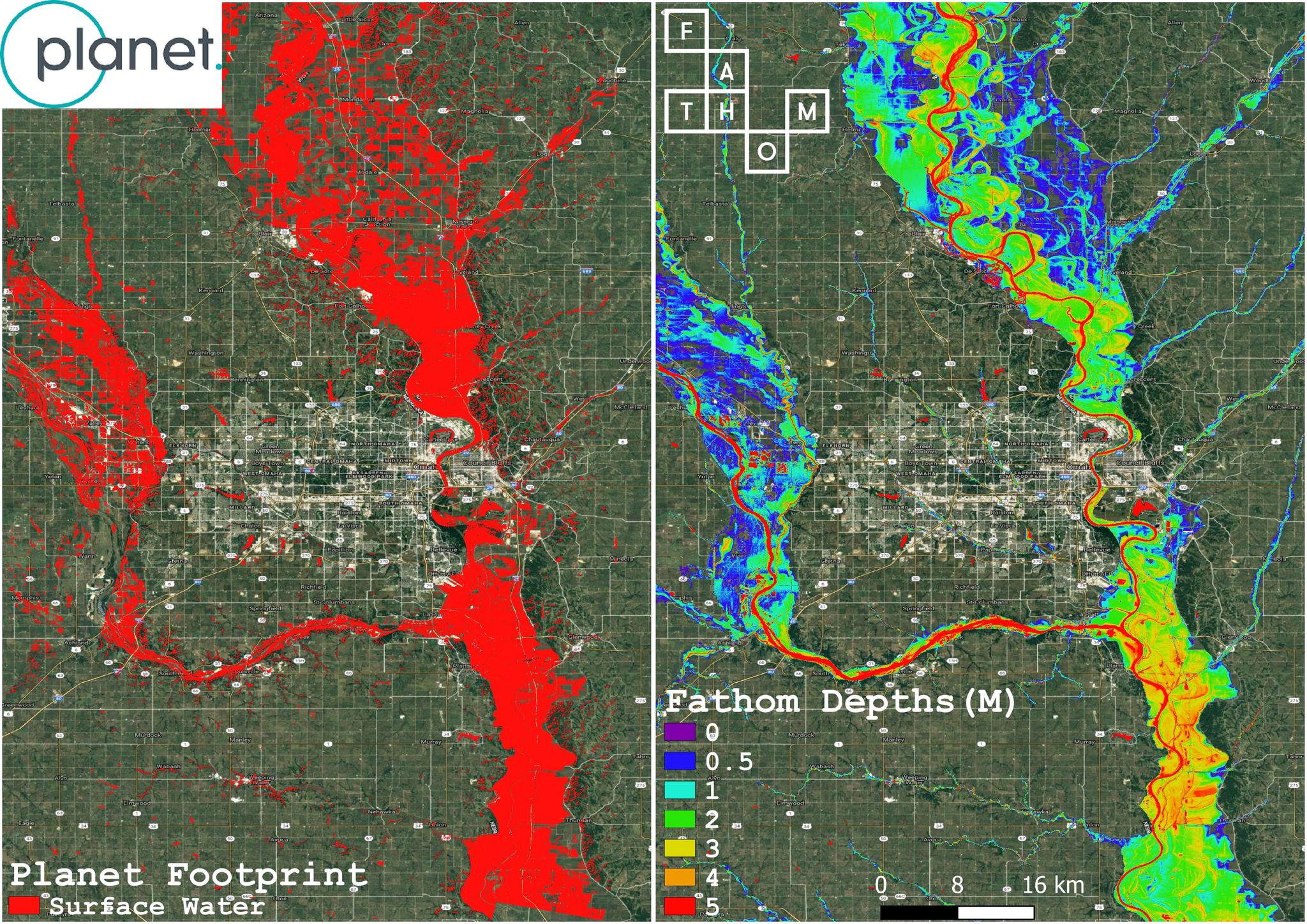
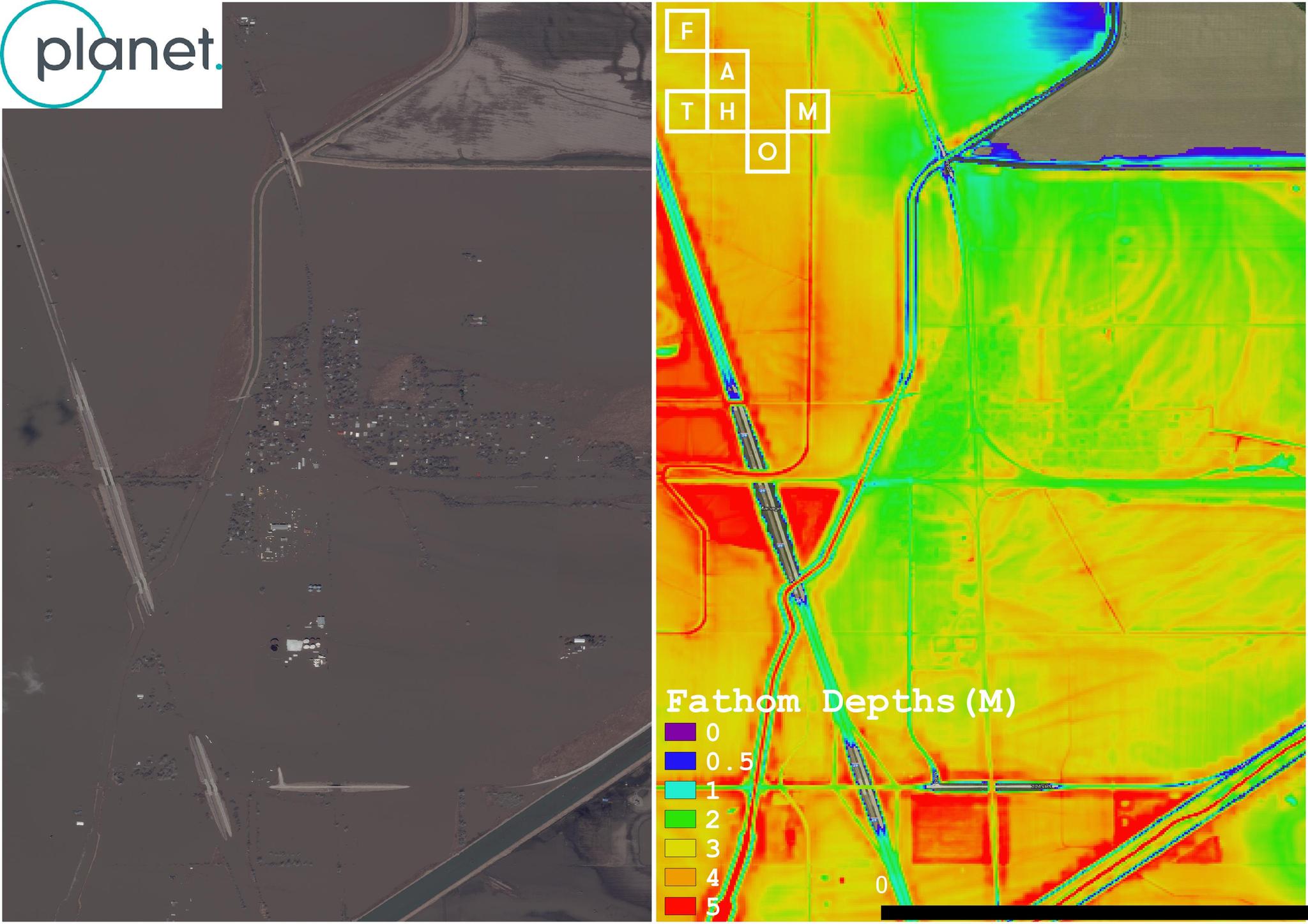
Flooding is the most common and costliest natural disaster in the United States causing billions of dollars in damages annually. The March 2019 floods across 14 states in the Midwest are a sobering reminder. Torrential rain and overflowing rivers swept through whole cities, towns, and farmlands, wreaking major havoc for farmers and ranchers. For governments, city planners, first responders, and insurance companies, having an accurate understanding of flood risk at the local, state, and national level is critical. Take Nebraska—the hardest hit state for the recent floods—where less than 10,000 insurance policies are in effect for its nearly two million residents, and costs are likely to exceed $1 billion. This insurance coverage gap is partly the result of federal flood maps being woefully out-of-date, leaving insurers and residents unprepared for high-cost flooding events. As part of a growing push to improve flood risk analysis, a company called Fathom has set its sights on building the most accurate, up-to-date flood maps over the entire globe to dynamically predict flood risk. Fathom has built sophisticated models that analyze river location and size, terrain data, and flow estimates to generate dynamic flood maps over the entire globe. They are currently working with (re)insurance companies, international development institutions, finance, and conservation groups, including World Bank, Microsoft, and Canopius. One of the critical benefits of Fathom’s solution is that it provides an estimate of flooding everywhere, covering all river channels regardless of size. Existing flood solutions, such as the FEMA flood hazard data, only cover selected river reaches resulting in a patchwork of coverage across the country. Recent published research suggests that FEMA underestimates flood risk by a factor of three. Fathom estimates that approximately 41 million people are exposed to a 100-year flood event, whereas FEMA estimates around 13 million. Insurance companies in particular have expressed keen interest in Fathom’s flood maps for use in understanding expected losses from future floods, as well as verifying claims after a flooding event with much greater accuracy. “This data is incredibly useful; footprints that are derived from observations provide greater credibility to post-event loss estimation,” said Rob Porter, Head of Catastrophe Modelling at Canopius, one of Fathom’s customers. Leveraging Planet’s daily global imagery, Fathom is exploring ways to not only improve modeling of flood extent, but also water depth. To see early results in action, consider the two images below, showing Omaha, Nebraska, on March 22, 2019, during the floods.
Ready to Get Started
Connect with a member of our Sales team. We'll help you find the right products and pricing for your needs