
How Planet Satellites Help Manage Fire Risk in a Parched Landscape
Preparing for Fire
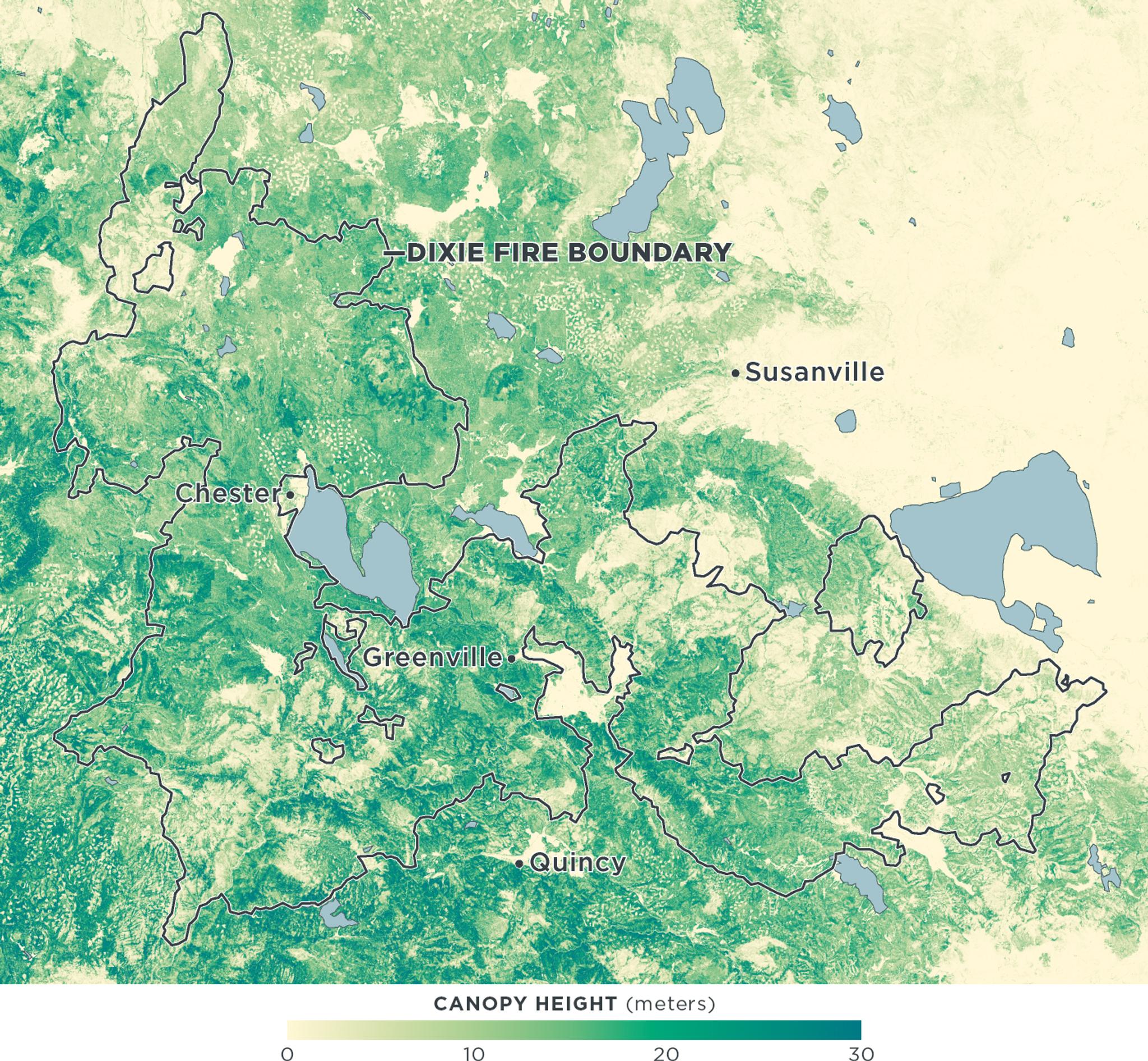
Even before a fire starts, Planet’s data can help land managers mitigate the threat. The California Forest Observatory — a collaboration between Planet, Salo Sciences, and other partners — creates and distributes statewide maps of forest structure and available fuel. These maps serve two main purposes. By showing where forests are vulnerable, they can help foresters plan efforts to remove excess fuel and make the landscape more resilient to fire. They can also improve the models of fire propagation that firefighters use to plan the response to a fire in progress. [caption id="attachment_147785" align="aligncenter" width="1400"]
During a Fire
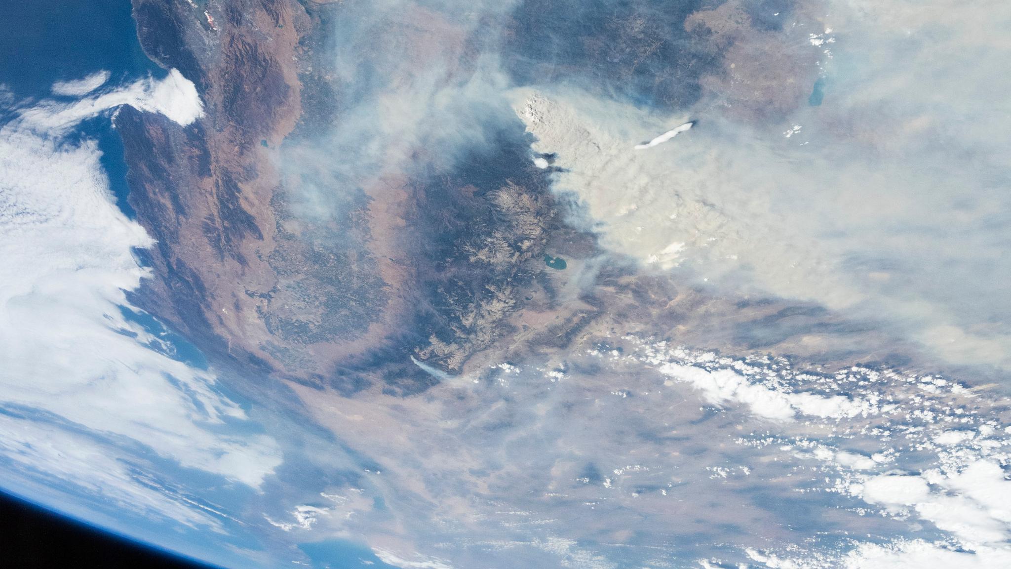
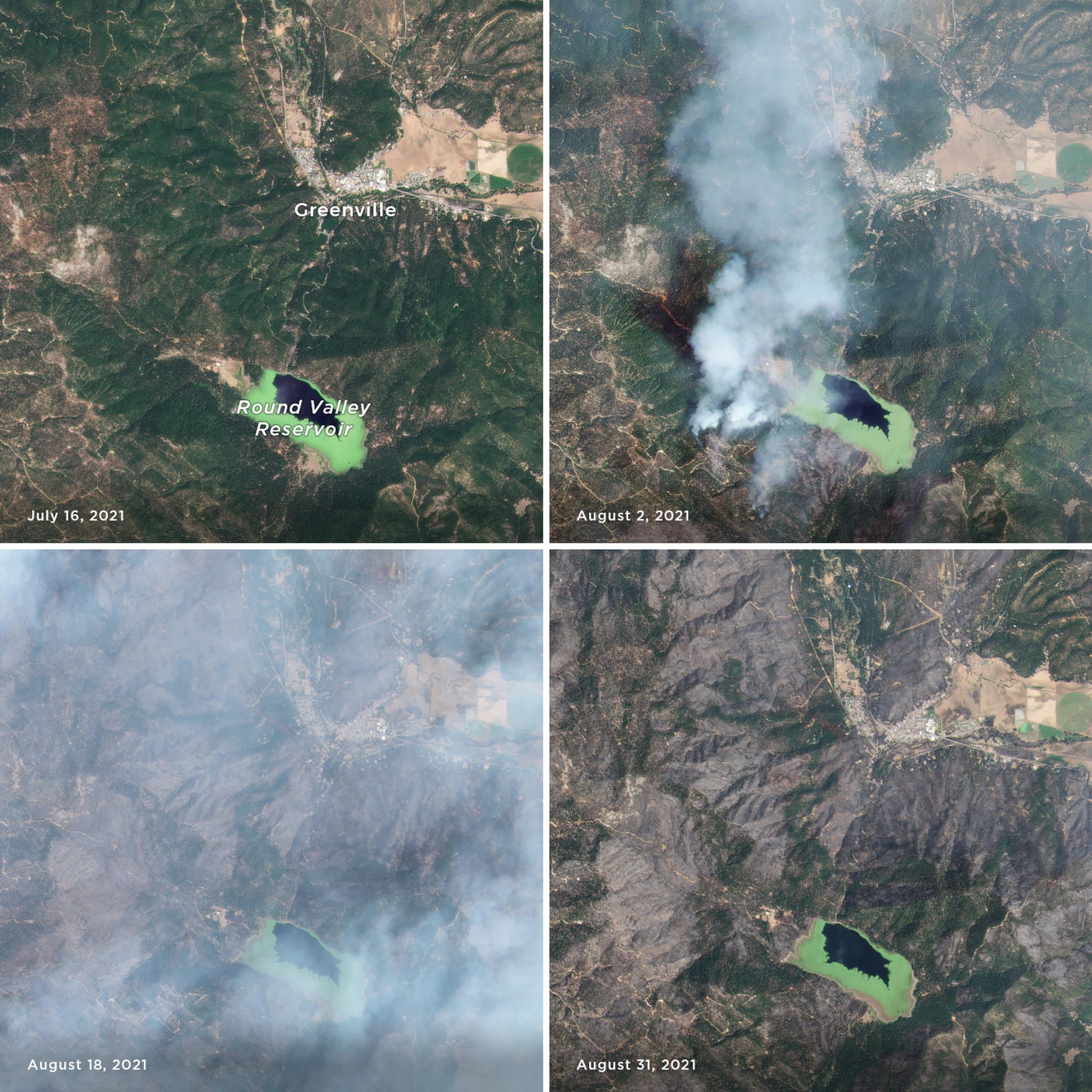
As a monitoring constellation, Planet’s Doves and SuperDoves are continuously collecting data, imaging nearly the entire Earth’s landmass every day. This allows our satellites to map the progress of a fire over time, weather (and smoke) permitting. Imagery delivered within hours of collection can help keep the public and firefighting officials informed of a fire’s progress. [caption id="attachment_147784" align="aligncenter" width="1400"]
Post-Fire
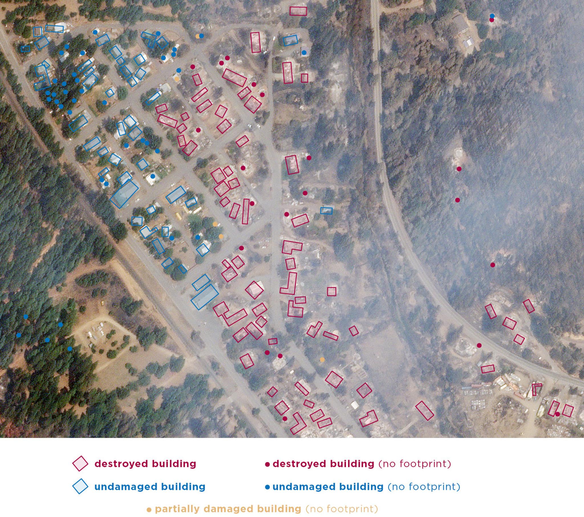
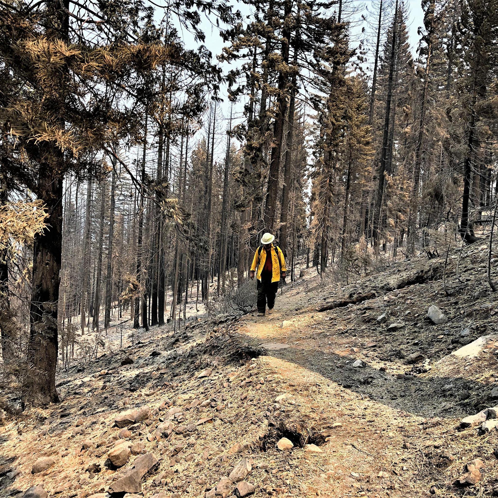
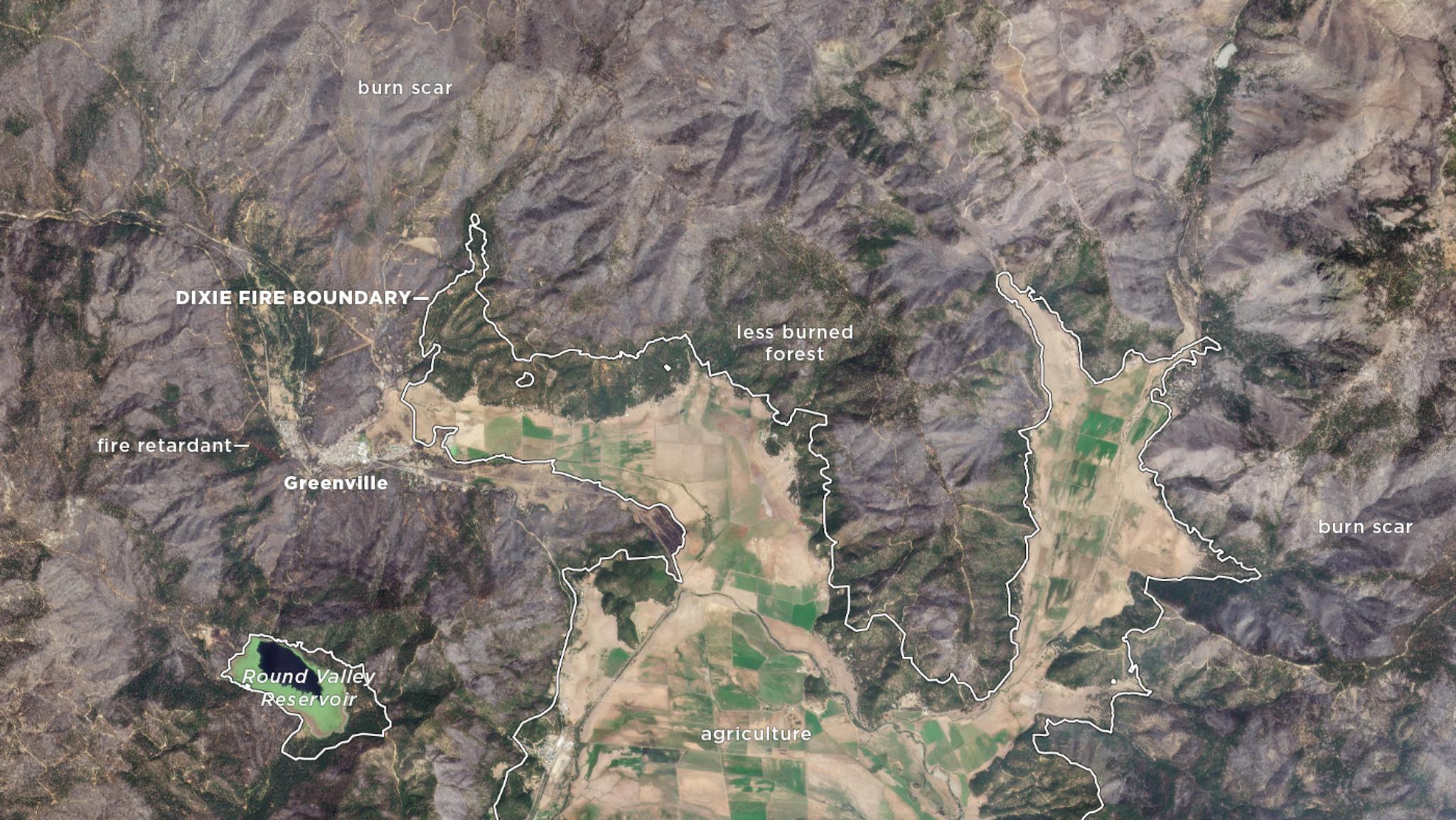
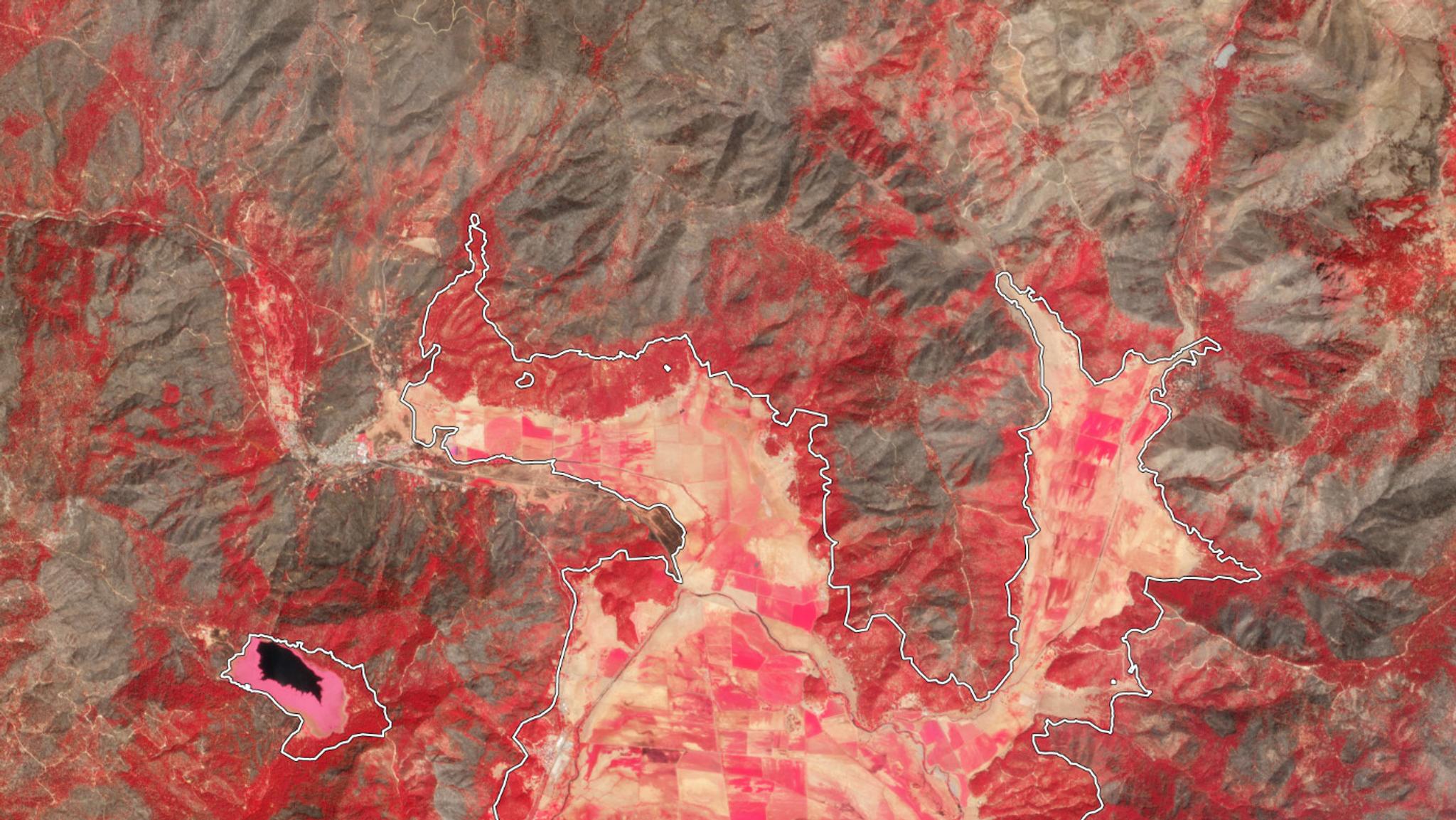
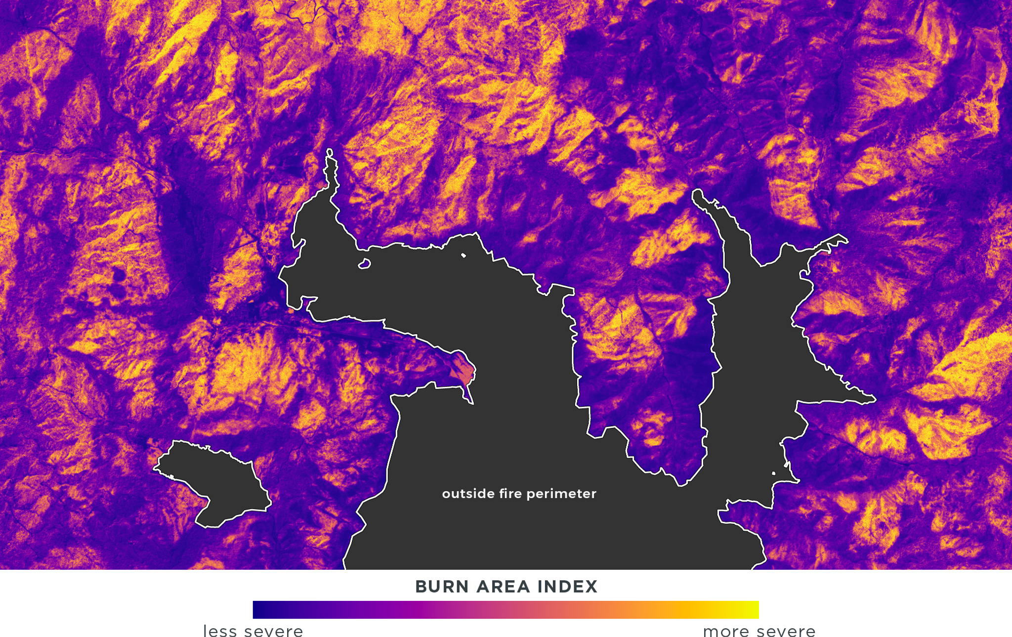
Satellite imagery continues to play a role in fire management even after the flames have passed by and fire crews have moved on. In the wake of a fire damage needs to be assessed, burn severity needs to be measured, and degraded landscapes need to be revitalized. [caption id="attachment_147790" align="aligncenter" width="1400"]
Ready to Get Started
Connect with a member of our Sales team. We'll help you find the right products and pricing for your needs