
Planet and Farmshots Offer Trial to John Deere Operations Center Users
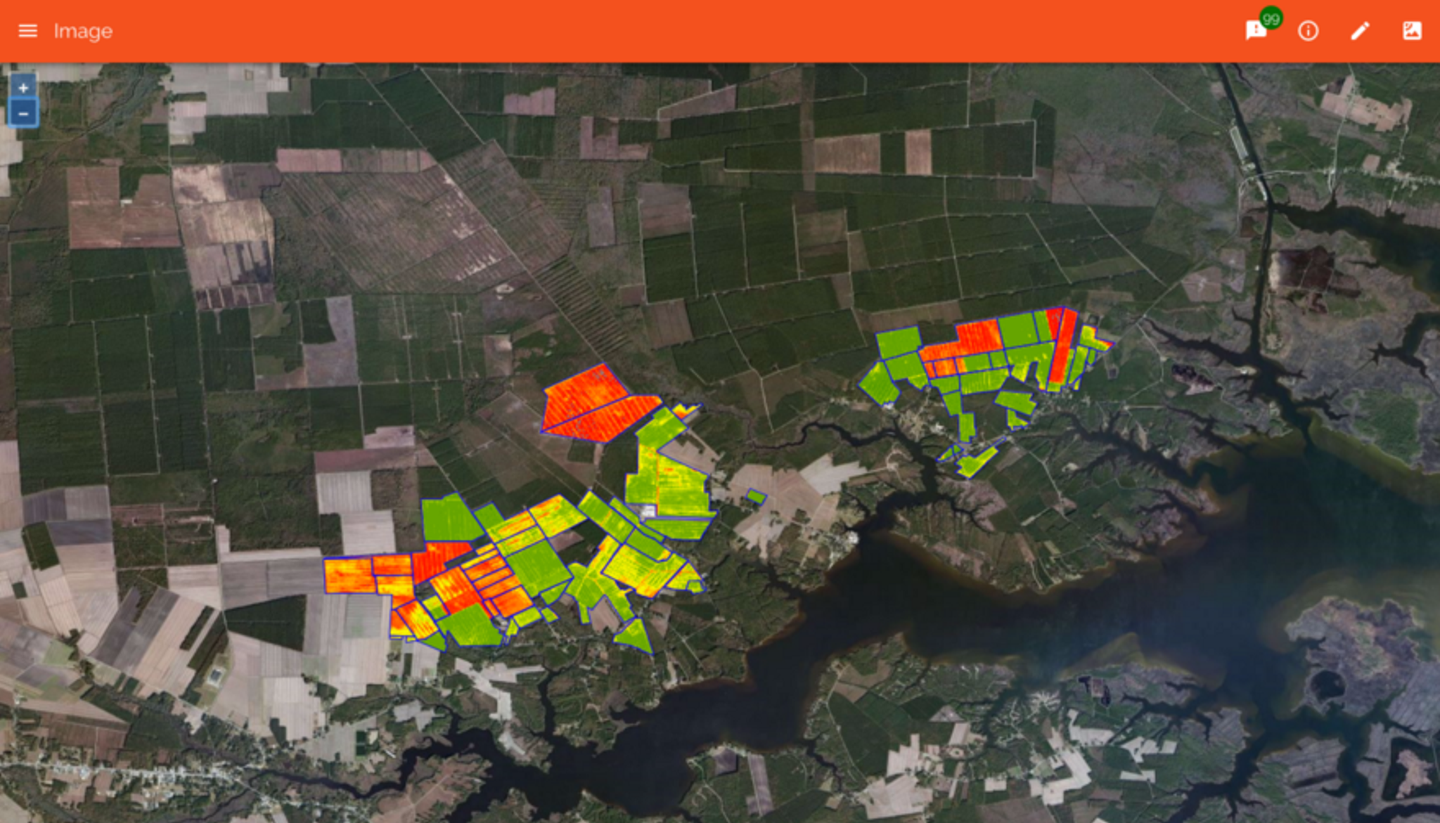
Planet and FarmShots have collaborated to provide John Deere Operations Center users access to Planet’s unprecedented global imaging capacity, allowing farmers to view up-to-daily imagery of their fields. Planet operates the largest constellation of Earth-imaging satellites and provides cost-effective and information-rich agricultural data to users in countries across the globe. FarmShots analyzes satellite & drone imagery of farms to help reduce field scouting effort by as much as 90%. When integrated with My John Deere Operations Center, it is possible to quickly create prescription maps based on plant health and upload these prescriptions directly to John Deere equipment for fast and easy treatment. Anyone with a free MyJohnDeere account and organization in Operations Center can use FarmShots’ precision agriculture software to access Planet’s high resolution satellite imagery maps. With access, users can import field boundaries into FarmShots directly from Operations Center; export plant health data layer to Field Analyzer; generate prescription maps for GreenStar 2630 displays; and compare plant health with yield maps year to year.
Ready to Get Started
Connect with a member of our Sales team. We'll help you find the right products and pricing for your needs