
The Kincade and Saddleridge Fires, Dallas Tornadoes and Japan’s Typhoon
As natural disasters continue to leave their mark on communities and environments, satellite imagery is proving useful to journalists as they inform the public about these important events. Here are some examples of how satellite data can be utilized to help monitor environmental catastrophes.
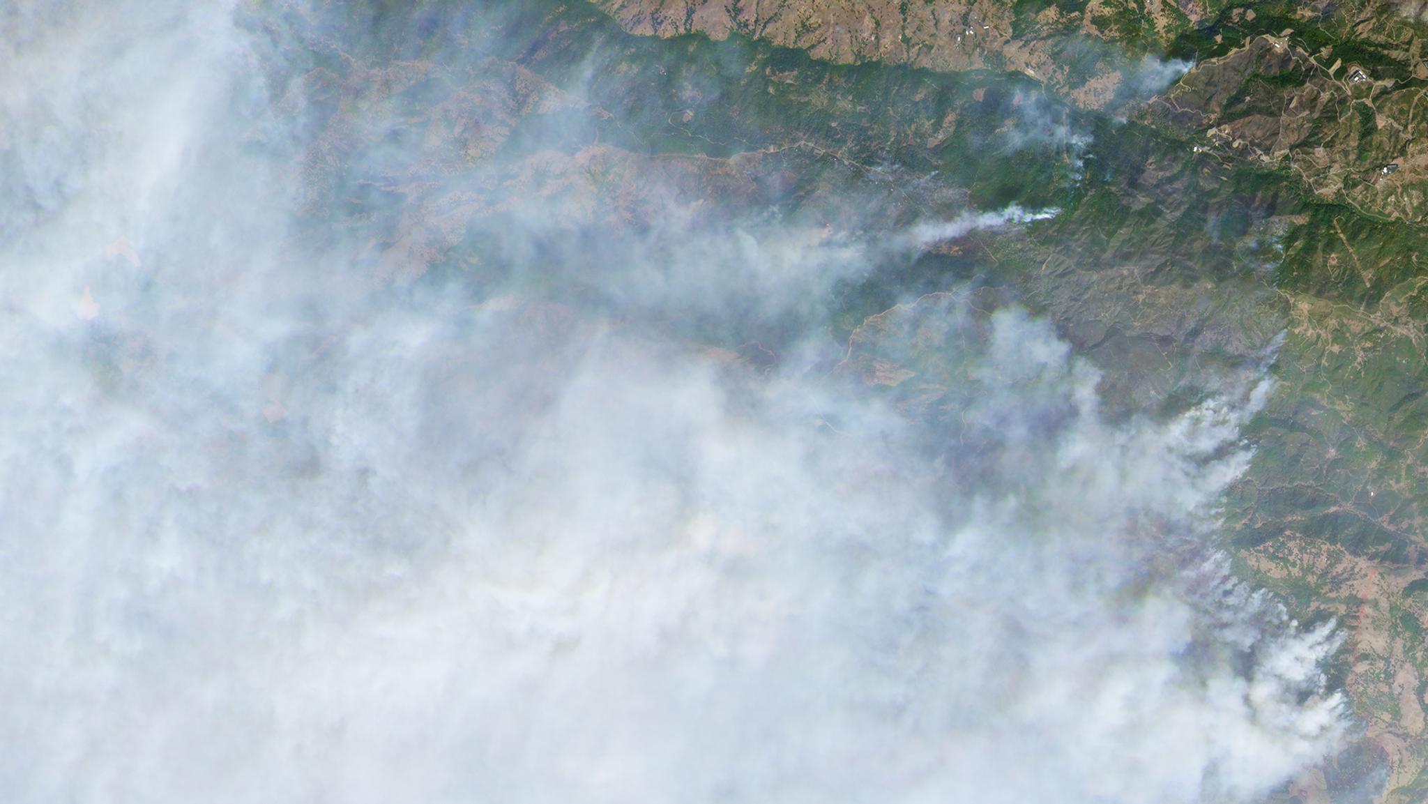
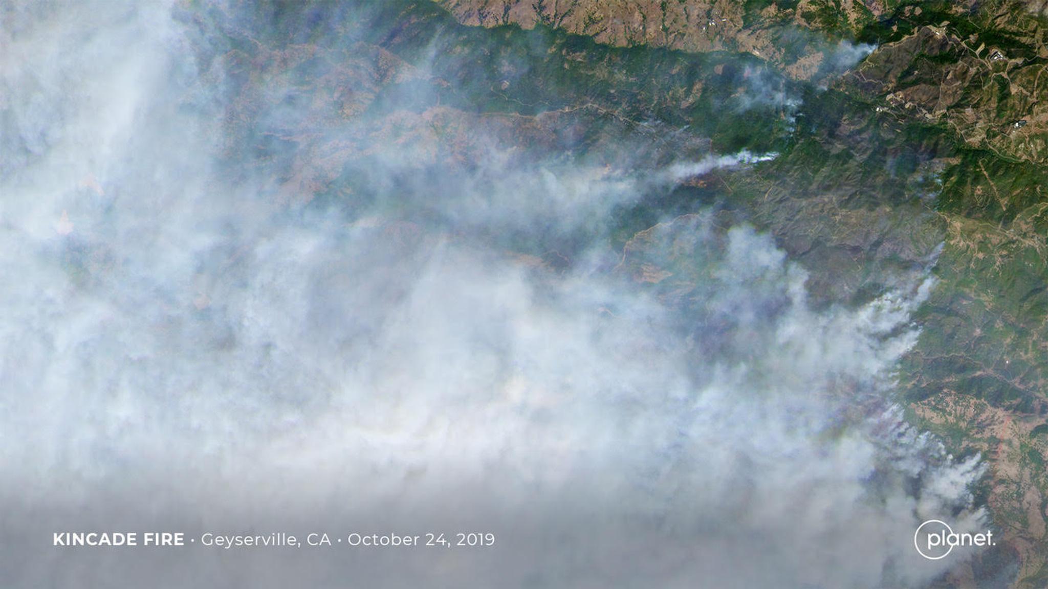
Kincade Fire
Over a thousand firefighters are currently battling the Kincade fire in Sonoma County today as wind-driven flames continue to tear through California’s wine country. At present, the fire is only five percent contained, and Planet continues to monitor the situation and provide reporters with the data they need to inform the public of the fire’s spread, as seen in the Washington Post, CNN, and SFist coverage this morning. [caption id="attachment_144160" align="aligncenter" width="1280"]
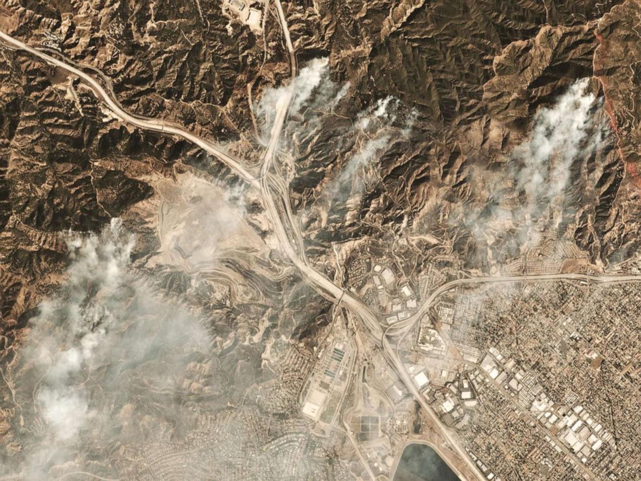
Saddleridge Fire
As of Tuesday this week, the Saddleridge fire that started in northern San Fernando Valley on October 10 is 97 percent contained, with 8,800 acres charred, according to officials. Soon after the fires began, satellite imagery showed the location of the fires as smoke clouds billowed over the area 20 miles north of Los Angeles, forcing school closures and causing traffic jams as many fled their homes. [caption id="attachment_144168" align="aligncenter" width="992"]
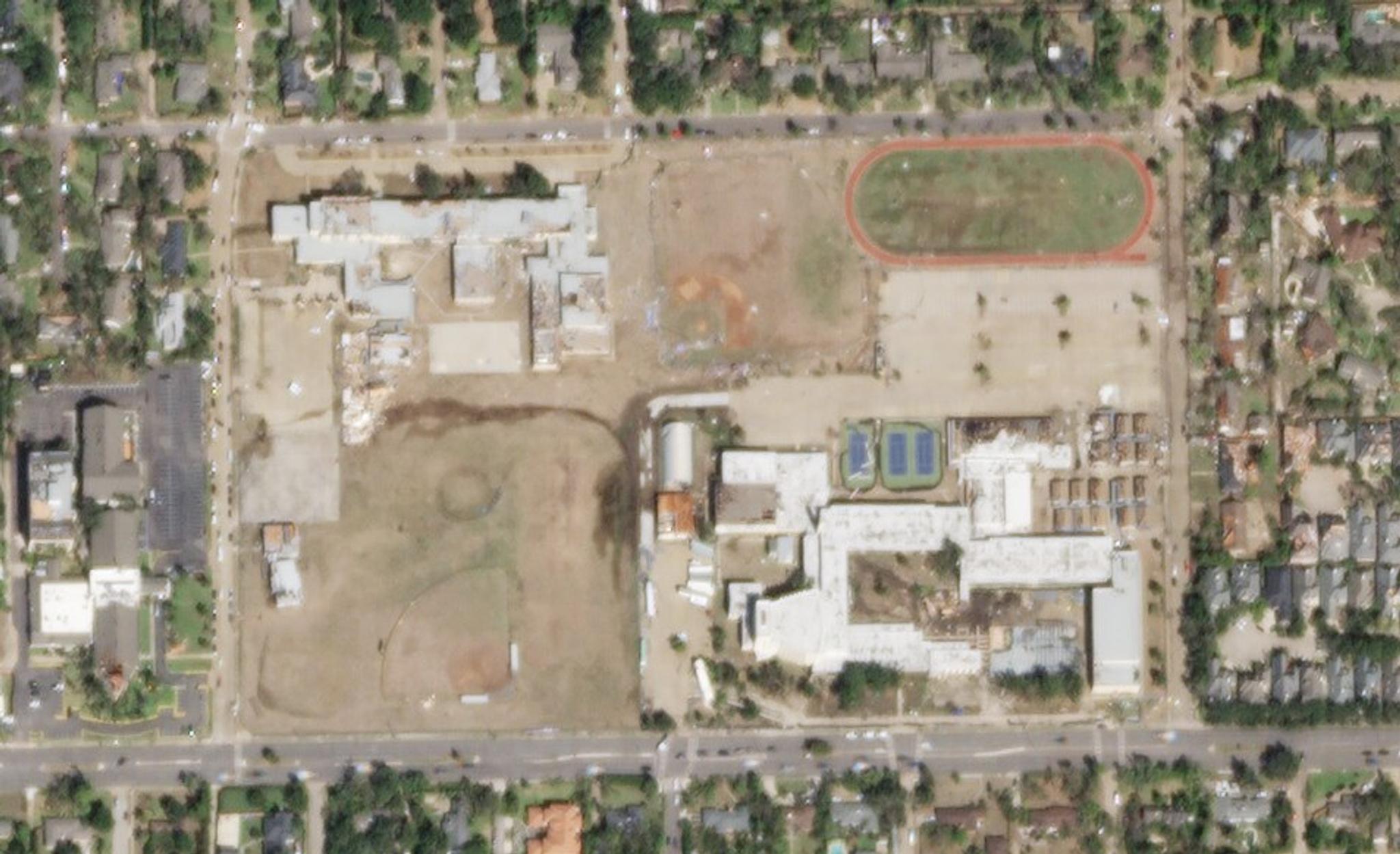
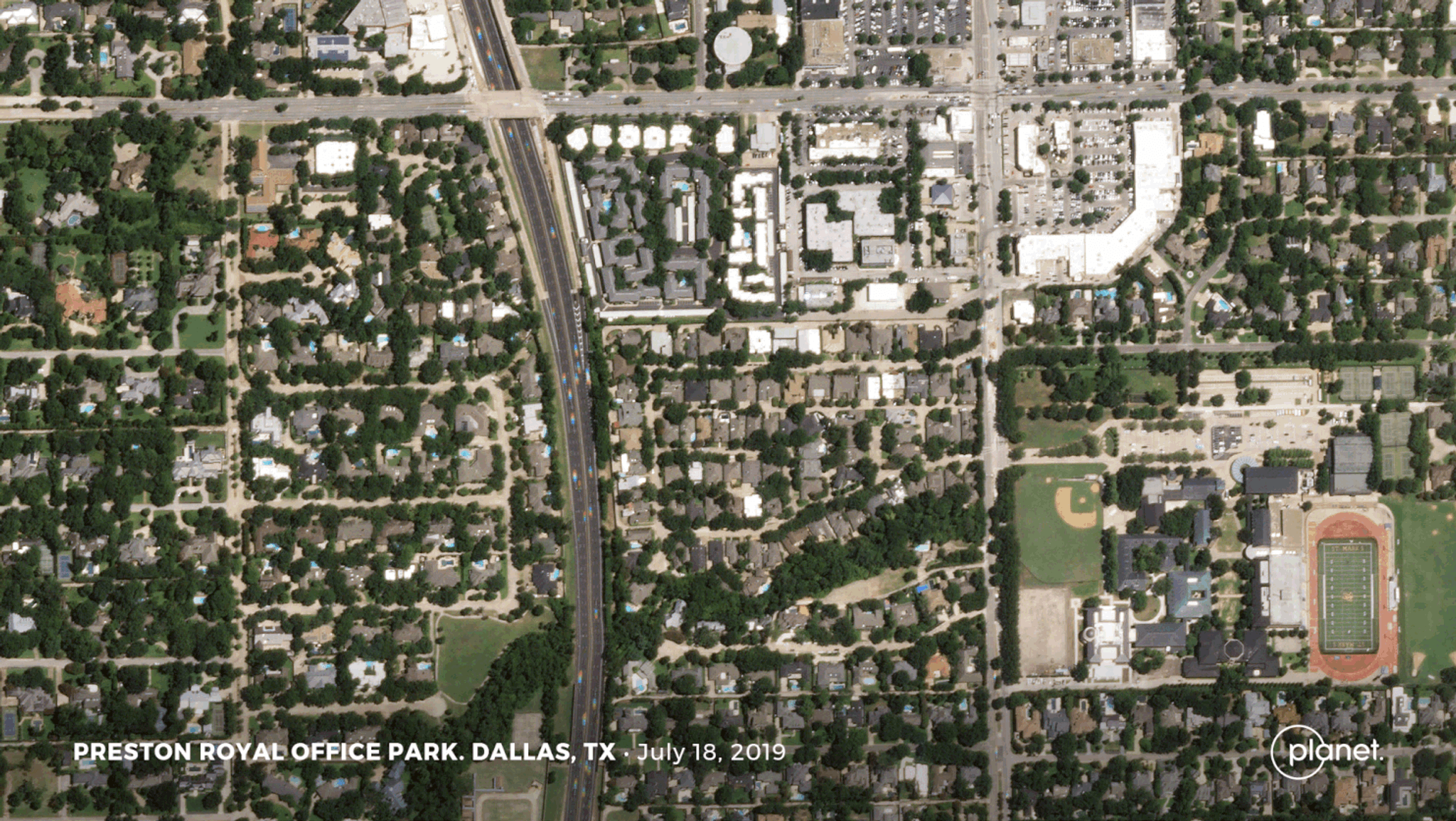
Dallas Tornado
A tornado twisted through northwest Dallas this Sunday, and reporters utilized satellite imagery and data to show the extent of the damage. [caption id="attachment_144169" align="aligncenter" width="1024"]
Japan’s Typhoon
Typhoon Hagibis—what some are calling the worst storm Japan has seen in over 60 years—battered the land and left parts of eastern and central Japan under water. Featured in Reuter’s in-depth report, our satellite imagery shows recreational floodplains that have been completely inundated. BBC reporters also utilized our imagery to show the effects of the flooding on the Naka river in Hinuma, as well as the Tama, Tone and Watarase rivers. [caption id="attachment_144172" align="aligncenter" width="1600"]

Keeping a Dove’s Eye on Things
In the vein of monitoring environmental impacts, California just announced plans to use Planet’s Doves to monitor wildfires within the state and coal plants around the world. The idea spawned from Satellites for Climate Action, an initiative to help people using Planet’s data to understand how the world is moving toward a “low-carbon future,” Quartz reports. Following a series of exciting product and satellite technology announcements at Planet’s Explore 19 conference last week—Governor Gavin Newsom delivered spirited remarks on the capabilities of our imagery and data. “What frustrates you also frustrates folks in positions like mine … receiving some report that says everything we kind of already knew, but with old data that doesn’t meet the moment. And then [that data] collects dust, generates a headline–maybe a task force–and we meet to collect another annual report that does the same,” Newsom said. “What I love about [Planet] is that it’s promoting the ability to, in [near-real] time, at 10:30 every morning, collect data and make real what that data holds and what it promises.” Journalists! Planet imagery can be useful for reporters who are investigating important issues. You cansign up for a Planet Explorer account—free for the first two weeks—to unlock the potential for visual and compelling stories.
Ready to Get Started
Connect with a member of our Sales team. We'll help you find the right products and pricing for your needs