
Land Cover and Land Use: Driving Solutions with Planet Data
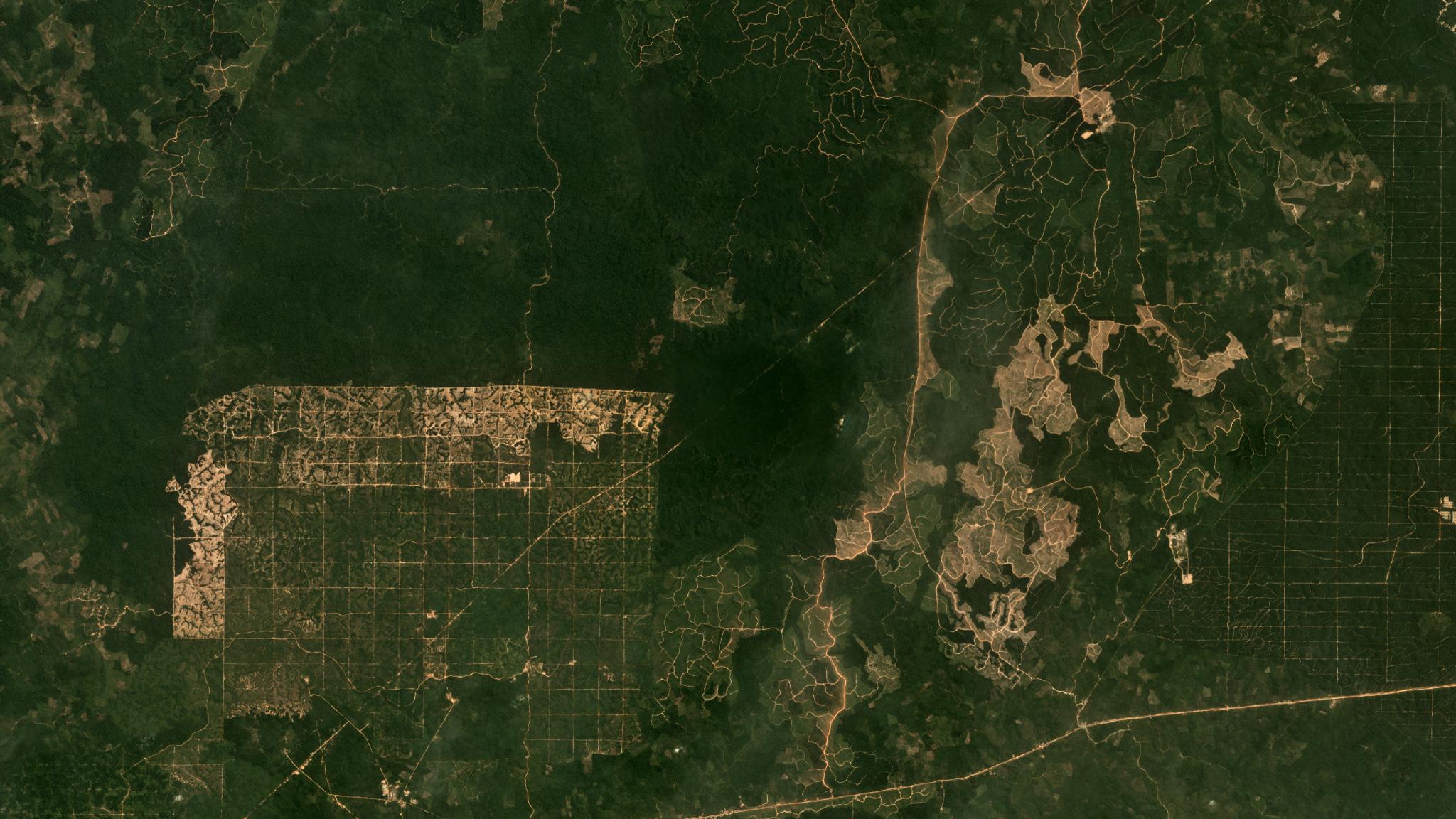
Sustainably managing land cover and land use is critical to meeting climate, sustainable development and food security goals around the world. Fortunately, advances in Earth observation and geospatial analysis technologies are helping us do just that. Take agricultural commodities production, for example. In 2012, Global Consumer Goods corporations signed the global New York Declaration on Forests, committing to removing deforestation from commodity supply chains. As governments move towards implementing Paris Agreement commitments, and investors increasingly consider material resource risks, many consumer goods companies are now looking for new solutions to identify, measure and report on deforestation and land use risks in commodities production. This is where advanced Earth observation and analytics technologies can step in. Planet’s daily, high-resolution, full-Earth satellite imaging supports solutions in:
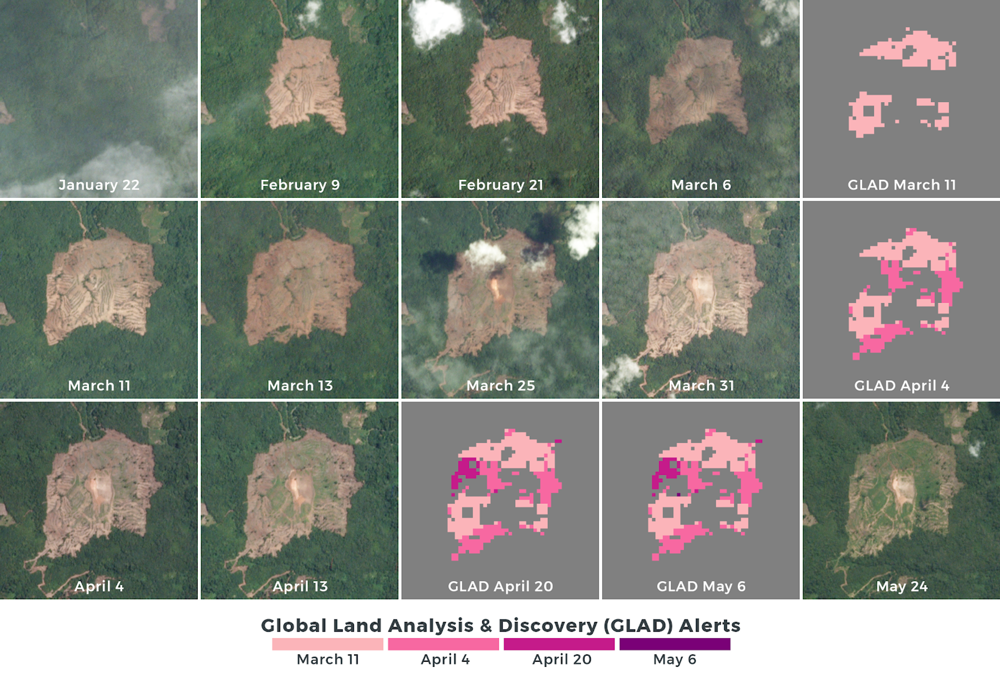
- Detecting land cover and land use changes: Complementing traditionally available datasets and alerts with higher spatial and temporal resolutions
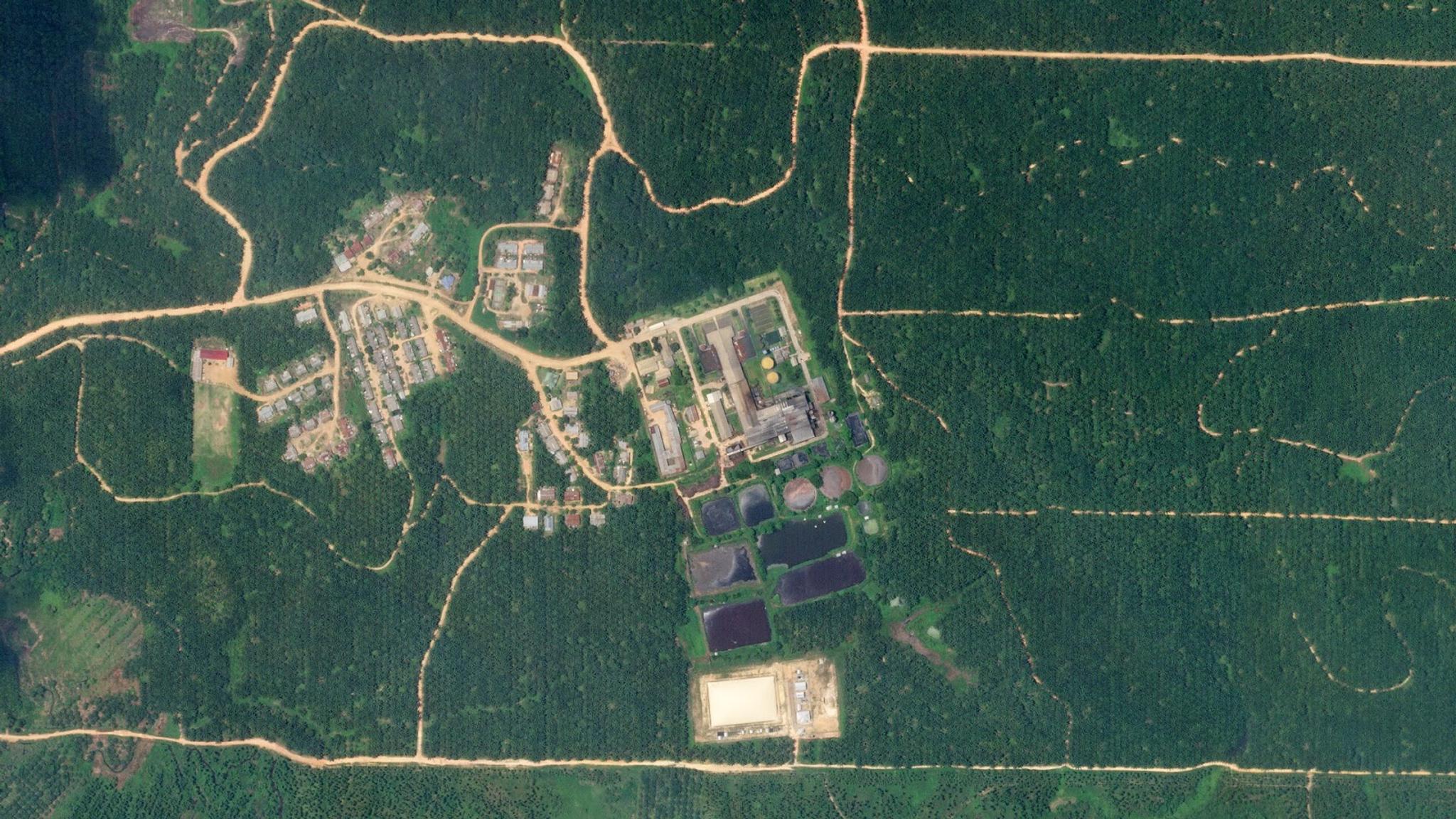
- Validating and classifying land cover and land use conversions: Pulling high-resolution imagery from just before and after an alert to validate and classify any land conversion
- Correlating changes to supply chain assets: With daily monitoring and very high-resolution tasking, you can correlate geospatial insights with asset-level information.
[caption id="attachment_145446" align="aligncenter" width="1600"]
Ready to Get Started
Connect with a member of our Sales team. We'll help you find the right products and pricing for your needs.