
Northern California Wildfire Satellite Data Available For Access
A state of emergency for Napa, Sonoma, Mendocino, Lake, Butte and Yuba counties has been declared as more than a dozen wildfires rage across Northern California. In response, we are making our satellite data available to everyone that needs it.
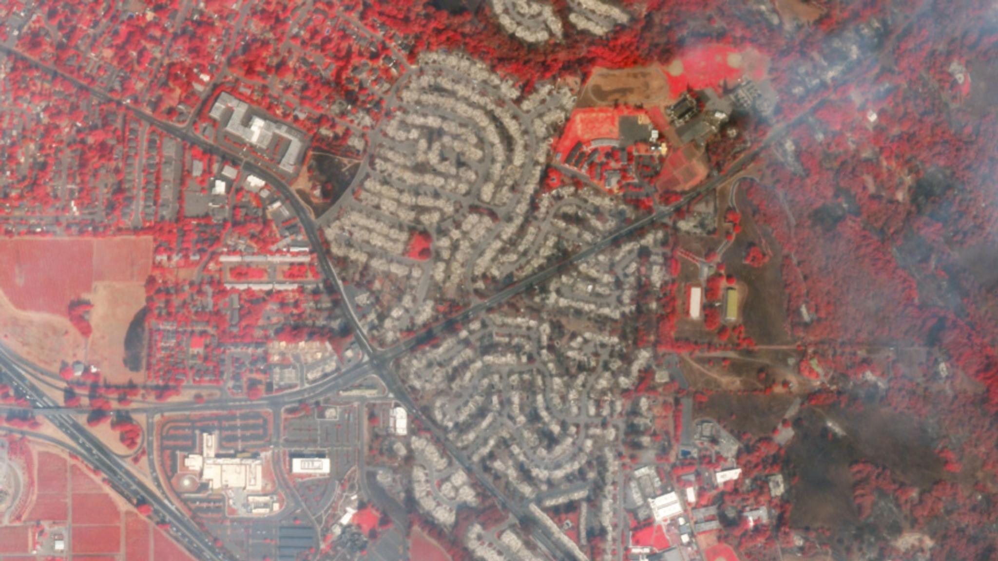
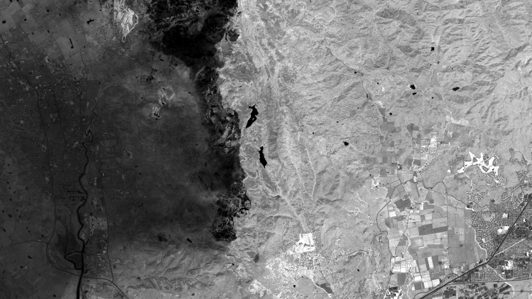
- 10/16/2017 - Santa Rosa: near-infrared (GeoTIFF / JPEG)
- 10/13/2017 - Santa Rosa (GeoTIFF)
- 10/13/2017 - Santa Rosa (GeoTIFF)
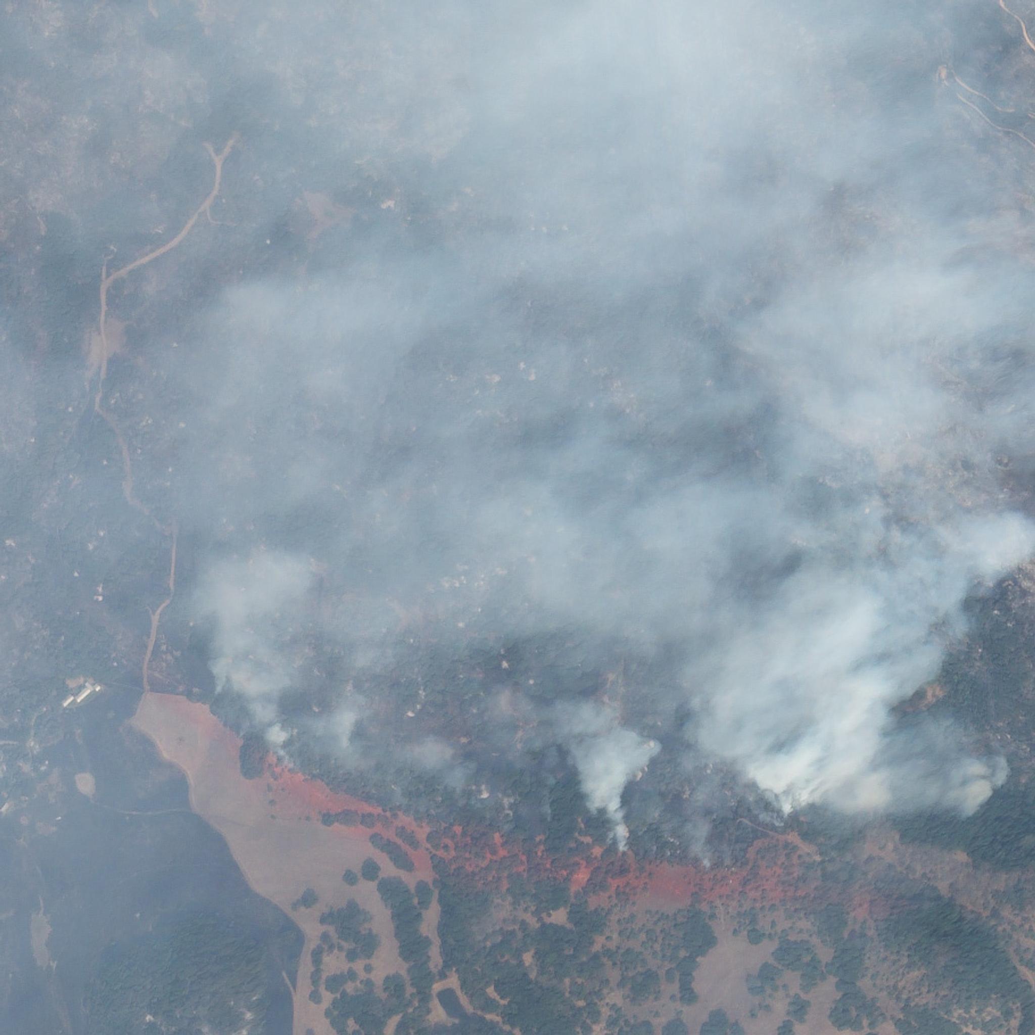
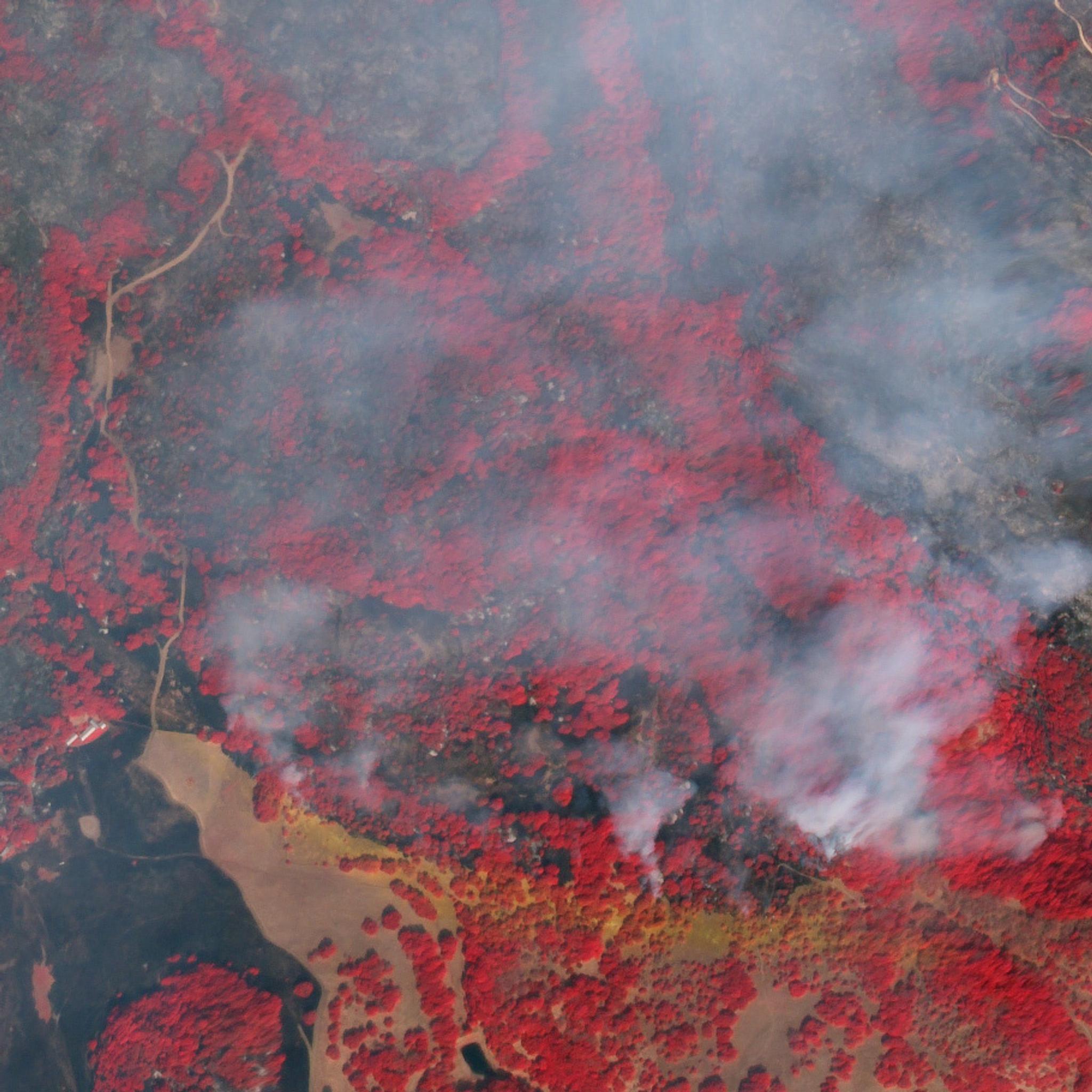
- 10/11/2017 - High resolution SkySat near-infrared imagery (GeoTIFF / JPEG)
- 10/11/2017 - High resolution SkySat true-color imagery (GeoTIFF / JPEG)
- 10/11/2017 - Santa Rosa: near-infrared (GeoTIFF / JPEG)
- 10/11/2017 - Santa Rosa (GeoTIFF)
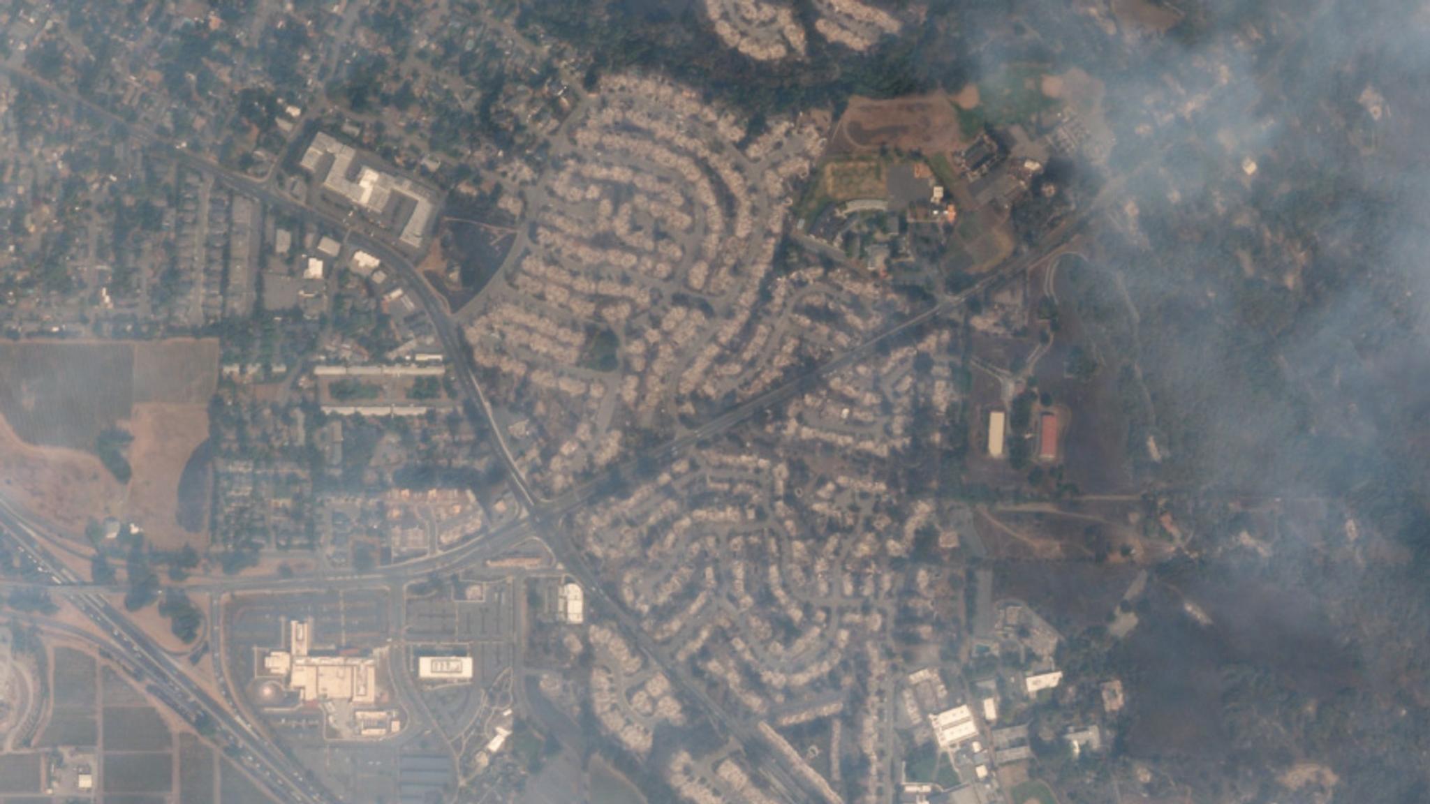
- 10/10/2017 - Santa Rosa: West (GeoTIFF / JPEG)
- 10/10/2017 - Santa Rosa: East (GeoTIFF / JPEG)
- 10/10/2017 - Santa Rosa Fire Map (JPEG)
- 10/08/2017 - Santa Rosa (JPEG)
- 10/09/2017 - Santa Rosa (JPEG)
- 10/06/2017 - Cloverdale (JPEG)
- 10/09/2017 - Cloverdale (JPEG)
.jpg)
.jpg)
Napa Imagery:
- 10/15/2017 - High resolution SkySat near-infrared imagery: burn scar (GeoTIFF / JPEG)
- 10/10/2017 - Napa: near-infrared (GeoTIFF / JPEG)
- 10/10/2017 - Napa: true-color (GeoTIFF / JPEG)
.jpg)
.jpg)
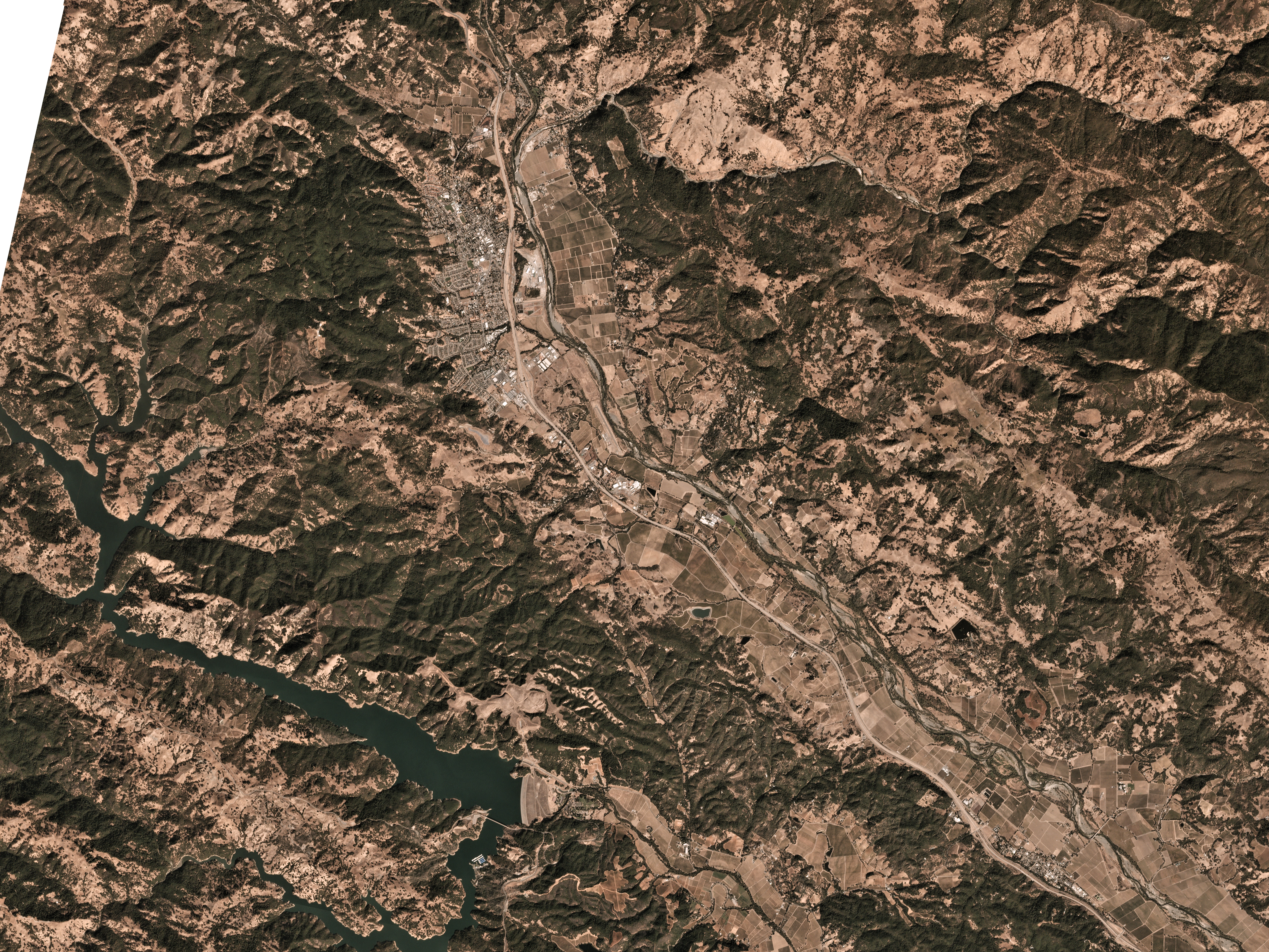
Healdsburg Imagery:
- 10/16/2017 - High resolution SkySat imagery (GeoTIFF)
Ready to Get Started
Connect with a member of our Sales team. We'll help you find the right products and pricing for your needs