
Planet and Everbridge Partner to Use Satellite Imagery for Critical Event Management
Planet is partnering with Everbridge, the global leader in Critical Event Management, to bring a powerful new data source to global security and operations teams. High-cadence satellite imagery can enhance situational awareness around critical events, and combined with Everbridge’s high-cadence alerts and critical event management capabilities, it becomes even more valuable. This partnership will enable new ways to gain awareness and respond to events with the goal to improve security, operations and resilience for corporations and governments around the world. “Our partnership with a global critical event management leader like Everbridge expands the way our new and existing users can combine global, high-resolution satellite imagery with effective crisis mitigation to protect people, operations and assets,” said Dina Kazzaz, head of Business Development at Planet. “These insights will allow our customers to better understand rapidly evolving conditions on the ground and respond to disasters more quickly and effectively.”
How it Works
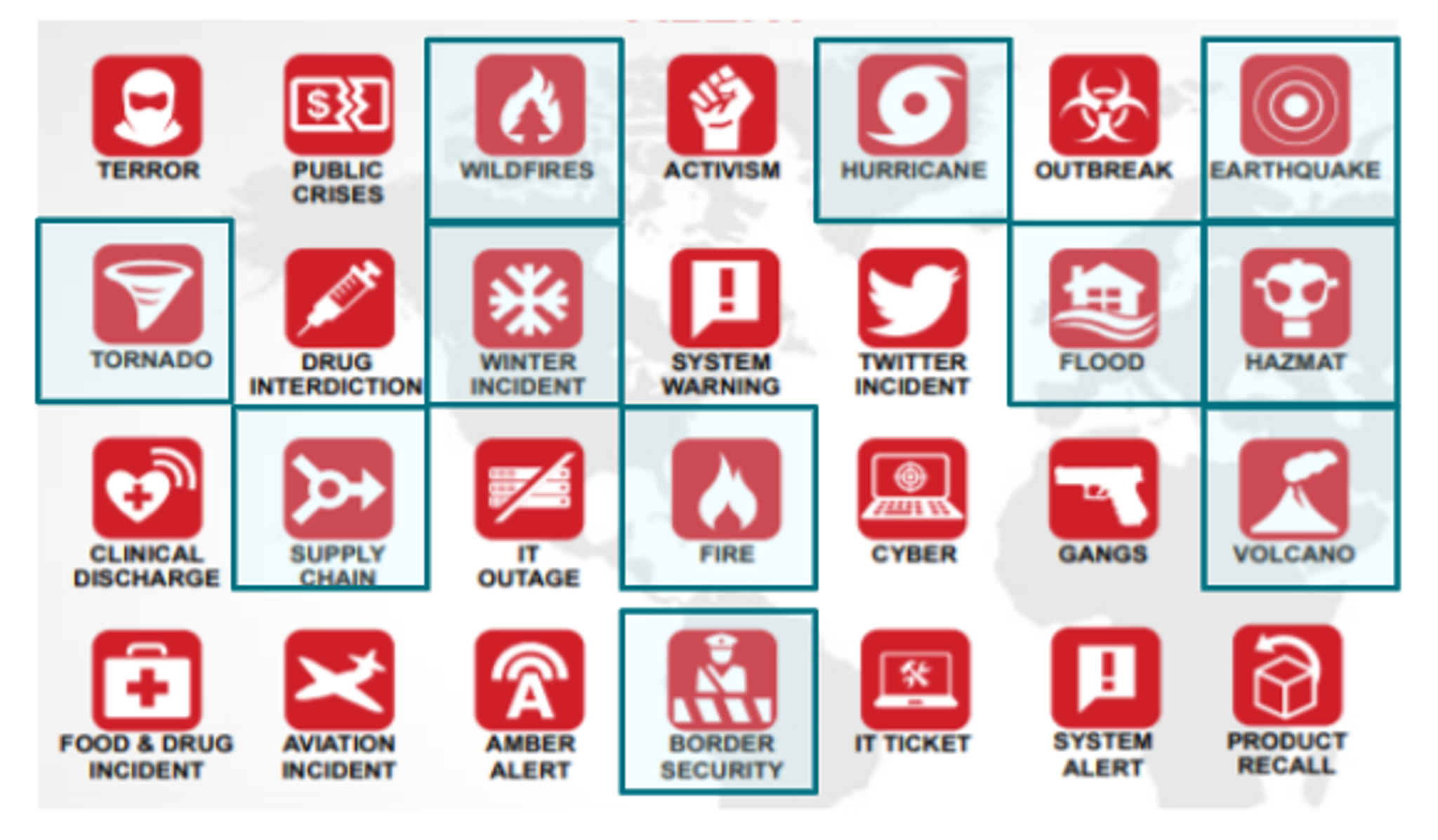
Over 5,300 global firms rely on Everbridge to keep their people safe and organizations running in anticipation of, or amid, critical events, whether natural, cyber or man-made. The Everbridge CEM solution provides an integrated, end-to-end approach for helping organizations assess the severity of events; determine their relevance to people, assets, suppliers, and supply chains; automate actions and workflows to mitigate threats and track progress; and analyze performance to improve future response. Everbridge’s Risk Intelligence leverages 22,000 risk data sources and produces alerts and analyses covering a variety of event categories. Planet data can help with assessing 11 of these major event categories (highlighted below). Planet’s imagery can also broadly provide greater situational awareness and up-to-date global maps to aid in response. [caption id="attachment_145829" align="aligncenter" width="580"]
Examples of Where Satellite Imagery Can Help
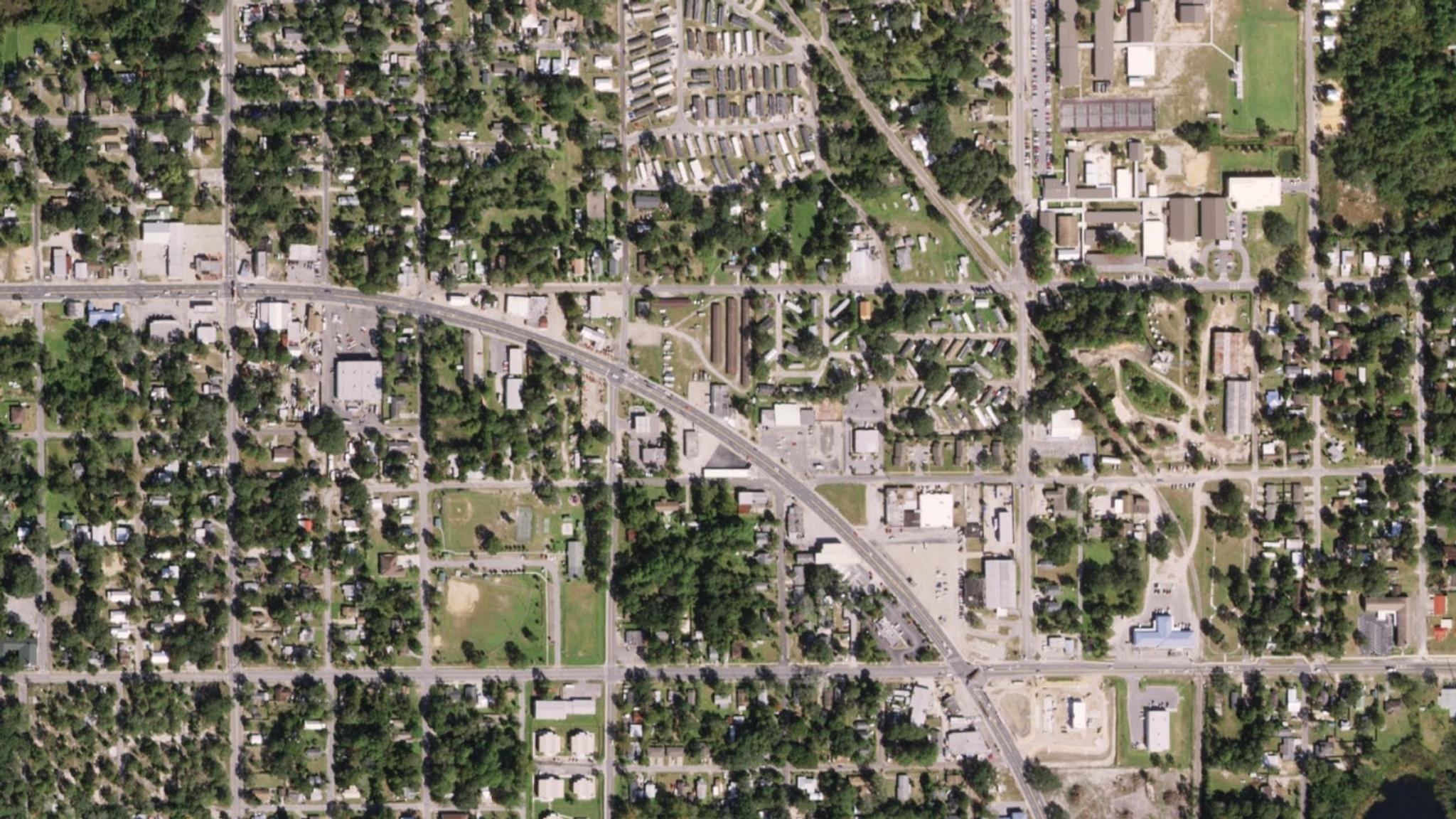
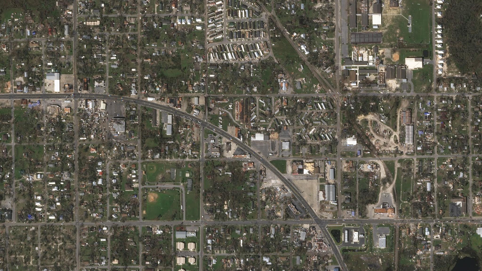
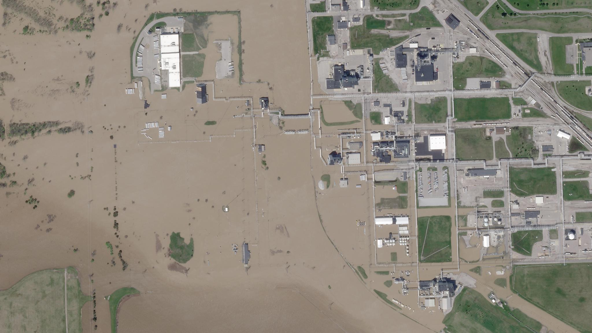
Assessing Hurricane Storm Damage In situations like when Hurricane Michael struck Florida in October 2018, before-and-after satellite imagery could be used to identify which areas were damaged and the extent of damage. Emergency responders, retailers, insurance companies and local businesses can plan better with such a birds-eye view. [caption id="attachment_145820" align="aligncenter" width="1600"]
Talk to us
Existing or prospective Planet or Everbridge customers can sign up to learn morehere.
Ready to Get Started
Connect with a member of our Sales team. We'll help you find the right products and pricing for your needs