
Planet Partners with SpaceNet for Multi-Temporal Urban Development Challenge
We’re excited to partner with SpaceNet LLC, a nonprofit focused on machine learning techniques for geospatial applications, to support the SpaceNet7 Multi-Temporal Urban Development Challenge which was just recently announced.
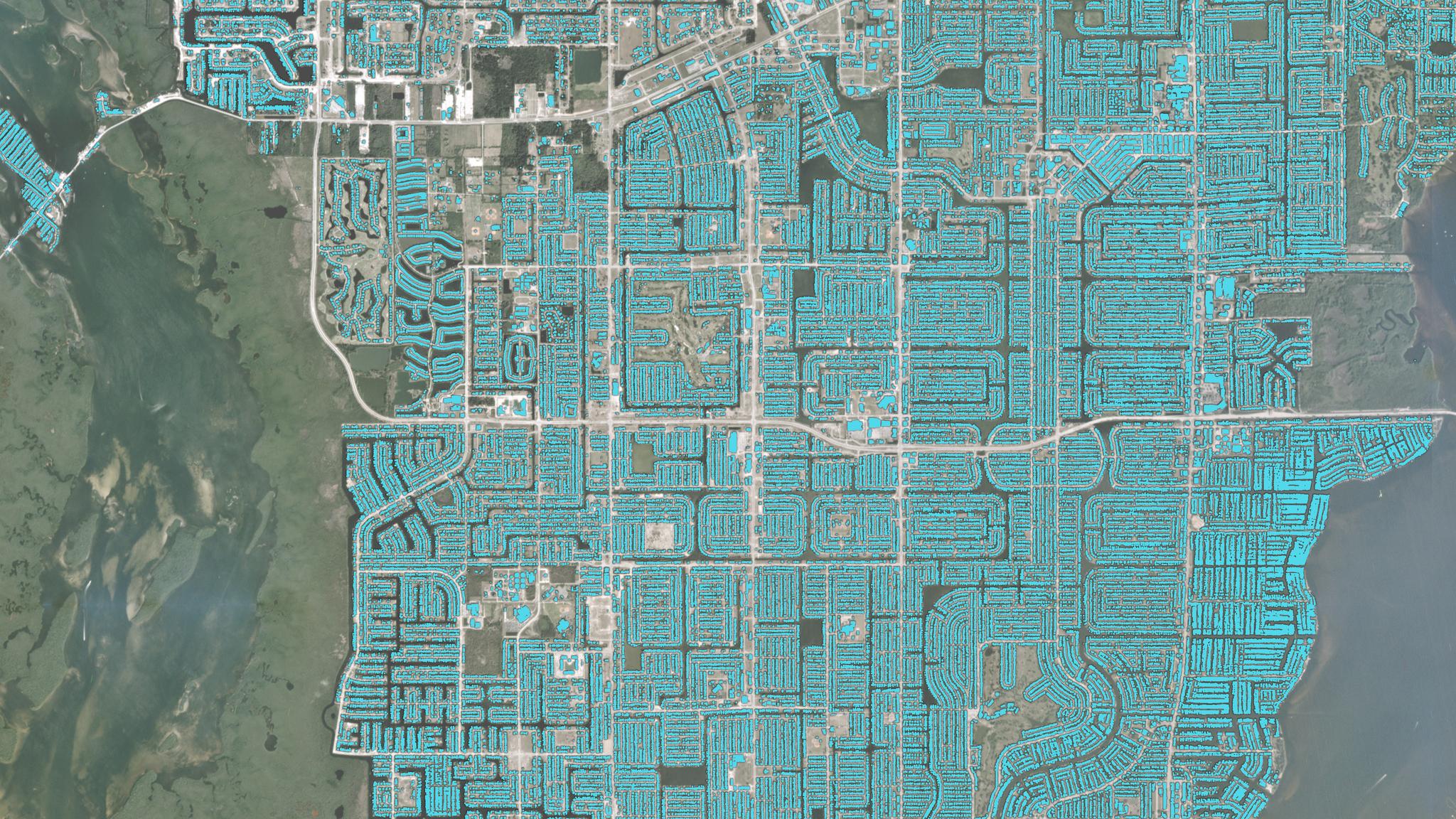
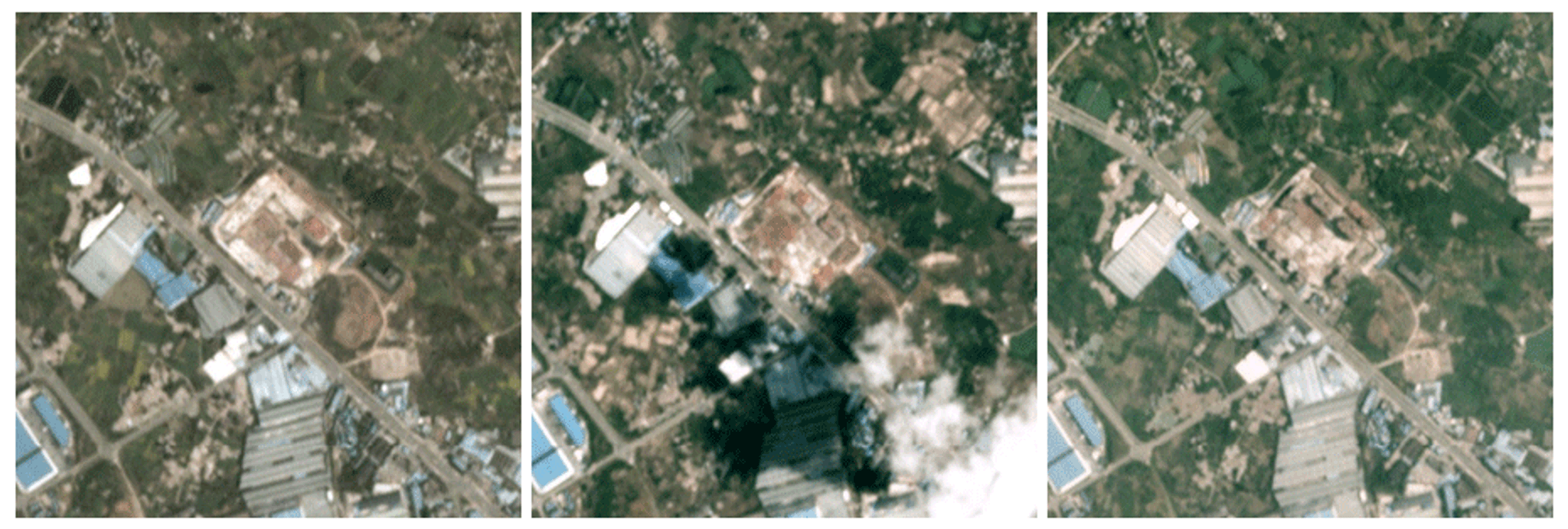
The challenge focuses on developing better methods to track building construction over time using Planet imagery mosaics. Rapid and accurate remote-sensing of infrastructure change can aid in a variety of efforts, from infrastructure development to disaster preparedness to epidemic prevention.
Established in 2016 by In-Q-Tel’s CosmiQ Works, and DigitalGlobe (now part of Maxar Technologies), SpaceNet is dedicated to accelerating the research and application of open source AI technology for geospatial applications. SpaceNet offers free, precision-labeled, electro-optical and synthetic aperture radar satellite imagery data sets and runs challenges with prizes to foster emerging analytical frameworks.
Previous competitions led to a dramatic expansion of the availability of open source data of building footprints and road networks for the geospatial machine learning community. Whereas all six previous SpaceNet challenges were based on static road and building detection, the partnership between SpaceNet and Planet will allow the seventh competition to focus on discovery of change events directly.
This technical challenge has been unlocked by access to a spatio-temporal dataset at a scale and cadence that was previously unavailable to the broader research community. Using dense time-series imagery of over 100 regions around the globe, this competition will allow researchers to experiment with novel change detection methods that would be infeasible on smaller datasets.
Planet images the entire landmass of the Earth on a daily basis at 3 to 5 meter resolution. The high temporal cadence and planetary coverage of our Dove constellation enables an entirely new class of remote-sensing applications, including detecting rapid urbanization, updating maps in a diverse set of geographical areas (not just dense urban areas), detecting unplanned infrastructure development, finding illegal activities in protected areas and uncovering precursors to deforestation.
Ready to Get Started
Connect with a member of our Sales team. We'll help you find the right products and pricing for your needs.