Planet Superpowers: Looking Broader
Look across vast, far-reaching geographies and timescales to gain a full picture of events.
The age-old expression “you can’t see the forest for the trees” reminds us that seeing things up-close can compromise the greater picture. In addition, it necessitates the practice of zooming out to gain a broader perspective and see larger patterns.
In Earth observation (EO), an area of interest may only reveal part of the story. Perhaps there’s a trail of smoke, which begs the question, “Where is the source?” Or evidence of building damage after a storm, which leads us to ask, “How widespread is the destruction?”
As EO data becomes easier to access, greater numbers of governments and businesses are using it to track and analyze Earth’s changing conditions over time — and gain invaluable context.
Let’s explore how it’s possible to use EO data to see a more broad, complete, and accurate picture.
EO Data and Broad Area Management
EO data is central to broad area management, which is the practice of monitoring, measuring, and reporting on assets, whether natural or man-made, across broad geographies and timescales.
This practice is best achieved with data, analytics, and software that can scale globally, is real time, and captures multiple dimensions of information (location, time, and physical characteristics).
Planet provides solutions that support broad area management to customers and partners across the globe. With always-on, daily monitoring, the Planet dataset offers an up-to-date view of changing conditions across the Earth.
Using Planet Data to Expand Your View
Basing decisions on data that is too narrow can have negative and even dangerous consequences — ranging from the loss of precious resources and funds to unnecessary suffering.

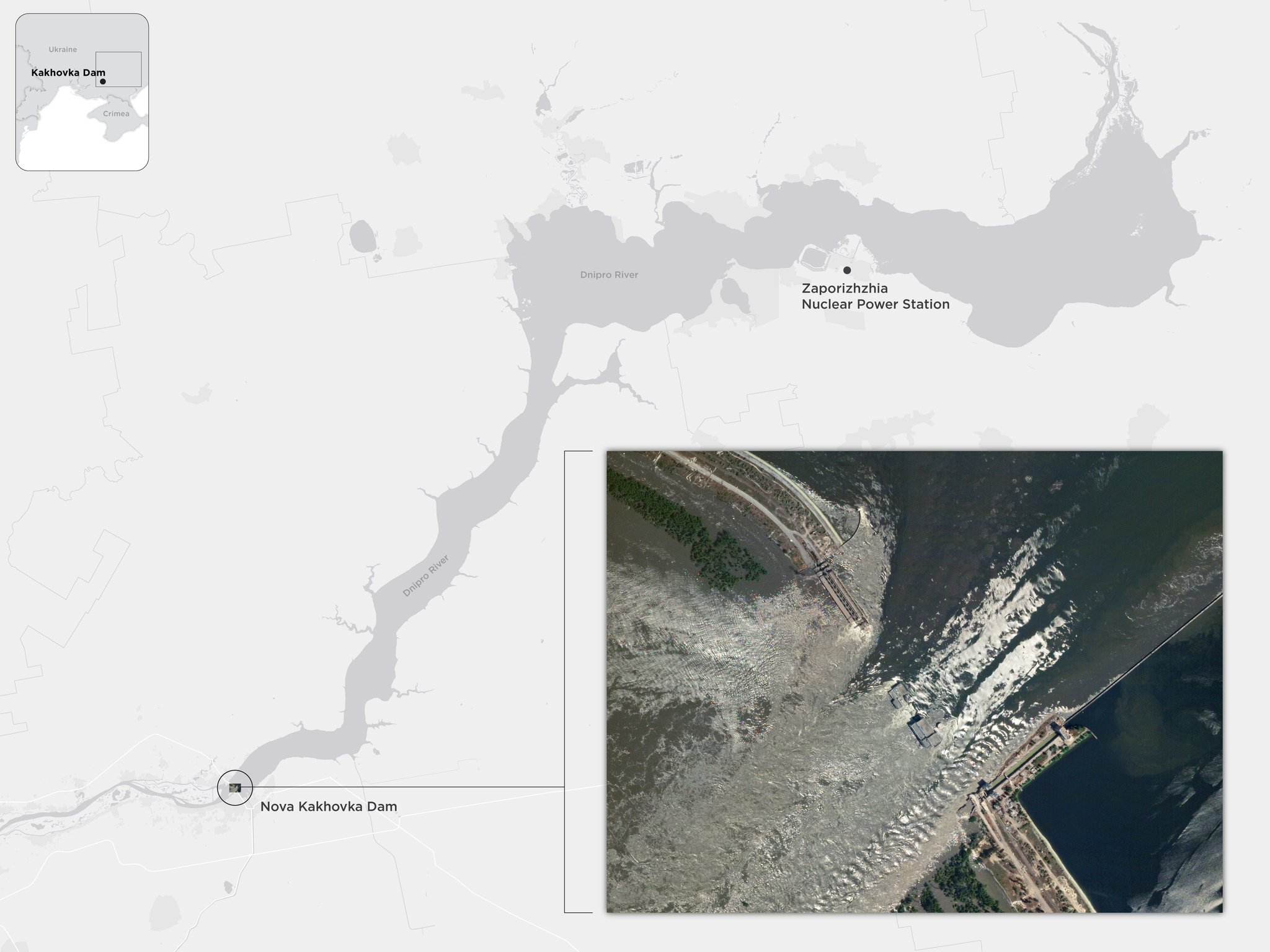
In early June 2023, the Nova Kakhovka dam across the Dnipro River in Ukraine collapsed, flooding several downstream cities. This high-resolution SkySat® image taken on June 6 captures the aftermath of the collapse in great detail. But it lacks the broader view — demonstrated by the background map.
Planet’s fleet of 3.7 meter resolution (GSD) Dove® satellites orbit the globe approximately every 90 minutes, capturing Earth’s landmass and coastal areas on a near-daily basis. This continuous global coverage means there is PlanetScope® data available almost anywhere you need it, so you can broaden your focus to include adjacent geographies immediately. This additional context can eliminate assumptions in choosing the path forward — allowing teams to act with confidence and agility.
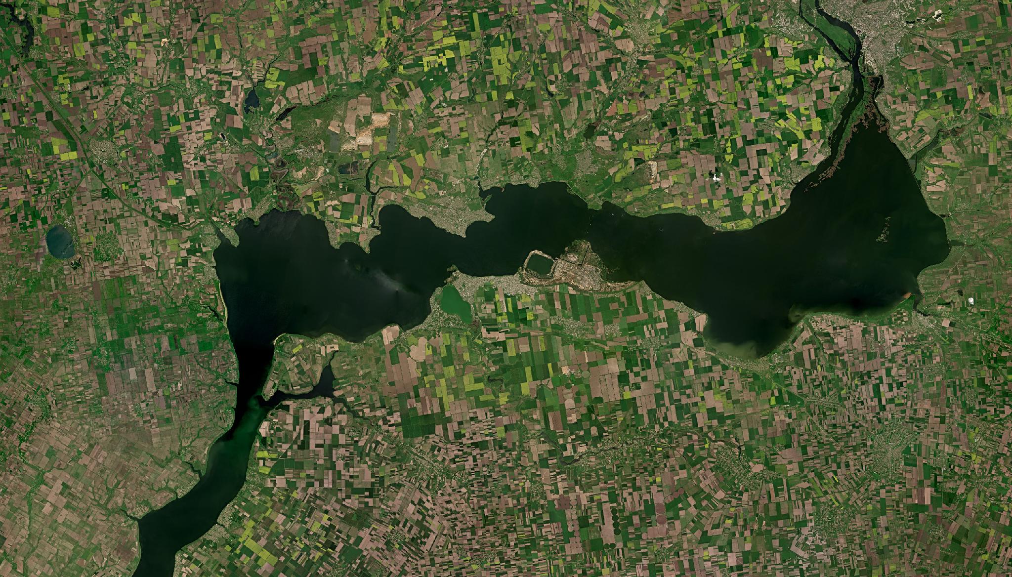
This time series of Planet Basemap images spanning May to July 2023, gives insights into the broader and potential downstream consequences of the collapse.
Always-On Monitoring in Practice
In today’s ever-evolving geopolitical landscape, government defense agencies rely on Planet’s global, daily imagery to monitor broad areas for anomalous activity and solve for known unknowns. This increases contextual awareness over broad areas and decreases the potential for strategic surprise.
“The global collection and daily coverage provided by Planet makes it a great addition to the defense and intelligence sector’s evolving capabilities,” says Kei Shibuya, Head of Business Development for SNET.
Historically, many defense and intelligence agencies relied largely upon tasked satellite imagery, which is limited to a small area of interest. And while tasked imagery offers superior resolution, it often doesn’t tell the whole story.

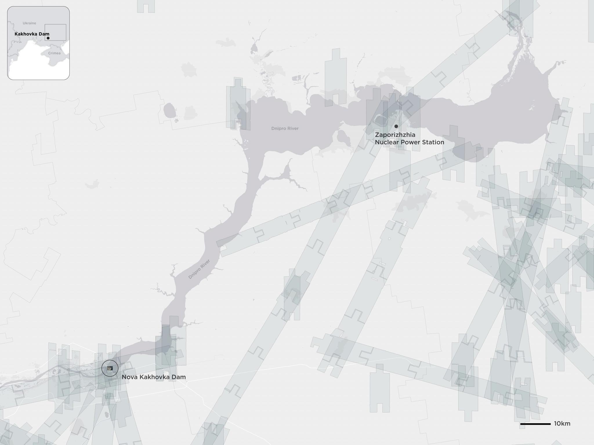
The footprints of SkySat images captured in June 2023, after the dam burst. Tasking satellites make covering broad areas a challenge, which can leave out context that can be crucial for intelligence.
Defense and intelligence agencies can gain strategic and operational advantage by leveraging always-on monitoring data to gain a broader understanding — which can in turn, inform their tasking strategy. Afterall, you cannot look closer until you know where you want to look.
Looking Broader With Planet
However you plan to take action, it’s critical that the information you have is flexible and keeps up with the speed of change in today’s world. Being able to look more broadly is one of the core superpowers behind broad area management.
Interested in learning more? Watch our on-demand webinar that showcases how Planet can help your team achieve broad area management, at scale.

Ready to Get Started
Connect with a member of our Sales team. We'll help you find the right products and pricing for your needs


