
Clear for Analysis with Planet’s New Usable Data Masks
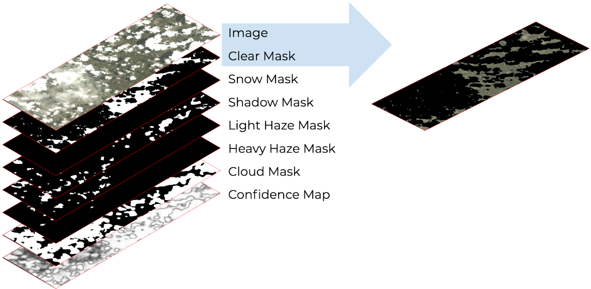
For the wealth of information optical satellite imagery contains, there will always remain a stubborn share of pixels that aren’t super helpful for analysis. Clouds (which cover around two-thirds of the Earth on any given day), shadows cast from clouds, haze, and snow can preclude us from accurately seeing what’s on the ground. As Planet collects in excess of 200 million square kilometers of imagery every day, it’s important that we help our customers sift out which are the best pixels for their applications from this massive dataset. This was the primary motivation behind our latest feature release: Usable Data Masks. With Usable Data Masks, Planet sought to address two things: significantly enhance the experience around data discovery, and reliably increase the fraction of pixels that are able to be consumed by a broad range of customers and applications. Previously, Planet only provided information about which pixels within a scene were unusable in a binary yes/no fashion. While this helps filter out bad pixels, it provided little insight about how useful the remaining pixels are. The new Usable Data Masks leverage powerful machine learning image segmentation techniques to identify which pixels in the image are clear or cloudy, or are contaminated by light or heavy haze, or snow. The resulting image mask layers, packaged as a GeoTIFF, helps visualize what parts of the image contain these elements and what parts are clear. [caption id="attachment_143433" align="aligncenter" width="1600"]
Ready to Get Started
Connect with a member of our Sales team. We'll help you find the right products and pricing for your needs