
Planet’s Rapid SkySat Data Enables Effective Regional Bushfire Management in Australia
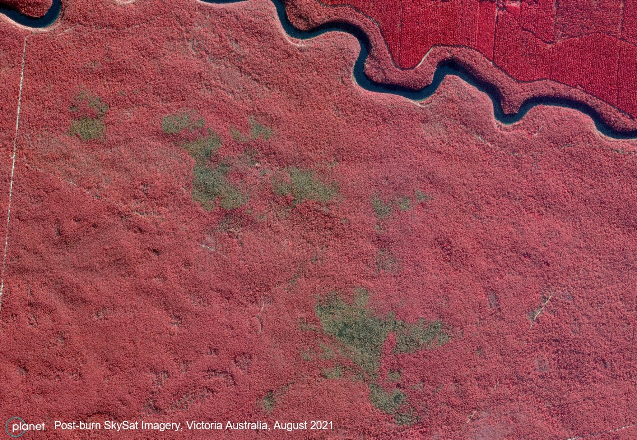
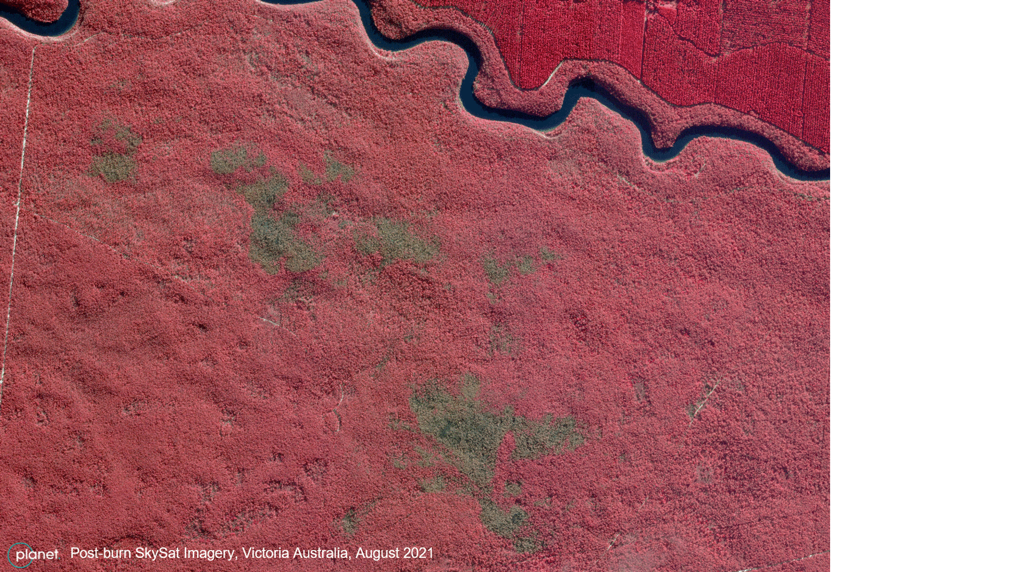
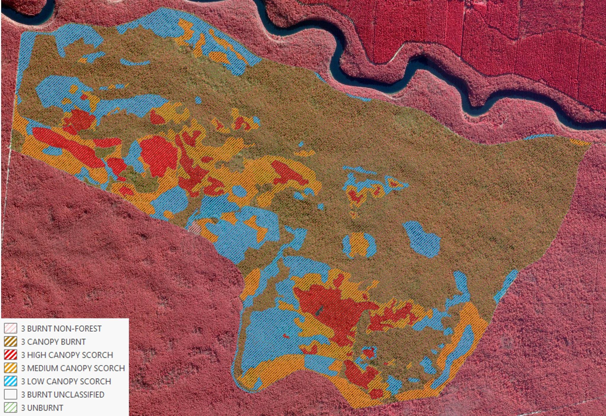
SkySat image of a post-burn forest site in Victoria, Australia. @ 2021, Planet Labs Inc. All Rights Reserved.
StoriesCivil governments around the world are making sustainable strides in local environmental management; and by using satellite-enabled data, they are able to analyze and support preventative management techniques to protect local communities and ecosystems. For example, Forest Fire Management Victoria, a governmental organization located in Victoria, Australia, leverages high-resolution tasking capabilities from Planet’s SkySat constellation to analyze its effectiveness in reducing the risk of bushfires in one of the most fire-prone areas of the world. As our climate continues to warm, bushfires pose an extremely serious risk to local communities in arid and semi-arid regions of Australia, but preventative measures, including planned burning, can help reduce fire risk. Planned burning is a management technique in which land is intentionally exposed to controlled fires to reduce the amount of vegetation that could provide fuel to damaging bushfires. This technique requires careful ecological calculation to both intelligently manage the potential fuel while also supporting the local ecosystem. As bushfires are a natural phenomenon in this region of the world and often support the health and balance of the local environment, managers need accurate real-time data and robust models to manage this complexity and protect natural assets. To support bushfire managers, NGIS a GIS services company has created a public-private partnership with the Barwon South West Region of Forest Fire Management Victoria to deliver Planet’s capabilities to assess planned burning outcomes in real-time. “Australia is so massive, so getting information from space on-demand is a great solution, especially for emergency management domains,” said NGIS Consultant Brittany Dahl when speaking about their partnership with Forest Fire Management Victoria. “They were interested in finding more information for certain months, so we showed them SkySat. What has been amazing about Planet is the tasking dashboard. They can task it anytime after a burn change and the resolution quality is high enough that they can use it for certain vegetation as well.” [caption id="attachment_147515" align="aligncenter" width="1920"]
Ready to Get Started
Connect with a member of our Sales team. We'll help you find the right products and pricing for your needs.