
Extreme Flow Velocities and Formation of a Dammed Lake
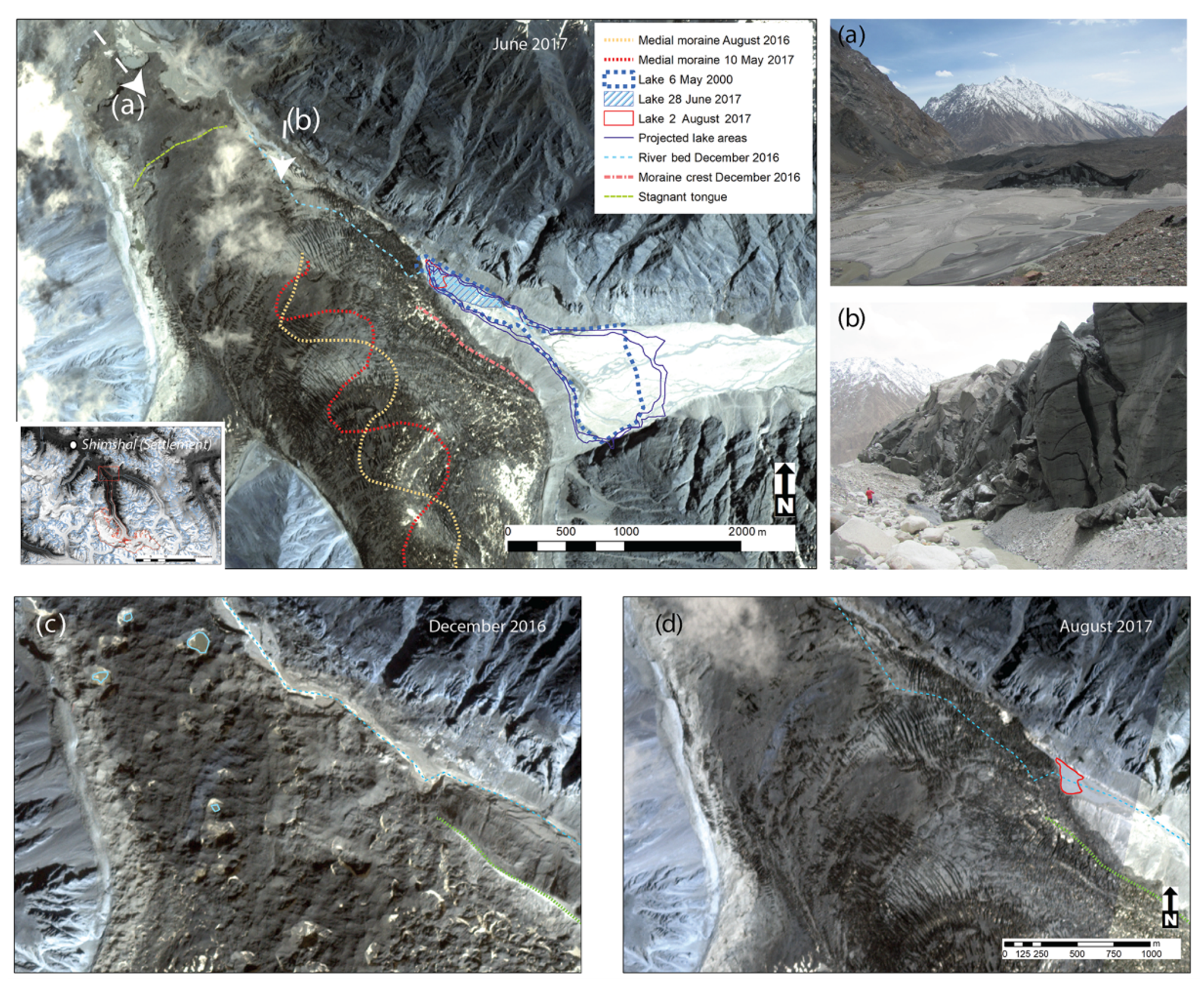
Jakob Steiner and team use digital elevation models and Landsat imagery in combination with high resolution Planet data to quantify surface elevation changes and flow velocities during a glacial surge of the Khurdopin Glacier. They conclude that the high frequency of Planet imagery is useful to capture peak surge velocities that are easily missed by less frequent Landsat imagery, observe surface changes that indicate potential drivers of a surge, and monitor hazards associated with a surge. Read the full paper, published in The Cryosphere, here, and learn more in Planet Stories. [caption id="attachment_138928" align="alignleft" width="1233"]
Ready to Get Started
Connect with a member of our Sales team. We'll help you find the right products and pricing for your needs.