Mapping Winter Cropped Area of Smallholder Farms
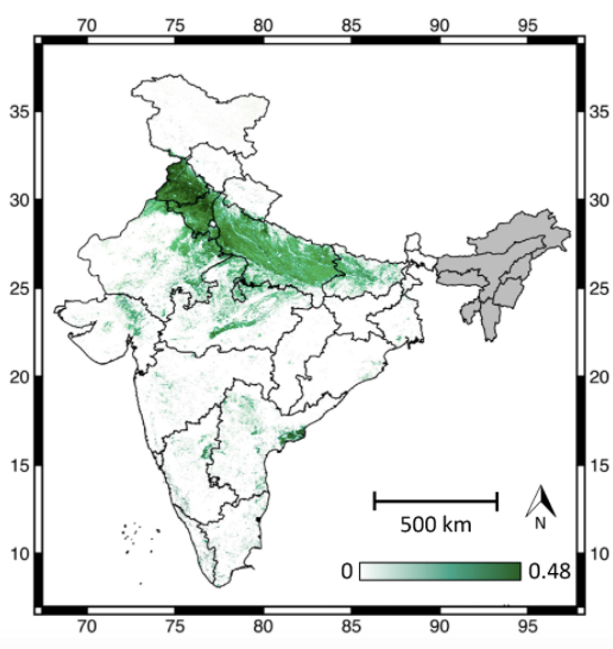
Fine-scale agricultural statistics are important tools for understanding trends in food production, especially in smallholder systems where heterogeneity in production is common. Satellite data is a key component to collecting these statistics for smallholder systems, though not without challenges such as complex sub-pixel heterogeneity, little to no available calibration data, and high amounts of cloud cover. Using RapidEye imagery to validate their crop estimates, Meha Jain and colleagues have developed an improved method utilizing MODIS imagery to better collect these agricultural statistics. Read the full paper, published in Remote Sensing, here. [caption id="attachment_138904" align="alignnone" width="516"]
Ready to Get Started
Connect with a member of our Sales team. We'll help you find the right products and pricing for your needs