PlanetScope Time-series Used to Understand Vegetation Phenology
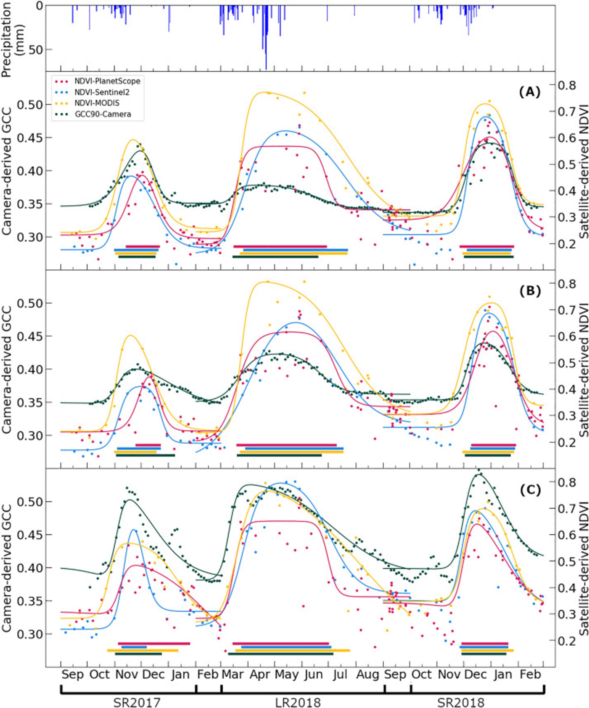
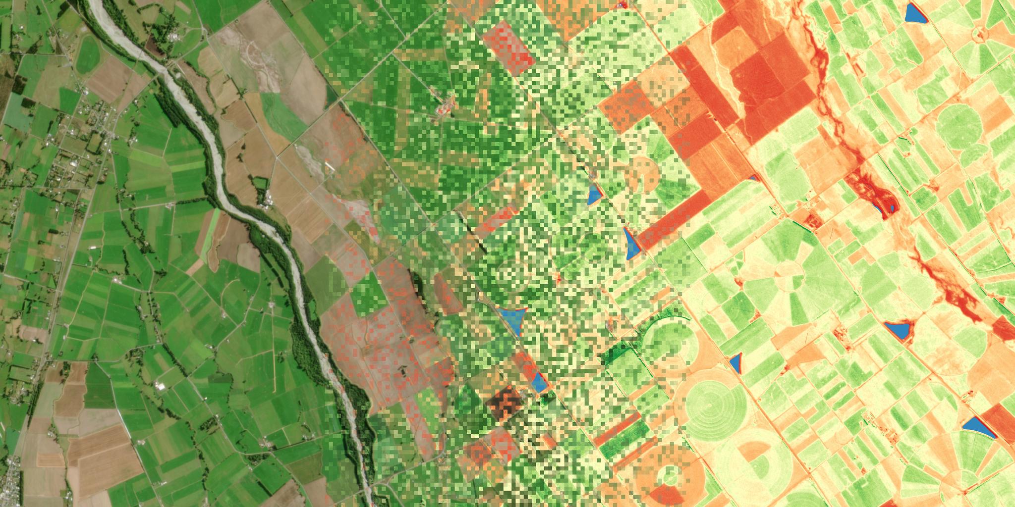
Change in vegetation color, chemistry and metabolic activity is one of the most striking signals of life in our biosphere. Satellite imagery plays an important role in effectively retrieving and mapping these vegetation changes over time—also called phenology. The rapid revisit period of the PlanetScope cubesat constellation provides researchers with a unique opportunity to obtain phenological information. Rapid changes in climate can greatly affect the local phenology, and require consistent monitoring to pinpoint the changes. MODIS captures daily imagery over large areas, but lacks the spatial resolution necessary to track fine-scale phenology. Improved temporal and spatial resolution helps to better understand greenness peaks, the impact of moisture deficits, and the impact of excessive rainfall. Researchers Yan Cheng, Anton Vrieling, Francesco Fava, Michele Meroni, Michael Marshall, and Stella Gachoki at the University of Twente and collaborating institutions used a combination of field cameras and MODIS imagery to evaluate the ability of PlanetScope and Sentinel-2 to track changes to local phenology at Kapiti Farm research station in Machakos County, Kenya. They then applied curve fitting to evaluate the quality and frequency of PlanetScope and Sentinel data. The researchers reported that: “PlanetScope had a better density of cloud-free observations as compared to Sentinel-2 NDVI time series. For that reason, phenology retrievals from PlanetScope were less affected by persistent cloud cover during rainy seasons, resulting in more consistent spatial patterns and fewer spatial artefacts as compared to Sentinel-2.” They further highlighted that: “visual assessment of the phenology results for small areas reveals that PlanetScope effectively captures the spatial variation caused by various vegetation covers.” The full study was published, open access, at the journal Remote Sensing of Environment. [caption id="attachment_145420" align="aligncenter" width="714"]


Ready to Get Started
Connect with a member of our Sales team. We'll help you find the right products and pricing for your needs.


