The Power of Remote Sensing Satellite Images to Help Protect and Preserve Public Lands1

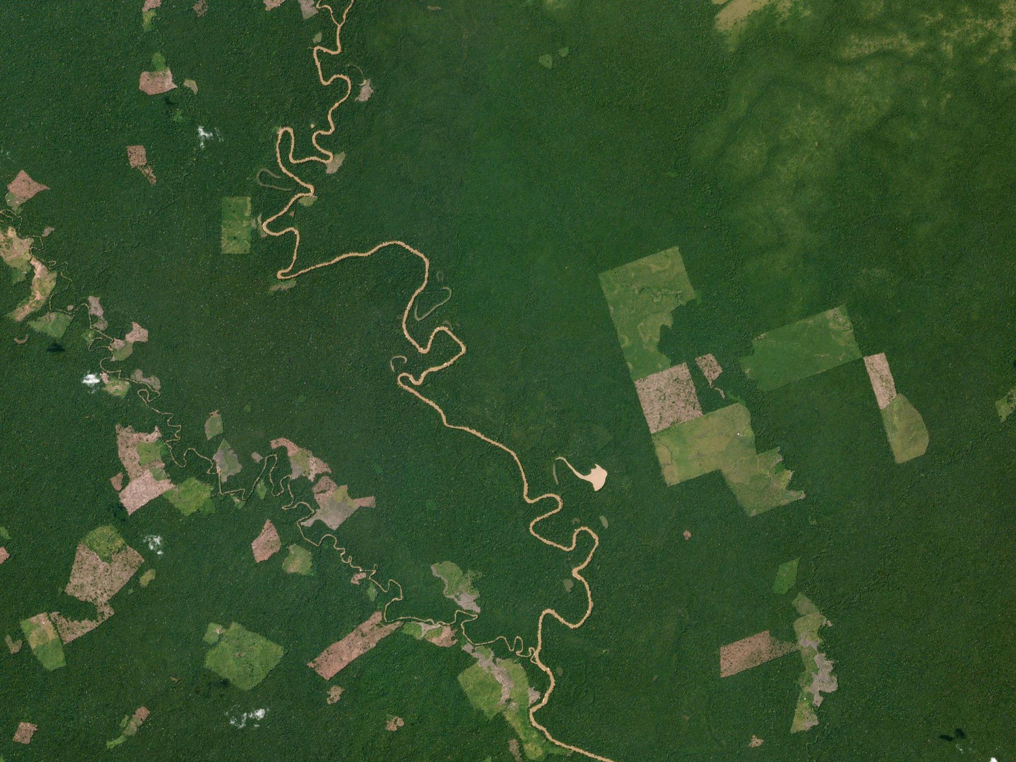
PlanetScope image of Chiribiquete National Park in Colombia, captured January 16, 2021. © 2021 Planet Labs PBC. All Rights Reserved.
TechThe Bureau of Land Management's new public lands rule highlights the growing importance of satellite imagery in conservation. With Planet's remote sensing technology, government agencies gain invaluable insights to monitor ecosystems, prevent illegal activities, and protect forests, wetlands, and wildlife, driving impactful, cost-efficient environmental preservation efforts.
The Bureau of Land Management (BLM) is making significant changes under the public lands rule to increase efforts and resources to protect natural resources. Now more than ever, satellite imagery for conservation is crucial, as satellite technology transforms the field through remote sensing, monitoring, and the innovative use of its insights.
Below, we’ll briefly explain remote sensing imagery and how satellite technology is vital in conservation. We'll also explore the benefits government agencies can gain from using satellite images and what the future holds for this technology.
Understanding Remote Sensing Satellite Images
Remote sensing for land management involves collecting data from a distance, typically satellites orbiting the Earth. These satellites capture images of the earth’s surface using optical, radar, sonar, and other sensors. This technology allows us to "sense" features of the planet on a scale impossible to achieve from the ground.
Remote sensing provides government agencies with high-resolution, high-frequency images across board areas. These images help make informed decisions, enforce regulations, monitor environments, and prevent disasters and degradation.
Using satellite images, we can better manage and protect public lands—a concept known as Forestry 4.0.
Applications in Protecting Public Lands
Remote sensing helps track and mitigate the impacts of natural disasters and slow environmental degradation. For example, NASA collaborated with Yosemite National Park to minimize forest fire damage by determining fire characteristics and the best response strategies.
Satellite imagery also supports the detection and prevention of illegal activities, such as unauthorized logging, mining, or poaching in protected areas.
The ability to analyze historical data also provides insights that were previously unavailable or required extensive resources. A study in BioScience demonstrated how images from the 1960s support current conservation efforts, showing that looking back in time is just as important as having a broad, detailed view of the present.
Forest Conservation
Governments use satellite imagery to monitor forests, better understand the health of plants and wildlife, and assess the severity of threats. This helps prevent both immediate and long-term damage to forests more effectively.
For instance, the Frankfurt Zoological Society (FZS) improved forest monitoring using Planet's satellite data by detecting threats like illegal logging and mining. With this data, FZS could address these threats more effectively, even with budget constraints.
Wetland Preservation
Governments also use satellite imagery to protect wetlands by monitoring their health and detecting threats like pollution or damage to vegetation. This is vital because wetlands are among the most productive ecosystems globally, comparable to rainforests and coral reefs in their ecological importance.
Wildlife Protection
Satellite images help track animal movements, habitat changes, and other vital data. This capability extends beyond human activities and enables better understanding and protection of wildlife.
In the Asia-Pacific region, home to critical ecosystems, Planet high-resolution satellite imagery helps monitor biodiversity. For example, our imagery provides detailed monitoring of the Indonesian archipelago, which hosts 17% of the world’s wildlife.
Benefits of Remote Sensing for Public Lands
Remote sensing satellite images provide accurate, timely monitoring, enabling better data-driven decision-making. This technology's unique advantages are why governments rely on it for land management.
Key benefits include comprehensive coverage and cost-efficiency:
- Comprehensive coverage: Remote sensing provides consistent data collection over large, remote, or hard-to-reach areas. Governments gain extensive coverage of any landmass they need to monitor, with daily images offering an accurate view of changes.
- Efficiency and cost-effectiveness: Satellite imagery reduces the need for ground surveys, lowering costs and improving project efficiency. The substantial economic benefits allow governments to allocate resources more effectively and build public trust through innovative conservation efforts.
Future Prospects and Innovations
Advancements in satellite technology will enhance these benefits, enabling more government collaboration and stronger public-private partnerships. Leading providers are already improving efficiency across diverse data sets. For example, Planet Insights Platform integrates earth data with advanced analytics, making insights more accessible to decision-makers.
Planet continues to lead in innovation and is committed to constant improvement. We use an agile aerospace approach and rapid iteration.
How Planet Powers Public Lands Monitoring
Planet's remote sensing technology is at the forefront of environmental protection with satellites. Our satellite imagery supports governments worldwide in conserving forests, wetlands, wildlife, and other public lands.
We offer comprehensive, efficient coverage, enabling decision-makers to act confidently and drive positive environmental changes. Our continued innovation ensures we remain at the cutting edge of global conservation efforts.To learn more about our work protecting public lands, browse our customer stories. You can also contact us to discuss how we can support your conservation efforts.

Ready to Get Started
Connect with a member of our Sales team. We'll help you find the right products and pricing for your needs.

