Scientists Use Planet Data to Examine Cause of Palu Valley Landslides

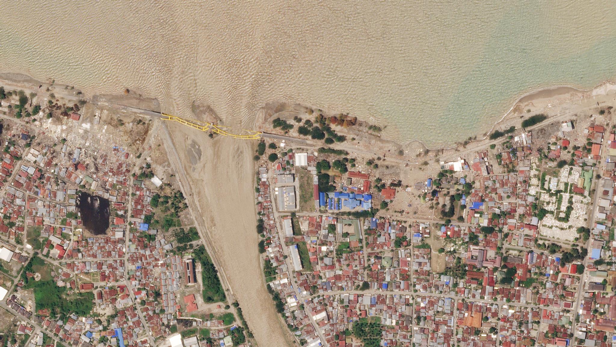
Post-earthquake image of Palu Valley, Indonesia © 2018, Planet Labs Inc. All Rights Reserved.
TechOn September 28, 2018, a destructive magnitude 7.5 earthquake struck central Sulawesi, Indonesia. The strength and stiffness of the soil decreased dramatically due to the shaking of the great quake, turning it from a solid to a liquid in one of the most dramatic soil liquefaction events ever recorded, leading to destructive landslides. Without the support of intact soil, buildings and structures were overturned or reduced to rubble, contributing significantly to the death toll of over 4,000 people. In an effort to better understand the unexpected severity of landslides triggered by the earthquake, a multinational research team spanning four continents, led by Dr. Kyle Bradley at the Earth Observatory of Singapore, utilized daily PlanetScope imagery to map out surface ruptures and landslides. According to their study published in Nature Geoscience, the team discovered that the ground failure and landsliding in the Palu Valley was largely the result of irrigated rice paddies sitting atop alluvial fans—triangle-shaped deposits of sand, gravel and smaller silt materials called alluvium. Alluvial fans form when the fast-flowing water in a steep stream or river hits a shallow gradient (like a valley floor), slows down and drops sediment. “We were able to use PlanetScope images captured directly before and after the earthquake, which allowed us to focus on and isolate the landsliding caused by ground shaking,” Bradley explains.
Tracing back from the fault found by @SotisValkan and @baasaltena, there is a surface rupture at least 35 km south of the coastline. This line connects with the soccer field above. #PaluEarthquake #PaluTsunami @planetlabs imagery from Sep 28 and Oct 1. pic.twitter.com/vTZXc5sjIc
— Dr. Joe Mascaro (@joe_mascaro) October 1, 2018
The 3-5 meter resolution of the PlanetScope images allowed Bradley and his team to easily map most of the details of the ruptures and landslides, and the near-daily cadence of Planet’s imagery also proved to be valuable for monitoring the land and collecting data in the desired time frame. All over the planet, ground surfaces have a layer of soil permanently saturated with water called water tables. These tables separate the groundwater zones that lay below them from the land surfaces above. Because the rice paddies in Palu are filled with water due to irrigation for farming, the water table beneath them was much closer to the surface, making the soil more susceptible to liquefaction. In the study, Bradley’s team highlights the need for more proactive assessment of the potential hazards caused by farming and irrigation. Alluvial fans had not previously been considered a threat, as soil liquefaction of this magnitude in this type of material had never been observed before. “Earthquake-triggered landsliding of gentle, irrigated alluvial slopes is an under-recognized, but avoidable, anthropogenic hazard,” the researchers wrote in their paper. Planet’s coverage of Palu also provided insight into the wider effects of the earthquake, according to Bradley, along with future earthquake threats that the area may face in this tectonically active region. “This includes many other landslides that happened on steeper mountain slopes in the surrounding region, the effects of liquefaction and the tsunami on the city itself, and the response of the Palu River and Palu Bay to the earthquake and landslides,” he says. ”We expect that this archive of images will prove to be a continuing source for discovery going forward.” “The rapid return time of PlanetScope imagery is critical for this kind of application. Equatorial areas often have dense cloud cover, so it is important to be able to select relatively cloud-free images from the period of interest,” Bradley says.

Ready to Get Started
Connect with a member of our Sales team. We'll help you find the right products and pricing for your needs.

