
Slingshot Aerospace Maps Flooded Areas following Hurricane Harvey
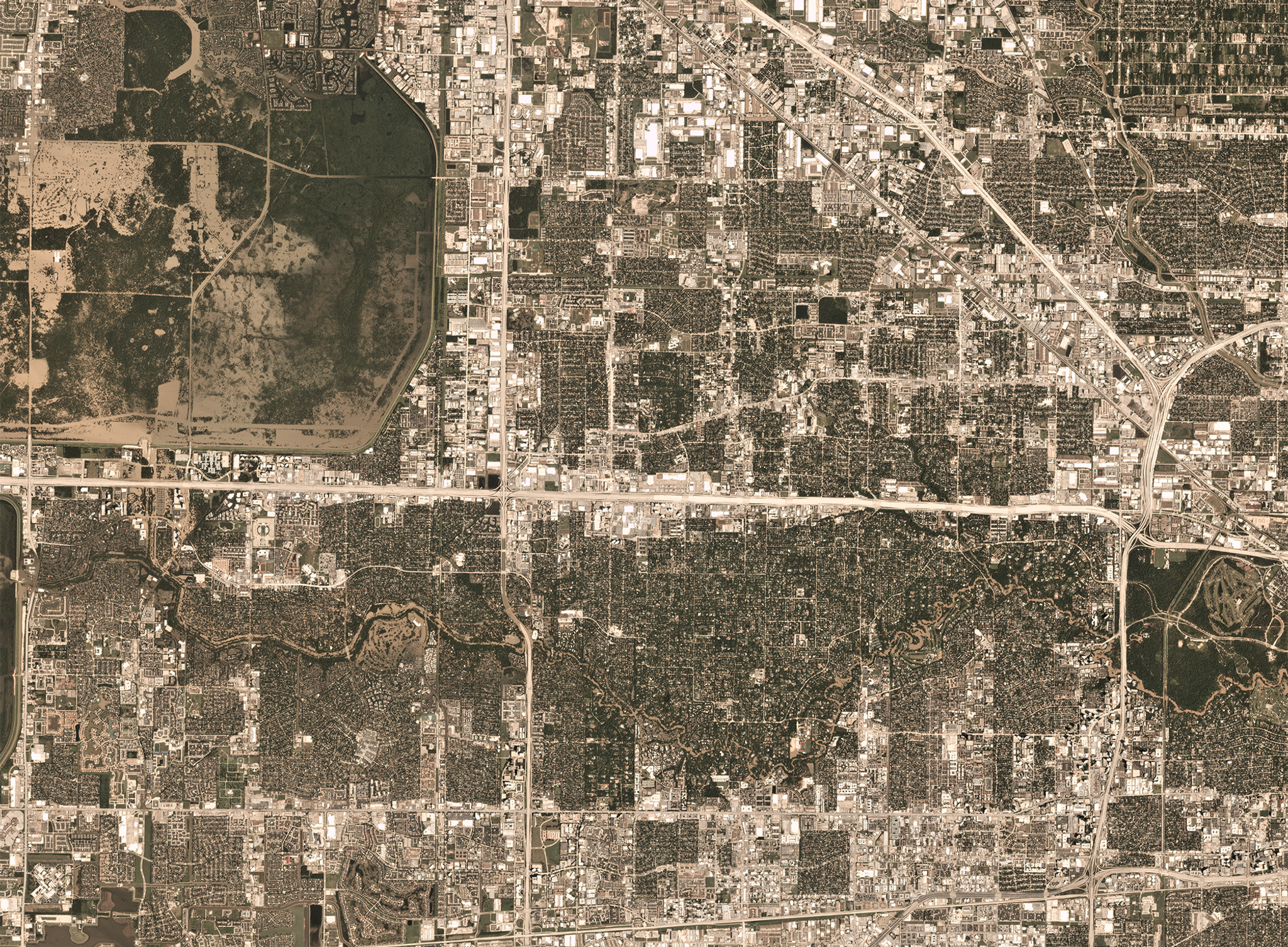
PlanetScope imagery of Houston, Texas following heavy floods in 2017 © 2017, Planet Labs Inc. All Rights Reserved.
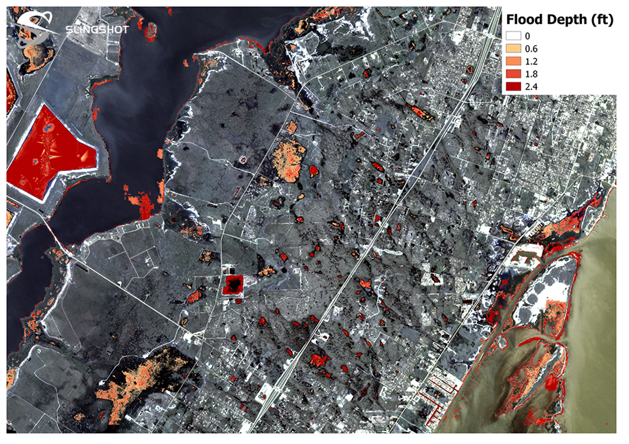
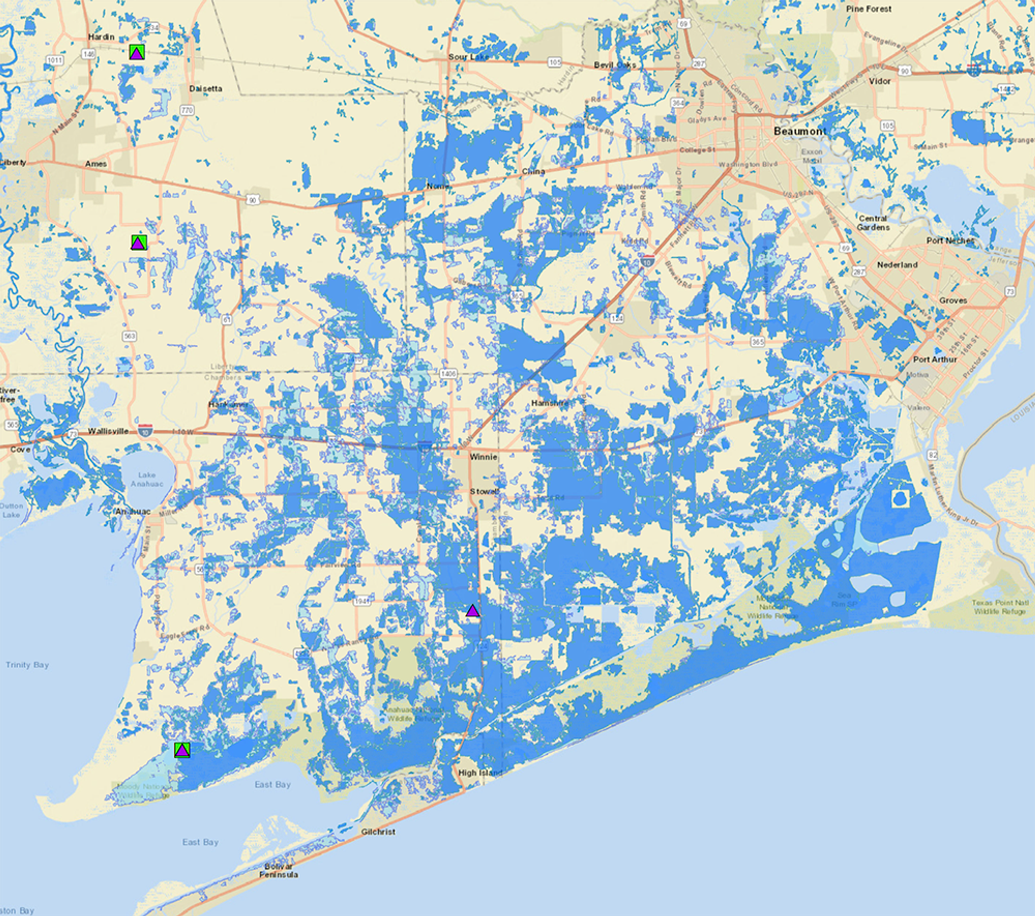
StoriesWhen Hurricane Harvey made landfall in Houston earlier this month, Slingshot Aerospace, a Planet Application Developer Program partner, leapt into action. Working with Team Rubicon and the BAE Systems Geospatial eXploitation Products™ (GXP®), Slingshot was able to use its flood detection algorithms on up-to-date satellite imagery to determine the extent of the flooding and its severity.
With this knowledge, they were able to highlight dry areas to assess search and rescue efforts to enable first responders and medical crews to safely reach those in need. Slingshot also used its algorithms to quickly identify flood relief and triage staging areas close to non-flooded roadways and optimal hospital routes.
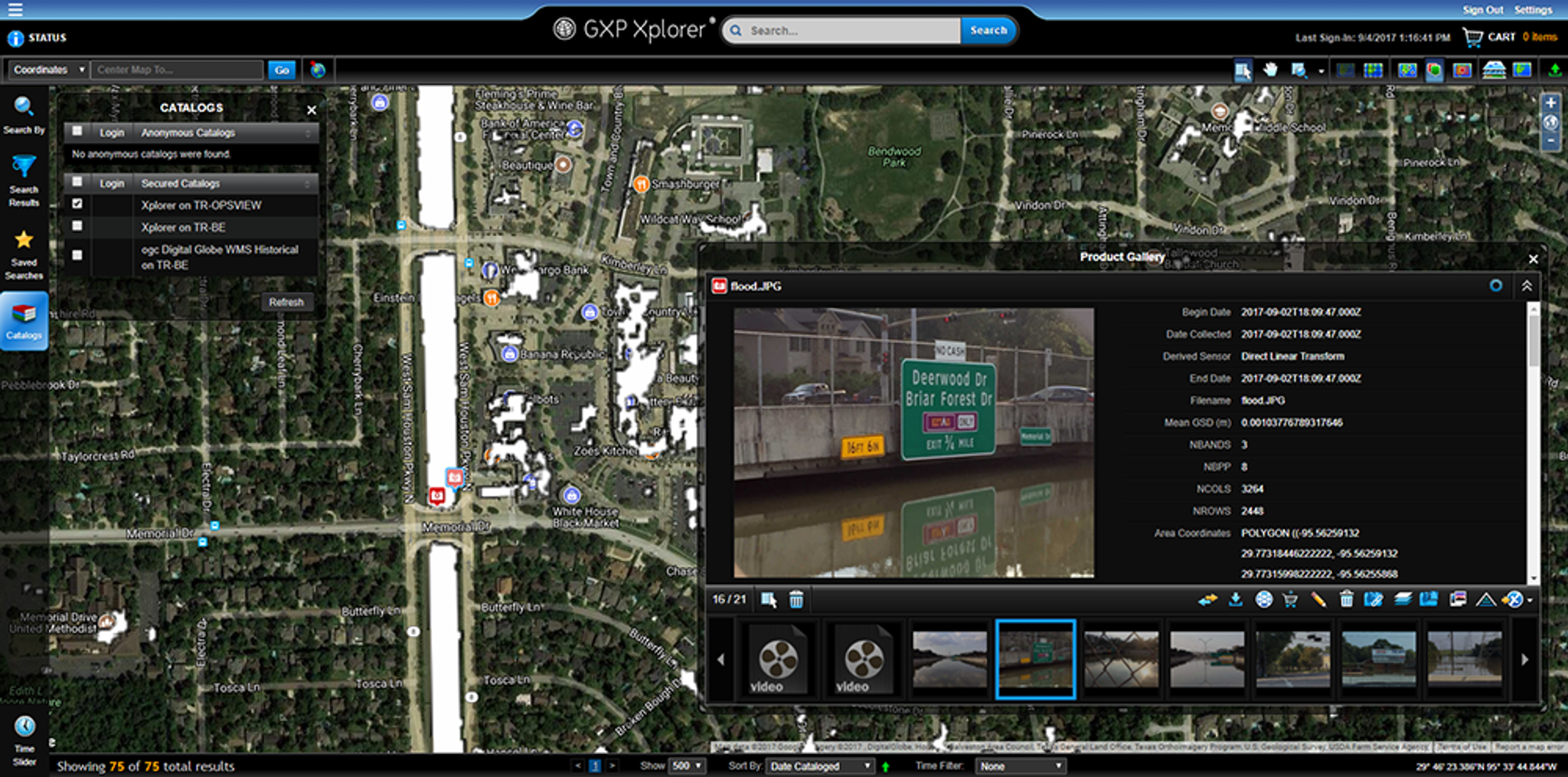
BAE Systems leveraged their cloud-hosted GXP solutions to provide Team Rubicon’s disaster response teams with the ability to visualize and analyze Planet imagery and Slingshot products. Take a look at the mapping they've done in the storm's aftermath:

Ready to Get Started
Connect with a member of our Sales team. We'll help you find the right products and pricing for your needs.