
New Project from World Bank & Planet Uses Satellite Imagery & Machine Learning to Drive Sustainable Urbanization in Tanzania
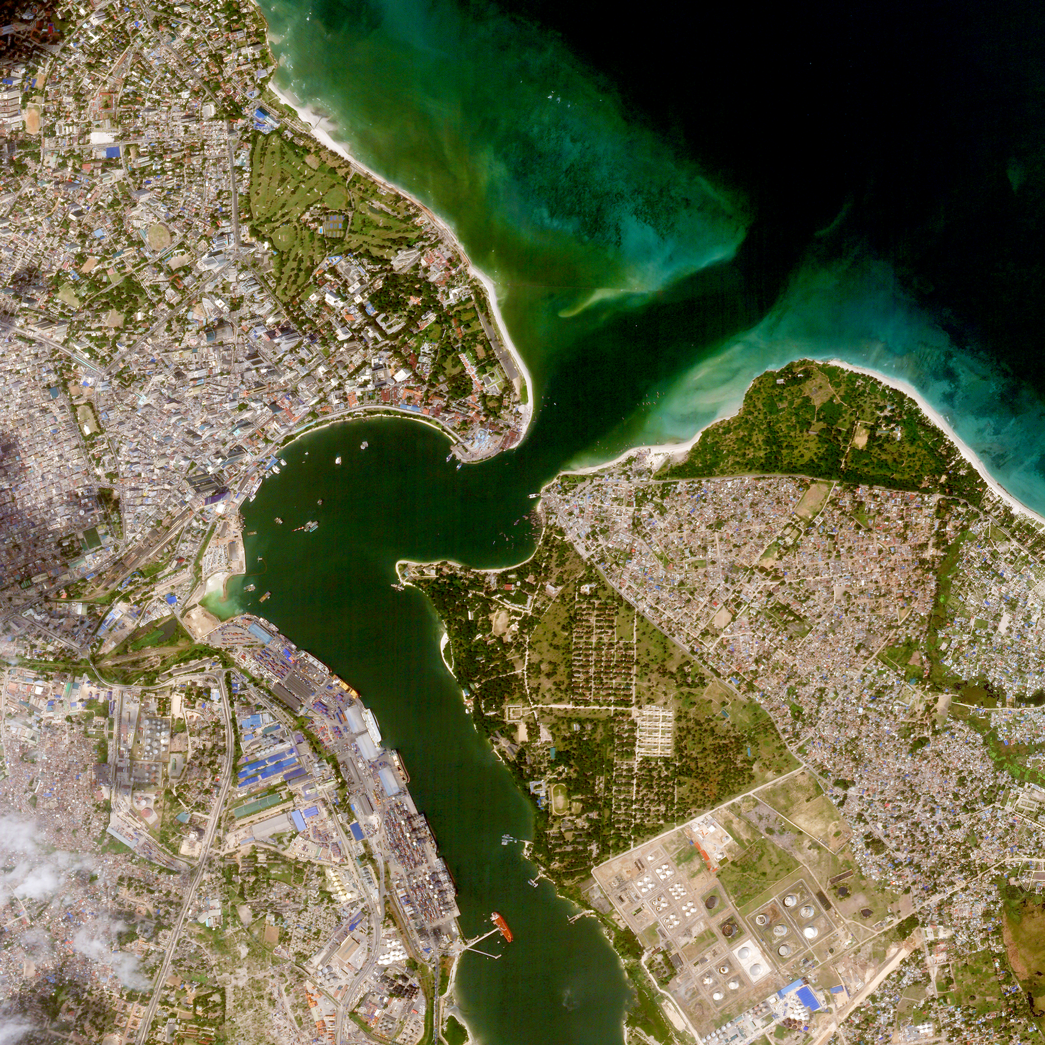
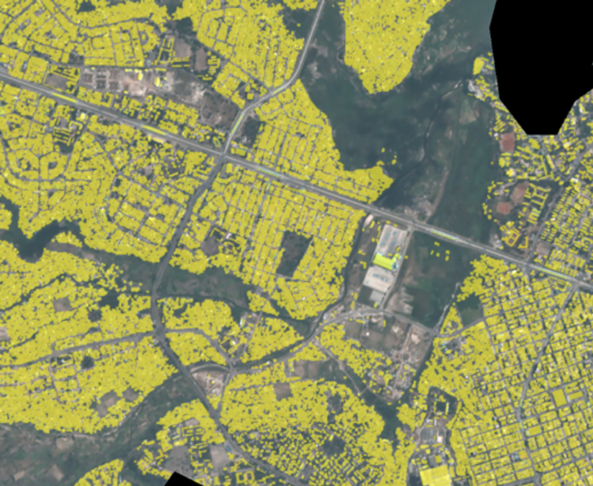
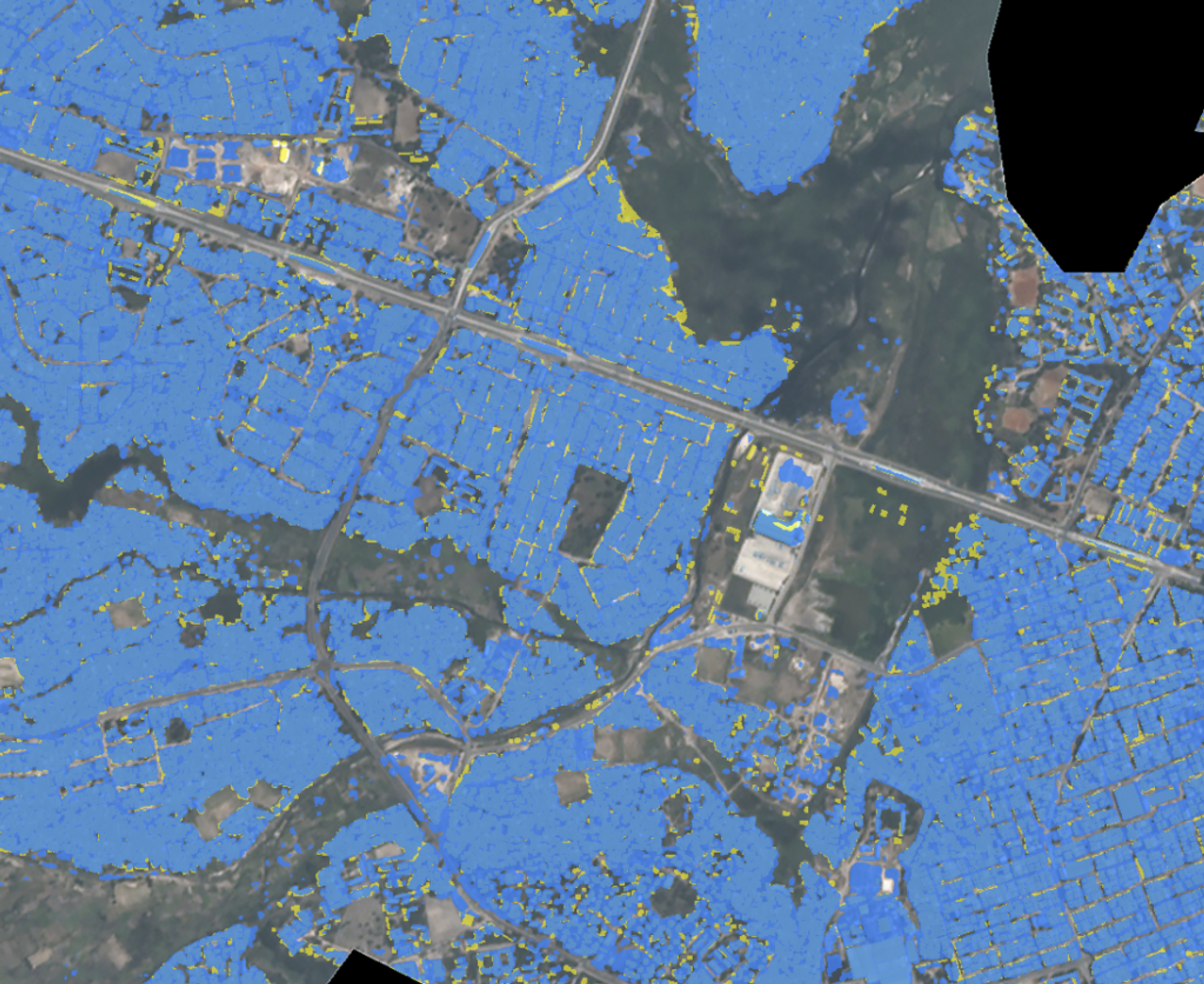
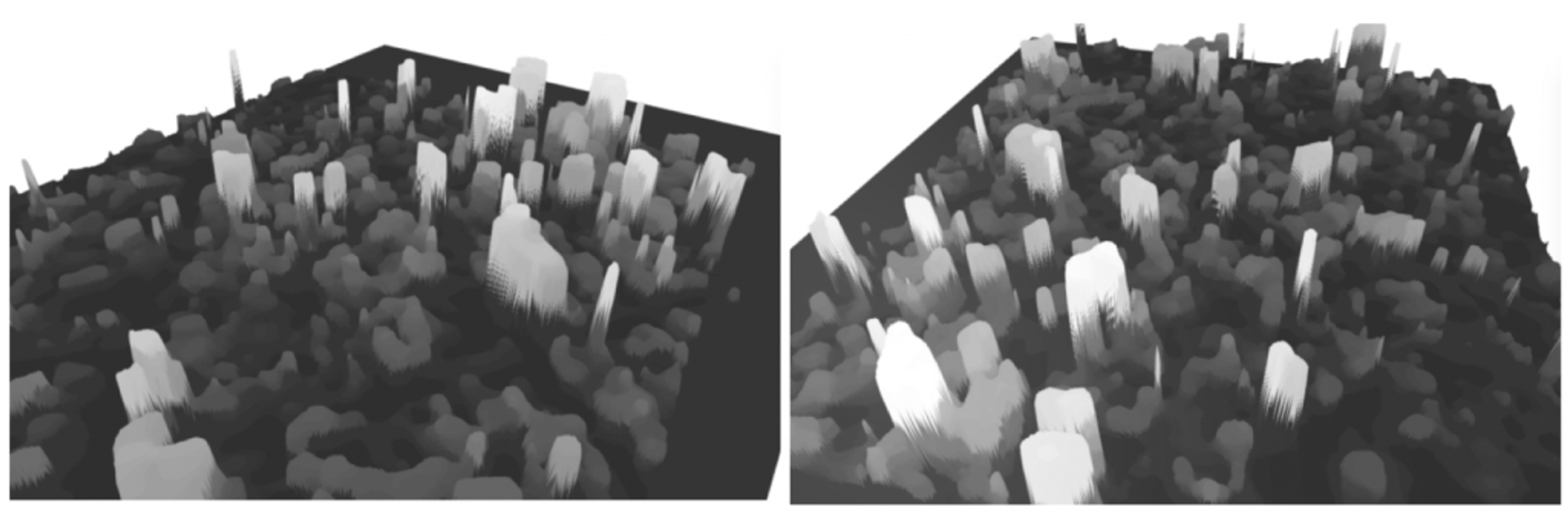
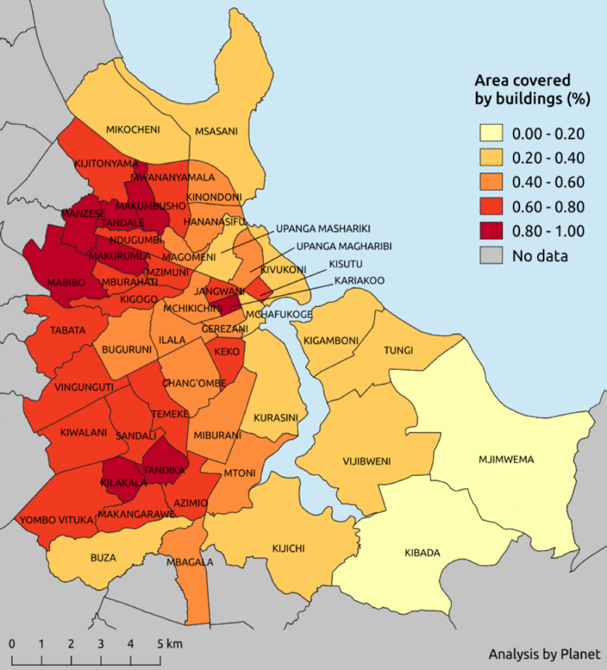
With more than two-thirds of the world’s population projected to live in cities by 2050, sustainable development increasingly depends on the successful management of urban growth. To that end, Planet is announcing today a groundbreaking R&D project with the World Bank to pioneer new tools to detect urban change in emerging countries, beginning with Dar es Salaam, Tanzania. The project falls under the Tanzania Urban Resilience Program, funded by the United Kingdom’s Department for International Development (DFID). Dar es Salaam is one of the largest and fastest-growing capital cities in East Africa. Research suggests the city is growing at a rate of 8% to 12%, but this is difficult to confirm, as much of the growth is unplanned and unmapped. Rapid urbanization combined with poor planning often carries substantial risk to infrastructure, public health, clean water provision, natural habitats and ecosystems, and social stability. To pilot new solutions to development financing and urban planning, Planet and the World Bank leveraged Planet’s frequent high-resolution satellite imagery, ground truth data from the community-based initiative Ramani Huria (Swahili for “Open Map”), and advanced deep learning techniques to automatically detect building development in Dar es Salaam as well as measure urban density. The project was comprised of two applications: one for automatic detection of building footprints and the other for measuring building height. Combined, these two indicators help provide an understanding of Floor Space Index, which governments, NGOs, and international development institutions use to understand how much land is available for development and to determine what is planned and unplanned. Building Footprint Detection Planet trained a convolutional neural network architecture to detect building footprints in PlanetScope imagery (shown in blue below). The high refresh rate of the Dove satellites, with the ground truth data from Ramani Huria (shown in yellow), yielded accurate results, as you can see in this image. The high accuracy of this automated model is expected to only further improve with future refinement.
Ready to Get Started
Connect with a member of our Sales team. We'll help you find the right products and pricing for your needs