Search
GENERAL AVAILABILITY | Tropical Forest Observatory
Monitor Tropical Forests with PlanetScope Mosaics
Tropical Forest Observatory
Prevent and reverse tropical deforestation with access to monthly PlanetScope mosaics for non-profit use cases.
TROPICAL FOREST OBSERVATORY
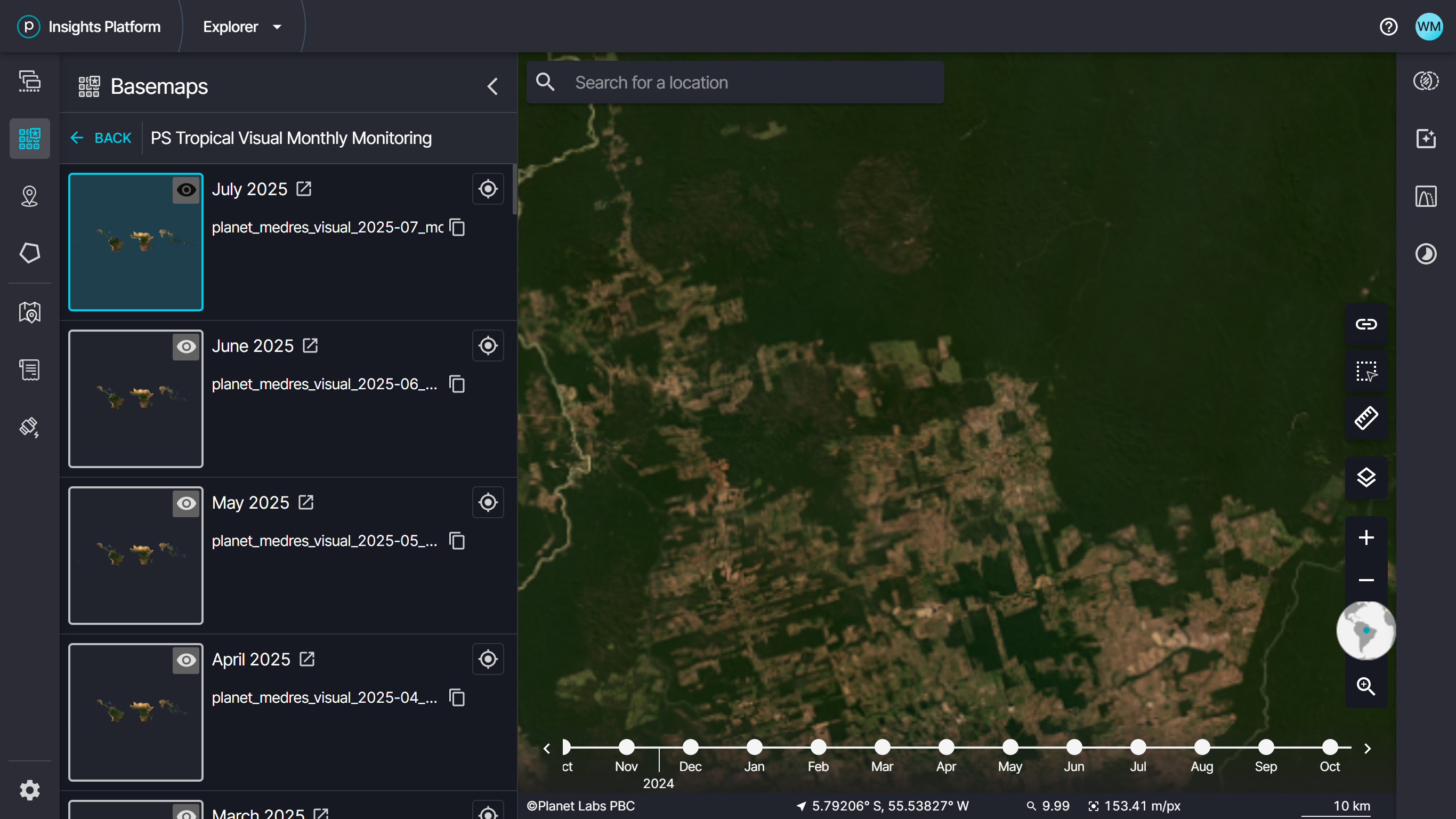
PlanetScope Mosaics for Tropical Forest Monitoring
As a public benefit corporation, Planet is committed to tropical forest conservation and helping to reduce and reverse tropical forest loss. The Tropical Forest Observatory program supports researchers, non-profit organizations, journalists, and Indigenous organizations to monitor tropical forests across the globe with access to PlanetScope data.
Tropical Forest Observatory provides consistent, high-quality satellite data at significantly discounted cost to support this vital work protecting tropical forests. The program offers this crucial dataset for non-commercial use cases. It includes access to monthly PlanetScope mosaics over the tropics, as well as a deep historical archive that you can use to monitor change.
Monthly PlanetScope Tropical Forest Mosaics
Monitor changes through time and across broad areas with monthly PlanetScope mosaics calibrated specifically for forest monitoring.
Tropical Forest Coverage
View and download visual and analytic mosaics across Earth’s tropical forests.
Deep Historical Archive
Go back in time with bi-annual mosaics from December 2015 through August 2020 and monthly mosaics starting in September 2020.
Access and Integration
Use Planet imagery through web apps, GIS integrations, or APIs.
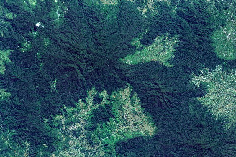
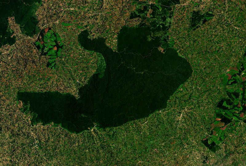
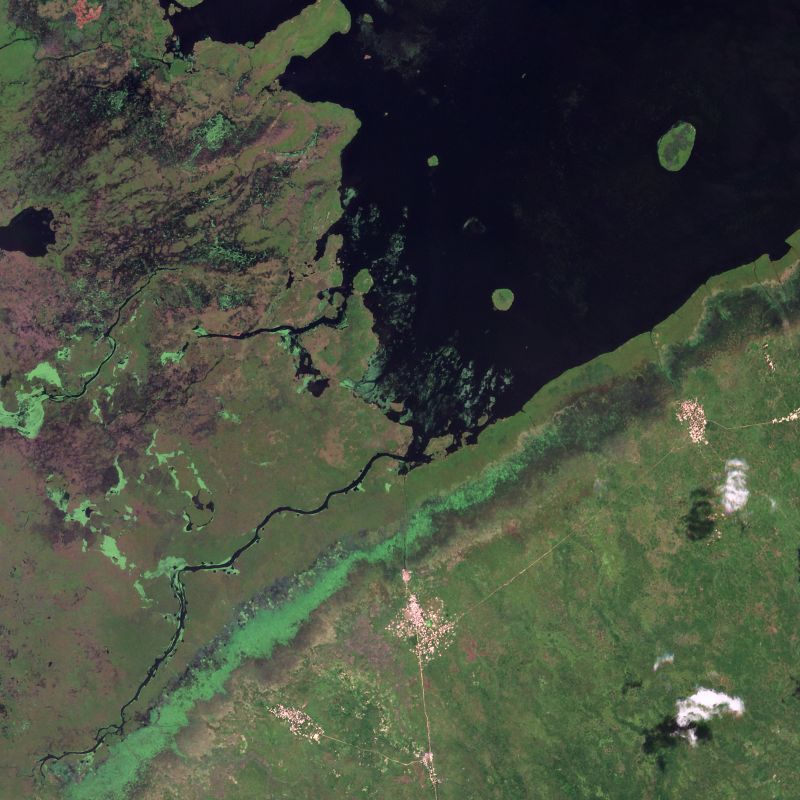
Map displaying the extent of data available through the Tropical Forest Observatory and example imagery over locations in Bolivia, Indonesia, and the Democratic Republic of the Congo.
HOW YOU CAN USE TROPICAL FOREST OBSERVATORY
Monitor Change and Power Projects to Reduce and Reverse Tropical Forest Loss
Monitor Change and Power Projects to Reduce and Reverse Tropical Forest Loss
You may use Tropical Forest Observatory to access PlanetScope mosaics for non-commercial activities related to reducing and reversing tropical forest loss. For full details, you can read the
Tropical Forest Observatory usage terms.
PRICING
Get Started With Tropical Forest Observatory
Get Started With Tropical Forest Observatory
Tropical Forest Observatory
Coverage
Tropical Forest Regions
License
For non-commercial use by individuals and teams. Usage must align with Tropical Forest Observatory terms of service.
- Monthly PlanetScope visual and analytic mosaics
- 70,000 processing units per month
- Access to public imagery from Sentinel and Landsat
- Access through web application, API, and GIS tools
Commercial and
Government Licenses
For commercial use cases and operational use by governments and businesses, please contact sales.
DIVE DEEPER
Learn More About Tropical Forest Monitoring With Planet Insights Platform
Learn More About Tropical Forest Monitoring With Planet Insights Platform


Get Answers to Your Questions about Tropical Forest Observatory
- 1.
What’s included in the Tropical Forest Observatory?
The Tropical Forest Observatory plan includes:- Monthly PlanetScope visual mosaics over the tropics
- Monthly PlanetScope analytic mosaics over the tropics
- Processing units for accessing Planet Insights Platform to use data
- 2.
What are the terms of use for the Tropical Forest Observatory program?
The Tropical Forest Observatory program is a non-commercial license to help reduce and reverse tropical forest loss. Please see the full license terms for more information. If you build a valuable product or service on Tropical Forest Observatory data that you’d like to commercialize or use in other contexts unrelated to the reduction or reversal of tropical forest loss, please contact sales. We’d be happy to provide easy graduation pathways into commercial partnership. - 3.
How much data do I get to use with the Tropical Forest Observatory plan?
With the base Tropical Forest Observatory plan, you receive 70,000 processing units per month. Processing units are used when you stream and download data. You can purchase additional processing units if you need additional data. The 70,000 monthly processing units included in the plan are enough for approximately 70,000 tile views, 46 visual mosaic quad downloads, or 23 analytic mosaic quad downloads each month. - 4.
Can I share the images I downloaded or my account access with colleagues or publicly?
The user account and license are for single-user access only. Your colleagues must have their own accounts to use the source imagery. We ask that other users also purchase access to Tropical Forest Observatory so they can access the imagery through their own account. The source imagery may not be distributed publicly; however, you may share derivatives that you create with the imagery. The Terms of Service allow for Display Rights and the sharing of screenshots with proper attribution and non-commercial use.
Ready to Get Started?
Ready to make an impact? Sign up for the Tropical Forest Observatory to gain access to monthly PlanetScope mosaics and help reduce tropical forest loss.
© 2026 Planet Labs PBC. All rights reserved.
| Privacy Policy | California Privacy Notice |California Do Not Sell
Your Privacy Choices | Cookie Notice | Terms of Use | Sitemap
