Chin Lakes, Alberta Jun 06, 2015
How Planet's Distinctive Approach to Global Monitoring Sets a New Standard for Defense Analysts
Learn how broad area management with Planet helps defense analysts continually monitor change across every region of interest. Global military spending swelled to $2.24 trillion in 2023, according to analysis by the Stockholm International Peace Research Institute (SIPRI). “The unprecedented…...
Continue Reading
PLANET PULSE
Monitoring the pulse of our planet with daily news and imagery, stories, and tech updates.
Stories
AI-enabled Insights from Publications Leveraging Planet Data
Planet AI Symposium Curious to learn more on how the combination of AI and Planet's satellite data is helping to build a more sustainable and resilient world? Join us on, Thursday, January 30th for the Planet AI Symposium where industry…
CONTINUE READINGNews
Industry Leaders Join Planet AI Symposium: A Virtual Event Exploring the Future of “Geospatial Artificial Intelligence”
Today, we are proud to launch the Planet AI Symposium, a virtual event where leading experts join Planet to discuss the future of artificial intelligence. This event explores how the intersection of AI and Earth observation data could help build…
CONTINUE READINGTechnology
From Satellite Data to Actionable Insights: Predicting Hay Yield for North Dakota with Planetary Variables
Authors: Thomas Frederikse & Stephanie Gijsbers The ability to predict crop yields is essential for optimizing agricultural productivity, managing food security, and streamlining supply chain operations. Traditional forecasting methods often struggle with limited and inconsistent data, making it difficult to…
CONTINUE READINGDiscover how daily imagery brings insights for meaningful change
GO TO PLANET INSIGHTS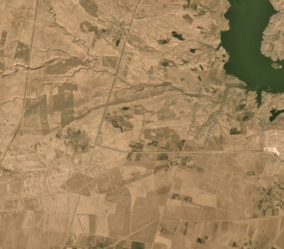
news
Planet Awarded New Contract with National Geospatial-Intelligence Agency
Today, Planet is pleased to announce that we have been awarded a new $5.9 million contract with the US government’s National Geospatial-Intelligence Agency for a six-month base period, with an option to extend an additional six months. Planet has been a provider of data and services to NGA since 2016 as part […]
CONTINUE READING
tech
Top Takeaways from the Satellite Interoperability Workshop
About a month ago, more than 100 leaders from the geospatial industry, government, and NGOs gathered at the USGS Menlo Park campus to discuss one of the biggest questions facing the Earth observation field: is the data from different satellites “interoperable,” or exchangeable, with one another? How much effort are we spending […]
CONTINUE READING
stories
The Top Global Trends Driving the Fourth Agricultural Revolution
Co-written with Deepthi Shankar Technological innovations are beginning to transform every link in the food chain, from seed to fork. In developed countries, digital technologies and analytics are making farm operations more insight-driven and efficient. Here are the five global trends catalyzing digital transformation in agriculture. Rising population and resulting increase in […]
CONTINUE READING
news
State of California and Planet Announce Groundbreaking Initiative to Support Action on Climate Change
Today, Planet is excited to announce a groundbreaking partnership with the State of California to develop Earth observation satellites to help climate action. The news was announced by California Governor Edmund G. Brown Jr. onstage during the closing remarks of the Global Climate Action Summit, and follow his remarks at the American […]
CONTINUE READING
stories
Planet Hosts 150+ International Governors, State Secretaries, & Researchers at Climate.EO Event
Earth observation technologies continue to play a vital role in our understanding of global climate change. To advance these efforts and inspire deeper commitments to sustainability, Planet and Norway’s Ministry of Climate and Environment co-hosted Climate.EO, an affiliate event of the Global Climate Action Summit. Held at Planet’s San Francisco headquarters, Climate.EO […]
CONTINUE READING