Chin Lakes, Alberta Jun 06, 2015
Why Satellite Data Is Asia-Pacific’s Greatest Ally in 2025
Planet is turning 15 in the year 2025, and as a leading provider of satellite imagery and data analysis, one thing has remained constant for us: change. Over the years, we have witnessed rapid changes through the lens of our…...
Continue Reading
PLANET PULSE
Monitoring the pulse of our planet with daily news and imagery, stories, and tech updates.
Stories
AI-enabled Insights from Publications Leveraging Planet Data
Planet AI Symposium Curious to learn more on how the combination of AI and Planet's satellite data is helping to build a more sustainable and resilient world? Join us on, Thursday, January 30th for the Planet AI Symposium where industry…
CONTINUE READINGNews
Industry Leaders Join Planet AI Symposium: A Virtual Event Exploring the Future of “Geospatial Artificial Intelligence”
Today, we are proud to launch the Planet AI Symposium, a virtual event where leading experts join Planet to discuss the future of artificial intelligence. This event explores how the intersection of AI and Earth observation data could help build…
CONTINUE READINGTechnology
How Planet's Distinctive Approach to Global Monitoring Sets a New Standard for Defense Analysts
Learn how broad area management with Planet helps defense analysts continually monitor change across every region of interest. Global military spending swelled to $2.24 trillion in 2023, according to analysis by the Stockholm International Peace Research Institute (SIPRI). “The unprecedented…
CONTINUE READINGDiscover how daily imagery brings insights for meaningful change
GO TO PLANET INSIGHTS
stories
Dattabot: Helping Indonesian Farms Secure Loans With Space Data
Farmers are often at the mercy of the elements. A wetter-than-usual growing season, for example, could provide a hospitable environment for crop diseases that significantly impact yields. Changes in crop conditions over time could signal near-term production booms or long-term problems. For Indonesian farmers, the uncertainty of weather patterns, soil conditions, and […]
CONTINUE READING
news
Planet to Offer Open Ocean Monitoring
Since its founding back in 2010, Planet’s worked to build a constellation capable of imaging the Earth’s entire landmass every day, something we are on track to accomplish following our launch of 88 satellites in February. But Planet’s “line-scanner” constellation can image more than just land. Approximately 70% of the Earth’s surface […]
CONTINUE READING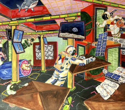
stories
An Artful Planet
From our earliest days as a company, Planet has integrated the arts into many aspects of what we do. Original artwork covers our satellites, radomes and launch vehicles. It adorns our walls. It is produced by outside artists who are invited to participate in our Artists-in-Residence program. It’s made together by our […]
CONTINUE READING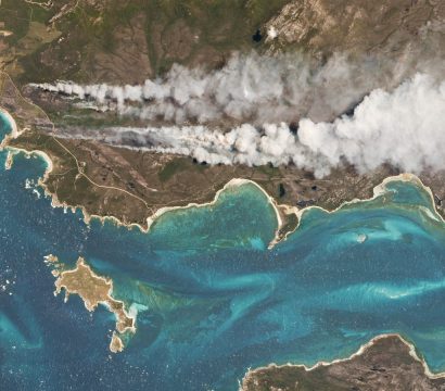
news
Explore and analyze Planet imagery with Harris ENVI
Whether you’re a farmer measuring crop performance or a crisis mapper assessing damage after a natural disaster, you need speedy and reliable remote sensing data preparation and analysis workflows that you can count on. Today, we are excited to announce that, with the integration of Planet data into the ENVI platform, Harris […]
CONTINUE READING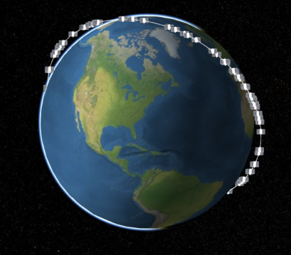
news
Planet Imagery Available to Cesium Community
Cesium, the open-sourced 3D mapping software, is well-known within the aerospace community. At Planet, you’ll often see our on-orbit flocks, visualized in Cesium, speeding around the globe in real-time. Now, the Cesium community can explore Planet’s imagery. In integrating Cesium with our API, AGI can layer our frequently updated Automated Basemaps on […]
CONTINUE READING