Chin Lakes, Alberta Jun 06, 2015
Planet Rings in 2025 by Welcoming Two New Executive Team Members
As we welcome in a new year, Planet’s leadership team welcomes two new members to its executive leadership team, both familiar faces to Planet. I am thrilled to announce Thomas Murphy has been promoted to General Counsel and Trevor Hammond…...
Continue Reading
PLANET PULSE
Monitoring the pulse of our planet with daily news and imagery, stories, and tech updates.
Stories
The EO Industry in 2025: Emerging Technologies and Shifting Policies Usher in a New Era for Space Innovation
This year was transformative for the space industry. We saw meteoric growth in the number of rocket launches, Earth imaging satellites capturing photos of our planet in unbelievable detail, awe-inspiring new datasets expanding our knowledge of Earth from space, and…
CONTINUE READINGNews
Pelican-2 & 36 SuperDoves Arrived in Vandenberg, California For Launch
Pelican-2 Is Equipped with the NVIDIA Jetson Platform and NASA CSP Satellite-to-Satellite Communications to Speed Data Delivery for Customers SAN FRANCISCO, December 9, 2024—Planet Labs PBC (NYSE:PL), a leading provider of daily Earth data and insights, today announced that its…
CONTINUE READINGTechnology
Leveraging Satellite-Based Solutions for Illegal Logging
Learn how satellite technology can be used to address illegal logging and help ensure compliance with regulations. Illegal logging presents a major global environmental challenge. This unlawful activity contributes significantly to deforestation, biodiversity loss, and climate change. Since forestry crime…
CONTINUE READINGDiscover how daily imagery brings insights for meaningful change
GO TO PLANET INSIGHTS
stories
Advancing Regenerative Agriculture with Skytec’s Ranger and Limestone Valley RC&D
How much does healthy soil impact our climate resiliency? It turns out quite a lot. Optimizing best practices in land management can increase biodiversity, enrich soil, and protect water quality, ultimately making our soil more resilient to climate instability. This practice, known as regenerative agriculture, is a critical tool for agriculture experts […]
CONTINUE READING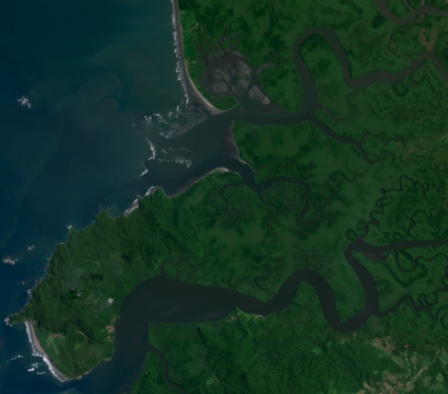
stories
How Upstream Tech’s Lens Platform and Planet Imagery Help One Tree Planted Visualize The Future of Global Reforestation
If a tree grows in the forest, but nobody’s there to see it, does it justify widespread reforestation investments? That’s the conundrum One Tree Planted faced as its operations have rapidly expanded in the last few years. The organization helps local communities plant trees to restore habitat for biodiversity, promote cleaner air, […]
CONTINUE READING
stories
Getting to Ground-Truth in Asia – Part Four: What’s ahead for the Earth Observation industry in Asia
A conversation with Ben Allard While we’ve explored a number of industries in which satellite data can be used to monitor and verify what we see on the ground based on what we can see from space in this “Getting to Ground-Truth in Asia” series, we now turn to what we believe […]
CONTINUE READING
news
Planet Acquires Sinergise Business: A New Chapter in Earth Observation
Welcome Sinergise and the Sentinel Hub Community! Planet has acquired the business of Sinergise, including Sentinel Hub, marking a significant step forward in our mission to make Earth observation (EO) data more accessible and impactful. We are excited to welcome Sentinel Hub users to the Planet community, and are eager to accelerate […]
CONTINUE READING
stories
Flash Drought Hotspots: Southwestern United States
Authors: Ryder Kimball & Steve Levay Special thanks to: Max Borrmann, Arjan Geers, and Megan Zaroda This blog is part of a series on the effects of rapid dryness on regions around the globe. For an introduction to Planet’s approach, read this post. For those of us in the U.S., the very […]
CONTINUE READING