Chin Lakes, Alberta Jun 06, 2015
How Planet's Distinctive Approach to Global Monitoring Sets a New Standard for Defense Analysts
Learn how broad area management with Planet helps defense analysts continually monitor change across every region of interest. Global military spending swelled to $2.24 trillion in 2023, according to analysis by the Stockholm International Peace Research Institute (SIPRI). “The unprecedented…...
Continue Reading
PLANET PULSE
Monitoring the pulse of our planet with daily news and imagery, stories, and tech updates.
Stories
AI-enabled Insights from Publications Leveraging Planet Data
Planet AI Symposium Curious to learn more on how the combination of AI and Planet's satellite data is helping to build a more sustainable and resilient world? Join us on, Thursday, January 30th for the Planet AI Symposium where industry…
CONTINUE READINGNews
Industry Leaders Join Planet AI Symposium: A Virtual Event Exploring the Future of “Geospatial Artificial Intelligence”
Today, we are proud to launch the Planet AI Symposium, a virtual event where leading experts join Planet to discuss the future of artificial intelligence. This event explores how the intersection of AI and Earth observation data could help build…
CONTINUE READINGTechnology
From Satellite Data to Actionable Insights: Predicting Hay Yield for North Dakota with Planetary Variables
Authors: Thomas Frederikse & Stephanie Gijsbers The ability to predict crop yields is essential for optimizing agricultural productivity, managing food security, and streamlining supply chain operations. Traditional forecasting methods often struggle with limited and inconsistent data, making it difficult to…
CONTINUE READINGDiscover how daily imagery brings insights for meaningful change
GO TO PLANET INSIGHTS
news
Update on Planet Operations During COVID-19 Events
As many are aware, Planet is headquartered in San Francisco, where shelter-in-place orders were issued on Monday to prevent the spread of novel coronavirus COVID-19. As per the order, San Francisco residents have been ordered to stay in their homes until further notice. While Planet is complying with guidance to prioritize the […]
CONTINUE READING
news
Planet Welcomes New CFO Ashley Fieglein Johnson
I’m happy to announce that Ashley Fieglein Johnson is Planet’s new chief financial officer (CFO). Ashley is an expert in corporate strategy, business development and finance, and she has extensive experience building and leading teams in the technology space. Ashley is joining Planet at an exciting time as the company continues to […]
CONTINUE READINGnews
State and Local Government Continue to Leverage Planet Data in 2020
State and local government officials are realizing the value that remote sensing data can provide for governance, and Planet has been generating strong civil government partnerships to support them. The New Mexico State Land Office (NMSLO), for example, utilized Planet data to address critical governance challenges, and will be presenting their Planet […]
CONTINUE READING
stories
Lisa McGill On What It Takes to Have a “Weird and Great” Aerospace Career
This is the second installment in the Stellar Minds series, where Planet employees are profiled and their accomplishments are highlighted. Keep checking the blog for upcoming features on remarkable people working in the aerospace industry today. Lisa McGill says the best way to succeed as an aerospace engineer is to do work […]
CONTINUE READING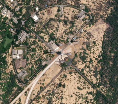
stories
A Love Letter to Flock 3p: Happy Three Year Anniversary
Dear Flock 3p, This Valentine’s Day, we’re celebrating your three year launch-anniversary. Can you believe it?! It was February 15th, 2017 in India and February 14th in San Francisco when you soared to the heavens on the PSLV rocket and spread your solar-powered wings. My how time flies (in space)! Not to […]
CONTINUE READING